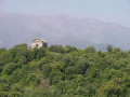
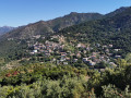
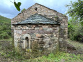
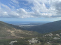
Mount Zuccarello, Sant’Andria Chapel, Ruins of Biguglia Castle

Starting from the village of Biguglia, this walk follows the path leading to the Sant’Andria Chapel. The path then becomes a little rockier and climbs steeply to the summit of Monte Zuccarello. You’ll be treated to a magnificent panoramic view of the Étang de Biguglia, the sea and the islands of the Tuscan archipelago. On the other side, you’ll be able to see the village of Oletta and the Bay of Saint-Florent.

Details

n°111900551
Creation:
Last update:
Last review:
–
  • Walking
    Activity: Walking
  • ↔
    Distance: 6.11 mi
  • ◔
    Average duration: 5h 10 
  • ▲
    Difficulty: Moderate

  • ⚐
    Back to start: Yes
  • ↗
    Ascent: + 2,710 ft
  • ↘
    Descent: - 2,710 ft

  • ▲
    Highest point: 3,133 ft
  • ▼
    Lowest point: 502 ft
  • ⚐ Country: France
  • ⚐ City: Biguglia (20620)
  • ⚑
    Start/End: N 42.62628° / E 9.41941°
  • ❏
    IGN map(s): Ref. 4348OT
  • Hour-by-hour weather

Description of the walk

Park in the village of Biguglia, ideally at Biguglia Castle, though there are several car parks available in the village. Take some time to look at the ruins of this castle, which was the centre of Genoese power in Corsica for 200 years.

(S/E) Then take the Chemin Sant’Andria heading south-west.

(1) At the Fork in the road, take the path on the right, cross the Ficabruna stream and continue along the path to the Pretelle stream.

(2) Carry on straight ahead until you reach a fork in the path.

(3) Turn right and begin the ascent to the summit of Mount Zuccarello.

(4) Once at the summit, and after a well-deserved break, head back down the same path to the fork you passed on the way up.

(3) This time, carry on straight on towards the Sant’Andria Chapel.

(5) Follow the path, cross the Pretelle Stream and rejoin the Sant’Andria Path.

(1) Carry on straight ahead to reach the village of Biguglia (S/E).

Waypoints

  1. S/E : mi 0 - alt. 502 ft - Biguglia Castle
  2. 1 : mi 0.22 - alt. 663 ft - Crossroads at the end of the circular loop
  3. 2 : mi 0.8 - alt. 1,050 ft - Petrelle (ruisseau) - Affluent du Bevinco
  4. 3 : mi 0.93 - alt. 1,122 ft - Junction. Return trip to Mount Zuccarello
  5. 4 : mi 2.75 - alt. 3,133 ft - Summit of Mount Zucarello
  6. 5 : mi 5.01 - alt. 1,125 ft - Sant’Andria Chapel
  7. S/E : mi 6.11 - alt. 502 ft - Biguglia Castle

Worth a visit

Other walks in the area

For more walks, use our search engine .

The GPS track and description are the property of this route's author. Please do not copy them without permission.