


Refine your search for walks in Mont de Lans
Mont de Lans walks


 A 13-day grand tour of the Parc des Ecrins via the GR® 54
 Visorando Member
 105.16 mi
 +37,625 ft
 -39,075 ft
 13 days
 Very difficult
 Departure from La Chapelle-en-Valgaudemar (Hautes-Alpes)
A very challenging 180 km route with 12,000 metres of elevation gain, requiring excellent physical fitness. Stages offering spectacular scenery, steep mountains, passes, wildlife, flora and colours. The most beautifulGR® route we have ever done. We completed the route in August, the ideal time to tackle the most difficult passes, which are likely to be snow-covered early in the season, such as La Muzelle, l’Aup Martin, the Pas de la Cavale, de la Valette, Vallonpierre and de La Vaurze.
Refuge de la Muzelle - Lodge l'Emparis in Mizoën
 9.89 mi
+3,045 ft
-6,040 ft
7h 10
9.89 mi
+3,045 ft
-6,040 ft
7h 10
 Difficult
Departure from Vénosc (Isère)
Difficult
Departure from Vénosc (Isère)
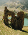
After a challenging and technical day on this trek, today is a transitional stage leading to the magnificent village of Mizoën. The descent to Venosc is absolutely stunning, featuring beautiful waterfalls.
Then, after a cable car ride reducing the elevation gain to 300 m, you’ll cross the resort of Les Deux Alpes, dominated by the Girose Glacier. You’ll reach Lac Chambon and the splendid village of Mizoën with its Lodge l’Emparis.
Walks near Mont de Lans
Emparis Plateau, from the Chambon Dam to La Grave
 14.22 mi
+5,581 ft
-4,124 ft
10 hrs
Very difficult
Departure from Mont-de-Lans (Isère)
14.22 mi
+5,581 ft
-4,124 ft
10 hrs
Very difficult
Departure from Mont-de-Lans (Isère)
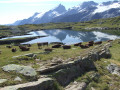
A mountain hike on the Emparis plateau with views of La Meije.This hike can be completed over several days.
Message from the moderators: You are in a Sensitive Natural Area (Natura 2000) which is subject to specific regulations (for more information on this SNA and available accommodation, see the practical information).
From Les Deux Alpes Mont de Lans to Les Deux Alpes Venosc via Clos des Balmettes
 4.37 mi
+902 ft
-719 ft
2h 50
4.37 mi
+902 ft
-719 ft
2h 50
 Easy
Departure from Mont-de-Lans (Isère)
Easy
Departure from Mont-de-Lans (Isère)
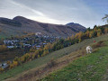
An easy hike to warm up and enjoy a superb view of the Deux Alpes resort. In this sense, the route allows you to benefit from the shade of the forest on the way up, and therefore to arrive in good conditions at Clos des Balmettes, where the descent to the resort will be in the open.
Lodge de l'Emparis - Refuge des Mouterres
 5.55 mi
+3,717 ft
-259 ft
5h 45
Difficult
Departure from Mizoën (Isère)
5.55 mi
+3,717 ft
-259 ft
5h 45
Difficult
Departure from Mizoën (Isère)
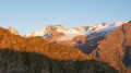
Another magical stage, thanks to the breathtaking scenery all along the balcony trail above Lac du Chambon, including a stop at the ‘petrifying’ spring. Opposite lies a long mountain range and majestic glaciers, with famous names: the Girose Glacier, Pic de la Grave, Le Râteau and the majestic Meije. You will finish this stage at the start of the Emparis plateau at the Refuge des Mouterres, one of the most beautiful camping spots with an exceptional view of the Meije.
Message from the moderators: You are in a sensitive natural area (Natura 2000) which is subject to specific regulations (see practical information).
Le Bourg d’Arud – Lake Plan Vianney
 6.61 mi
+4,731 ft
-390 ft
7h 10
Difficult
Departure from Vénosc (Isère)
6.61 mi
+4,731 ft
-390 ft
7h 10
Difficult
Departure from Vénosc (Isère)
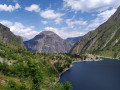
First day of hiking. Spectacular scenery. Nothing but uphill. Morning walk along a tourist trail to Lac du Lauvitel. Don’t miss the panoramic view of the lake!
The paths are very walkable but can be steep in places. Magnificent natural surroundings: you may spot chamois, marmots and weasels.
Refuge des Mouterres - La Grave
 9.47 mi
+1,440 ft
-3,957 ft
5h 35
Difficult
Departure from Mizoën (Isère)
9.47 mi
+1,440 ft
-3,957 ft
5h 35
Difficult
Departure from Mizoën (Isère)
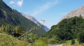
Stage7 of this route. One of the most beautiful stages of this tour of the Écrins National Park. After making the most of the welcome at the Refuge des Mouterres and a campsite with an extraordinary view, you will discover the unspoilt nature of the Emparis Plateau, a Natura 2000 site with abundant mountain flora.
You will leave theGR® 54C for a detour across the Emparis Plateau and its three lakes, Cristallin, Noir and Lérié, before descending to La Grave.
Message from the moderators: You are in a sensitive natural area (Natura 2000) which is subject to specific regulations (see practical information).
Lac du Vallon - Le Bourg-d'Oisans
 8.76 mi
+1,070 ft
-6,886 ft
5h 00
Difficult
Departure from Chantelouve (Isère)
8.76 mi
+1,070 ft
-6,886 ft
5h 00
Difficult
Departure from Chantelouve (Isère)
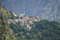
The last stage begins at the large Vallon Lake. You will then cross the Col du Rochail, which rises to an altitude of 2,756 metres. After this climb, your path will take you to the Refuge des Sources, then to Villard-Notre-Dame, a village offering a superb view of Bourg-d'Oisans, your final destination.
The Lakes of Alpe d’Huez
 7.89 mi
+151 ft
-5,253 ft
3h 45
7.89 mi
+151 ft
-5,253 ft
3h 45
 Moderate
Departure from Oz (Isère)
Moderate
Departure from Oz (Isère)
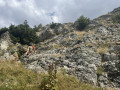
A downhill hike through a rocky landscape where you hop from lake to lake – yes, it’s possible.
Of course, you’ll need to take the cable cars of the Alpe d’Huez–Vaujany ski area to reach the summit of the Dôme des Petites Rousses, the starting point of this hike.
Please note: the time estimated by the software is an underestimate.
Lac Labarre - Lac du Vallon
 6.06 mi
+3,192 ft
-2,828 ft
5h 35
Difficult
Departure from Valjouffrey (Isère)
6.06 mi
+3,192 ft
-2,828 ft
5h 35
Difficult
Departure from Valjouffrey (Isère)
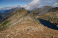
From Lac Labarre, the route follows part of the GR®54B. You will cross the Col de la Romeïou, the Cabane de la Selle, then the Col du Paletas. From there, a wild hike along the ridges, passing by the Neyrard at an altitude of 2,796 m, will take you to Lac du Vallon.
La Grave - Alpe de Villar-d'Arêne mountain hut
 6.87 mi
+2,618 ft
-669 ft
5h 25
Difficult
Departure from La Grave (Hautes-Alpes)
6.87 mi
+2,618 ft
-669 ft
5h 25
Difficult
Departure from La Grave (Hautes-Alpes)
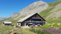
After a rest day in La Grave, set off on this8th stage, which presents no technical difficulties and involves no significant elevation gain. A route that circles La Meije, initially following the Romanche torrent. You will pass close to Villar d'Arène. Thesecond section, starting from Pont d'Arsine, is slightly more challenging and much wilder, taking in the Pas d'Anna Falque and the Plan d'Alpe before reaching the Refuge de l'Alpe de Villar-d'Arêne, which offers breathtaking views of the surrounding mountains.
La Grave – Goléon Mountain Hut
4.72 mi
+3,271 ft
-108 ft
5h 00
Difficult
Departure from La Grave (Hautes-Alpes)
The idea behind this three-day self-supported trek is to link the Goléon massif to the Grandes Rousses massif via the ridges to the north of the Plateau d’Emparis.
It’s a wild hike requiring not only good physical fitness but also the ability to read maps and the terrain.
Thefirst day is just a warm-up.