


Refine your search for walks in Lortet
Lortet walks


 Tour of Mont starting from Lortet
 Visorando Member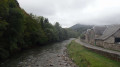
 4.05 mi
 +630 ft
 -604 ft
 2h 25
2h 25
 Moderate
 Departure from Lortet (Hautes-Pyrénées)
Starting from the village of Lortet, you will first cross the Neste river and, after a steep climb through the forest, you will be rewarded with beautiful landscapes.
 Pic d'Arneille
 4.76 mi
+1,814 ft
-1,814 ft
2.5 hrs
Moderate
Departure from Labastide (Hautes-Pyrénées)
4.76 mi
+1,814 ft
-1,814 ft
2.5 hrs
Moderate
Departure from Labastide (Hautes-Pyrénées)
A little-visited and little-known spot, ideal in sub-zero temperatures, where the ascent takes place in the woods, well sheltered from the wind.
This hike can also be done without snow, and it is possible to set off from Esparros, starting from the chasm.
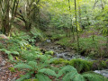
The Aure Valley from Rebouc
 Association / Club / Walk leader
 5.38 mi
+1,522 ft
-1,526 ft
3h 50
5.38 mi
+1,522 ft
-1,526 ft
3h 50
 Difficult
Departure from Hèches (Hautes-Pyrénées)
Difficult
Departure from Hèches (Hautes-Pyrénées)
The route is no longer marked or maintained!!!Between May and October: tall, dense ferns between points 4 and 6 make the route very difficult.
A summary of what the valley entrance has to offer: breathtaking 360° views, highlighting the incredible alignment of the valley. Discover steep paths, fords, shaded areas, mossy areas, ridges, meadows, forests and scrubby moorland, ending with a passage along a turbulent stream with multiple waterfalls.
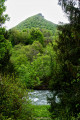
Short circular loop from Larrieu to Rebouc
 2.62 mi
+285 ft
-285 ft
1h 25
2.62 mi
+285 ft
-285 ft
1h 25
 Easy
Departure from Hèches (Hautes-Pyrénées)
Easy
Departure from Hèches (Hautes-Pyrénées)
This route is no longer signposted, but a GPS or map will suffice. This beginner-level route presents no difficulties apart from the elevation gain. It will allow you to explore the hills of Rebouc whilst staying on a tarmac road that is very quiet. Ideal for getting some fresh air, requiring no special equipment and suitable for all fitness levels.
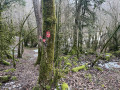
Tour of the three villages: Rebouc, Hèches and Héchettes
 5.70 mi
+817 ft
-843 ft
3h 20
Easy
Departure from Hèches (Hautes-Pyrénées)
5.70 mi
+817 ft
-843 ft
3h 20
Easy
Departure from Hèches (Hautes-Pyrénées)
the route is no longer marked or maintained!between points 4 and 5, there may be sections of around 20 metres of tall grass between June and September, but it remains passable all year round. The path may be muddy 100 metres before point 5.
The circular is accessible on foot or by bike. You will discover Rebouc, Hèches and Héchettes, villages that have remained almost unchanged since 1820-1860, as evidenced by the inscriptions carved in marble on the doors. This route will also allow you to discover the winding and sometimes steep paths that connected each of these villages. Between villages, forests and meadows, the walk will be bucolic!
Tour du Bouchet
 Local authority8.31 mi
+1,804 ft
-1,798 ft
5h 25
Moderate
Departure from Montsérié (Hautes-Pyrénées)
Local authority8.31 mi
+1,804 ft
-1,798 ft
5h 25
Moderate
Departure from Montsérié (Hautes-Pyrénées)
During this walk, the great Bouchère Wood will be your companion. This hike takes you to explore the neighbouring “Ores” valley. Starting from Montsérié, a village rich in archaeological finds, it passes through beautiful Old Forests. An “Old Forest” is an ancient, mature forest: that is to say, it has been continuously forested since at least the mid-19th century. You will also discover Bayelle de Gazave, a vast and beautiful high-altitude clearing, surrounded by mountains.
Route des villages in Laborde
4.87 mi
+558 ft
-551 ft
2h 45
Easy
Departure from Laborde (Hautes-Pyrénées)
A short, picturesque walk exploring the small villages of the Baronnies, starting from Laborde.
Signal de Bassia route on the Baronnies side
 4.28 mi
+2,513 ft
-2,507 ft
4h 10
Moderate
Departure from Esparros (Hautes-Pyrénées)
4.28 mi
+2,513 ft
-2,507 ft
4h 10
Moderate
Departure from Esparros (Hautes-Pyrénées)
Pass by the Puits de la Pindorle, then follow the ridge to Cap de Castillon. 360° view of the ridge from the Signal de Bassia. Caution: steep descent from Cap de Castillon.
Pla de la Peyre
4.06 mi
+1,483 ft
-1,470 ft
3h 10
Moderate
Departure from Sarrancolin (Hautes-Pyrénées)
A short walk starting from Sarrancolin, offering a beautiful view of the Aure Valley and leading to the Pla de la Peyre. A significant climb and little shade towards the end.
The Tumulus de Capvern trail
 8.78 mi
+784 ft
-814 ft
4h 45
Moderate
Departure from Capvern (Hautes-Pyrénées)
8.78 mi
+784 ft
-814 ft
4h 45
Moderate
Departure from Capvern (Hautes-Pyrénées)
A lovely circular walk with long stretches through the woods (very pleasant in summer) and a beautiful view of the Pic du Midi de Bigorre at the start. Pass near the Tumulus de l'Estaque and enjoy a superb view of the Château de Malvezin. I recommend doing the walk in this direction, otherwise you won't necessarily see the château!
Pic de Montaut via the Coq ridge and the Cabane de Collantigue
 9.10 mi
+3,583 ft
-3,583 ft
7h 20
Difficult
Departure from Sarrancolin (Hautes-Pyrénées)
9.10 mi
+3,583 ft
-3,583 ft
7h 20
Difficult
Departure from Sarrancolin (Hautes-Pyrénées)
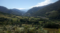
A lovely hike done clockwise for a gradual and gentler climb. With two options available, this hike can be adapted to suit different levels. The aim is to meet up at the Collantigue hut to share a meal and a rest.
Col de Beyrède from Sarrancolin
 10.20 mi
+2,644 ft
-2,621 ft
7h 00
Moderate
Departure from Sarrancolin (Hautes-Pyrénées)
10.20 mi
+2,644 ft
-2,621 ft
7h 00
Moderate
Departure from Sarrancolin (Hautes-Pyrénées)
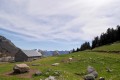
A fairly long circular hike from Sarrancolin. This ascent to the Col de Beyrède from the Arreau Valley allows you to rediscover the old paths that once enabled shepherds to drive their flocks up to the summer pastures. Of course, some sections of these paths have been modified by motorised vehicles.Please note: this walk is unmarked from (3). The GPX track may prove useful, particularly from (10) to (14).
Collantigue hut
 6.04 mi
+2,651 ft
-2,651 ft
5h 05
Moderate
Departure from Ilhet (Hautes-Pyrénées)
6.04 mi
+2,651 ft
-2,651 ft
5h 05
Moderate
Departure from Ilhet (Hautes-Pyrénées)
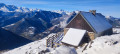
Climb up to this beautiful hut, which is in perfect condition. It is closed and private. However, there is a small hut in good condition available below this spot.
Please note: part of the hike is unmarked, so a good sense of direction is necessary.This hike can be done in average snow conditions. However, this requires even better orientation skills.
Bassia ridge
 4.86 mi
+2,064 ft
-2,064 ft
4h 00
Difficult
Departure from Beyrède-Jumet (Hautes-Pyrénées)
4.86 mi
+2,064 ft
-2,064 ft
4h 00
Difficult
Departure from Beyrède-Jumet (Hautes-Pyrénées)
The Crête de Bassia from the Col de Beyrède offers a magnificent panoramic view of the Baronnies de Bigorre to the north and the Pyrenees mountain range from Arbizon to the Pic du Midi de Bigorre to the south.
Anglo-Canadian Cemetery - Pic de Douly and Mont Aspet
 8.27 mi
+2,943 ft
-2,923 ft
4 hrs
Moderate
Departure from Nistos (Hautes-Pyrénées)
8.27 mi
+2,943 ft
-2,923 ft
4 hrs
Moderate
Departure from Nistos (Hautes-Pyrénées)
This hike can be done with or without snow...
On the evening of 13 July 1944, seven British and Canadian airmen from the Royal Air Force took off to resupply the Nistos maquis. The Halifax aircraft crashed into the Pic du Douly. The airmen did not survive and were buried on site. Debris from the aircraft is still visible today. All this calls for silence and contemplation...
Pic de Montaut from Nistos Cap Nestès
 6.20 mi
+2,277 ft
-2,257 ft
4h 50
Moderate
Departure from Sarrancolin (Hautes-Pyrénées)
6.20 mi
+2,277 ft
-2,257 ft
4h 50
Moderate
Departure from Sarrancolin (Hautes-Pyrénées)
A beautiful ridge hike offering superb views of the Aure Valley, to be done on foot or with snowshoes.
No fewer than four peaks along the route, a real rollercoaster ride in the Pyrenees.
Pic de Mont Aspet from the Nistos Cap Nestès cross-country ski resort
 5.49 mi
+958 ft
-974 ft
3h 20
Moderate
Departure from Sarrancolin (Hautes-Pyrénées)
5.49 mi
+958 ft
-974 ft
3h 20
Moderate
Departure from Sarrancolin (Hautes-Pyrénées)
A hike without too much elevation gain that leads to Pic de Mont Aspet (1,849 m), where you will have a magnificent 360° view.
Beyrède Pass from Espiadet
 5.44 mi
+1,358 ft
-1,332 ft
4 hrs
Moderate
Departure from Campan (Hautes-Pyrénées)
5.44 mi
+1,358 ft
-1,332 ft
4 hrs
Moderate
Departure from Campan (Hautes-Pyrénées)
A lovely snowshoe hike from the Payolle marble quarry. This is an unmarked trail, so a basic sense of direction is required.N.B. In some places, the IGN map is not up to date. The GPX track can be very useful.