Country:

 City:
City:


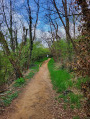
If you are travelling by car, the start of this route is in Saint-Genis-Laval, at the junction of Chemin de Putet and Rue du Frère Benoît, where there is plenty of parking. Alternatively, you can start from the car park at the Saint-Genis-Laval cemetery or the car park at Fort de Côte Lorette.
For those who prefer public transport, the starting point is a 500-metre walk from the TCL bus stops at Saint-Genis Gadagne on routes 78 or C10.
(S/E) Walk up Rue du Frère Benoît, heading due south, with the cemetery on your right. Turn right onto Rue de l’Égalité. At the top of the street, at the junction with Rue de la Red Cross, turn left towards Fort de Côte Lorette.
(1) At the entrance to the Fort de Côte Lorette area, cross the car park, keeping the monument commemorating the massacre by the Nazi occupying forces of 120 Resistance fighters taken from Montluc prison on 20 August 1944 on your left. Walk through the western part of the park until you reach the corner overlooking Rue de la Red Cross.
(2) Turn left onto this street, continue straight on at the first and second junctions until you reach Chemin de la Vidaude, which you should follow for about 1 km. When you reach the outskirts of Saint-Genis-Laval, at the junction with Chemin de Sacuny, continue straight on until you reach the entrance gate to the Sentier de Sacouny.
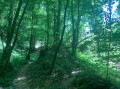
(3) Set off along the path through the meadows. As you enter the woods, ignore the paths on your right and head down into the woods for about 150 metres, then turn right onto the uphill path. After about a hundred metres, at the junction, turn left and follow the path which curves to the right and reaches a Fork in the road. Turn left again, heading due north; keep left at the junction and continue to the exit gate. Turn left onto the Chemin de Bernicot (tarmac road) and head down to the large roundabout on the D342.
(4) Cross the D342 at the pedestrian crossing south of the roundabout, then take the farm track heading towards the railway line. Go under the railway bridge and follow the Chemin des Acacias uphill, ignoring the streets on your right. You’ll reach another roundabout.
(5) At the new roundabout, take Rue du Bonnet straight ahead and, after about a hundred metres, turn right to head up towards Chemin des Revousses, which you’ll find on your left after a 250-metre climb.
Walk down Chemin des Revousses due south for about 1 km, until you rejoin Rue du Bonnet. Turn right, then right again at the junction, until you reach the roundabout opposite Jean Zay Secondary School.
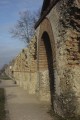
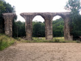
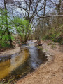
(6) Take Chemin du Barray heading north-west for about 1 km, then, when you reach the edge of the sensitive natural area, turn left onto Chemin de la Levée. At the junction, turn right onto the Chemin de la Rivière until you reach the footbridge over the Garon. Leave the footbridge on your right and take the signposted path along the riverbank. Follow it as far as the Auberge du Garon, then turn right onto the bridge to cross the river and turn left onto the Chemin du Garon. Follow this until you reach the Roman Aqueduct.
(7) Continue along the Chemin du Garon. After a left-hand bend, at the Fork in the road, turn left onto the path running alongside the river. Follow this path until you reach the junction with theGR®765East.
(8) Leave the footbridge on your left and take the path that starts on your right, climbing steeply. After a 300-metre climb, at the junction, take the road on your left and then, at the Fork in the road, turn right onto the Chemin de Combarembert.
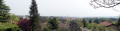
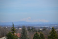
Further on, pass the horse farm on your right, and after a car park, turn right onto the Chemin de Boissière for about 300 m, then left between the horse paddocks. Enjoy the view of the Monts du Lyonnais and the Pilat before reaching a junction near No. 2 on the Chemin du Mondor.
(9) Turn right onto the Chemin du Mondor, which is tarmac at first and then becomes a dirt track; continue south-east until you reach a water reservoir on your left and a crossroads marked by the Croix Ramier.
(10) Cross the road at the Croix Ramier and take the stony path downhill, ignoring the path on the right; cross the Route des Collonges, pass the Chemin de la Chaize on your left and reach a junction. Take the path on the left to reach the roundabout at the entrance to Chaponost.
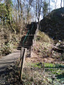
(11) Cross the roundabout (take care) and continue straight on heading due north (take the footpath on the right-hand verge of the road). Turn right after the houses near Rue de Gilbertin. Cross the stream via the footbridge, then turn right onto the path leading up the hill via a few wooden steps. In the hamlet of Les Palisses, leave the road on your left and take the path on the right, leading to a junction in a bend in the road.
(12) At the junction, take the road on your right, following the bend, and ignore the Chemin de l’Arcelans, which is also on your right. At the hairpin bend to the right that follows, leave the road and take the tarmac path on your left. After about 200 metres, you’ll reach a Fork in the road in the hamlet of La Combe.
(13) Take the path starting on the right, to the left of a cross between the houses, leaving the Chemin de la Combe on your left. Ignore the paths on your left until you reach the railway line. Cross it and reach the Route de Brignais. Cross the road, taking care of traffic as there is no pedestrian crossing. Follow the road on your right until you reach the Chemin de Pressin.
(14) Turn left onto Chemin de Pressin heading eastwards until you reach the horticultural college. At the junction, cross the road and continue straight ahead, keeping an easterly direction, still on Chemin de Pressin between two boundary walls. Continue to the junction with Chemin de Moly.
(15) Turn right, then immediately left onto Chemin de la Molinette. Continue until you reach Chemin du Clos Burtin; follow it to the right. At the next junction, turn left and head due south to reach Chemin de Putet and the starting point (S/E).


 Visorando Member
 Easy
Easy