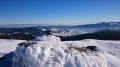
La Bresse par le Lac des Corbeaux et l'Étang de Sèchemer

Randonnée en raquettes (ou à pied en été) en partant du camping du haut des Bluches ; montée vers le Lac des Corbeaux et retour par l'Étang de Sèchemer.

Details

458940
Creation:
Last update:
Last review:
  • Snowshoeing
    Activity: Snowshoeing
  • ↔
    Distance: 3.98 mi
  • ◔
    Duration according to the author: 4 hrs 
  • ▲
    Difficulty: Moderate

  • ⚐
    Back to start: Yes
  • ↗
    Ascent: + 653 ft
  • ↘
    Descent: - 650 ft

  • ▲
    Highest point: 3,015 ft
  • ▼
    Lowest point: 2,356 ft

Photos

Description of the walk

Se garer sur le parking du camping du Haut des Bluches. Balisage panneaux raquettes (voir photo).

(S/E) Dirigez-vous vers le panneau "Départ circuit raquettes" près des cabanes en bois, quelques mètres à l'Ouest du parking. Monter en face sur 200m puis rester sur la trace de gauche encore 600m pour rejoindre la route du Lac des Corbeaux.

(1) Prendre à gauche la route sur 700m.

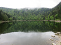
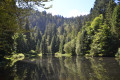
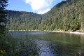
(2) Au carrefour devant le Lac des corbeaux, partir à droite vers le parking et virer à gauche pour faire le tour du lac.

(2) De retour au croisement, laisser le chemin le plus à droite et prendre à droite, passer devant le restaurant et continuer tout droit sur le Chemin de Sèchemer sur 2300m environ.

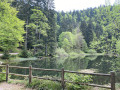
(3) Au pont de l'Étang de Sèchemer, prendre à gauche sur 200m.

(4) À la fourche suivante, bifurquer à droite dans le sous-bois et retrouver le véhicule au camping (S/E).

Waypoints

  1. S/E : mi 0 - alt. 2,362 ft - Departure from the campsite near the - Moselotte (rivière)
  2. 1 : mi 0.63 - alt. 2,713 ft - Route du Lac des Corbeaux, on the left
  3. 2 : mi 1.01 - alt. 2,907 ft - Lac des Corbeaux
  4. 3 : mi 3.2 - alt. 2,828 ft - Bridge, on the left.
  5. 4 : mi 3.31 - alt. 2,766 ft - Fork, on the right
  6. S/E : mi 3.98 - alt. 2,365 ft - Campsite arrival

Notes

Point d'eau, abri, toilettes au camping.
Toilettes sèches au Lac des Corbeaux.
Toilettes et point d'eau, abri au restaurant du Lac des Corbeaux.

Worth a visit

Ski alpin ou ski de fond, activités neige dans les stations de la Bresse.
En été, pêche dans les rivières et lacs alentours.
Imagerie et musée d'Epinal.
Lac de Gérardmer, casino.

Reviews and comments

4.7 / 5
Based on 29 reviews

Reliability of the description
4.7 / 5
Ease of following the route
4.8 / 5
Route interest
4.5 / 5
lemarcheur65
lemarcheur65 ★

First of all,hello again

There’s no straightforward way to change the snowshoeing activity to a walking activity.
Apart from copying the route to your account and changing the activity to ‘walking’, in which case the duration will be calculated automatically.

When searching for a hike, you can filter and set search criteria.

Machine-translated

User 17374976

The route is listed as taking 4 hours on the walk description sheet, whereas in reality it only takes 2 hours 30 minutes. It’s a shame there’s such a difference, because when you’re planning a route, you expect the time estimate to be accurate, and here there’s a significant discrepancy. Given the difference in time, it’s not a question of walking pace. As the organiser of this walk, I’ve come across as an amateur in the eyes of the group who were with me.

How can we change it to ‘Hiking’ instead of ‘Snowshoe Hike’ so that we get the walking time (2 hours 25 minutes) rather than the snowshoe time (4 hours)?

Machine-translated

lemarcheur65
lemarcheur65 ★

Hello User 17374976

The route is listed under ==>
Activity: Snowshoe hike
Duration according to the author: 4 hours
Difficulty: Medium

If this hike had been listed under the heading ==>
Activity: Hiking (which I suppose is what you did)
Average duration: 2 hours 25 minutes
Difficulty: Easy

So?

Machine-translated

User 17374976
• Edited:

Overall rating : 5 / 5

Date of your route : Jul 04, 2026
Reliability of the description : Not used / Not applicable
Ease of following the route : ★★★★★ Very good
Route interest : ★★★★★ Very good
Very busy route : Yes

The route is listed as taking 4 hours on the walk’s description page, whereas in reality it only takes 2 hours 30 minutes. It’s a shame there’s such a discrepancy, because when you’re planning a route, you expect the time estimate to be accurate, and here there’s a significant difference. Given the difference in time, it’s not a question of the walkers’ pace. As the organiser of this walk, I’ve come across as an amateur in the eyes of the group who were with me.

Machine-translated

Zou48
Zou48

Overall rating : 5 / 5

Date of your route : May 06, 2026
Reliability of the description : ★★★★★ Very good
Ease of following the route : ★★★★★ Very good
Route interest : ★★★★★ Very good
Very busy route : No

A lovely route, featuring two beautiful bodies of water: Lac des Corbeaux and Étang de Sèchemer.

Machine-translated

boubou6855
boubou6855

Overall rating : 5 / 5

Date of your route : Apr 09, 2026
Reliability of the description : ★★★★★ Very good
Ease of following the route : ★★★★★ Very good
Route interest : ★★★★★ Very good
Very busy route : Yes

A lovely walk with a picnic by the lake.

Machine-translated

Philhame
Philhame

Overall rating : 5 / 5

Date of your route : Aug 10, 2025
Reliability of the description : ★★★★★ Very good
Ease of following the route : ★★★★★ Very good
Route interest : ★★★★★ Very good
Very busy route : Yes

The tour around Lac des Corbeaux is easy.
It is a very popular spot in summer, especially during hot weather.
Most of the hike is in the shade

Machine-translated

courjus52
courjus52

Hello, thank you for letting me know about the change to the route. I have updated the description and map from point 4 onwards.
Best regards.

Machine-translated

AlainT
AlainT
• Edited:

Overall rating : 4.7 / 5

Date of your route : Jun 25, 2025
Reliability of the description : ★★★★★ Very good
Ease of following the route : ★★★★★ Very good
Route interest : ★★★★☆ Good
Very busy route : No

This hike does not present any particular difficulties. The tour of the Lac des Corbeaux is easy to complete as it is flat and the path is fairly wide. The route changes at point 4, where you need to take the dotted path marked on the map by a green triangle.

Machine-translated

Alain Remy
Alain Remy
• Edited:

Overall rating : 4.3 / 5

Date of your route : Apr 12, 2025
Reliability of the description : ★★★★☆ Good
Ease of following the route : ★★★★★ Very good
Route interest : ★★★★☆ Good
Very busy route : No

A lovely hike with the option of picnicking by the lake or enjoying refreshments at the inn.
Change to the route from point 4, and new signposting suggested.

Machine-translated

RomLomb
RomLomb

Overall rating : 5 / 5

Date of your route : Aug 17, 2024
Reliability of the description : ★★★★★ Very good
Ease of following the route : ★★★★★ Very good
Route interest : ★★★★★ Very good
Very busy route : No

Hike completed on Saturday, 17 August.
It took us 1 hour and 45 minutes to complete the entire circuit.

You can swim in the lake, and there is also an inn with toilets and food.

Picnic table by the pond.

Machine-translated

liliane.clarens
liliane.clarens

Overall rating : 5 / 5

Date of your route : Aug 10, 2024
Reliability of the description : ★★★★★ Very good
Ease of following the route : ★★★★★ Very good
Route interest : ★★★★★ Very good
Very busy route : No

After a beautiful morning climb through the woods, you will discover the magical Lac des Corbeaux, surrounded by a beautiful pine forest and numerous signposts.
Continuing halfway down the descent, we arrive at the Etang de Sèchemer, a pleasant and peaceful spot.
At the start and finish, you can catch a glimpse of tree houses.
Thanks to the author for this route, which must be superb in the snow.

Machine-translated

Franck et Sébastien
Franck et Sébastien
• Edited:

Overall rating : 5 / 5

Date of your route : Sep 07, 2023
Reliability of the description : ★★★★★ Very good
Ease of following the route : ★★★★★ Very good
Route interest : ★★★★★ Very good
Very busy route : No

Sorry, wrong route :-/

Machine-translated

PHILOU3157
PHILOU3157

Overall rating : 5 / 5

Date of your route : Sep 25, 2023
Reliability of the description : ★★★★★ Very good
Ease of following the route : ★★★★★ Very good
Route interest : ★★★★★ Very good
Very busy route : No

Machine-translated

dominique cornet
dominique cornet

Overall rating : 3.7 / 5

Date of your route : Aug 14, 2023
Reliability of the description : ★★★★☆ Good
Ease of following the route : ★★★☆☆ Average
Route interest : ★★★★☆ Good
Very busy route : Yes

nice walk in good weather. Lots of people at the lake.

Machine-translated

Other walks in the area

For more walks, use our search engine .

The GPS track and description are the property of this route's author. Please do not copy them without permission.