Country:

 City:
City:


To start the walk, head up the small road to the top of the hamlet of La Pénide. It is easy to park in front of the last house.
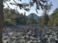
(S/E) Walk past this house on the right along a path that runs alongside meadows. The path veers to the right and begins to climb into the woods. On a flat stretch, turn left onto a forest track which immediately runs alongside a scree slope. The scree slope is to the right of the path, which helps ensure you’ve taken the right route.
This path climbs through the woods and joins a level path.
(1) Cross this track to take a well-marked path opposite which climbs straight up the slope. After a few hundred metres, a forest track joins it on the left. Continue climbing along this track. You’ll reach a wide track coming up from the right. Follow this track to the left as it climbs and you’ll come to a small road at a bend. Do not take this road; instead, continue along the track, which turns left whilst continuing to climb. After barely 100 metres, you’ll reach the first junction at the top of the meadow on the left.
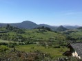
(2) Take the path on the right, which quickly leads to the hamlet of Sénéol, and rejoin the road you left further down. Follow this road through the hamlet, taking in the splendid view. You’ll reach trail no. 2, ‘Le Knoll du Ranc’, at the edge of the hamlet.
Follow the signposting for trail no. 2.
(3) Continue along the road as it begins to descend, then leave it at the bend to head straight on towards an isolated house and theGR®40.
Take the forest track on the left and follow it for about 1 km. Then leave theGR® and the track, following the signposting on the left which climbs straight up the slope. You’ll come to a fork.
(4) On the right, the route bypassing the summit of the Ranc is signposted. You must take this route if the ground is wet.
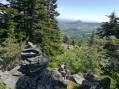
If the ground is dry, continue straight on to reach the base of a low pile of rocks. From there to the summit of the Ranc, the route is mainly marked by these cairns, spaced at regular intervals. Climb these rocks to the summit of the Ranc before descending via a more comfortable path. You’ll reach some old quarries and the markings for Trail No. 2, which are clearly visible once again.
At the bottom of the slope, turn sharply right to reach a wide path in just over 200 metres. Take this path on the right and you will very quickly reach the bypass route around the summit of the Ranc.
(5) From there, turn left and join theGR®40; follow it further to the left along a track. After about 200 metres, leave the track andthe GR® to follow a cart track on the right. After turning left, the cart track becomes a path and joins a small road. Turn left at right angles to the road and take the wide track which climbs up to a major junction. Turn right downhill with theGR®40, follow it for a few hundred metres, then leave it to the right onto a path that runs almost along the contour line. Return to the previous road.
(6) Cross the road but leave Trail No. 2, which descends to the left, to take a path almost directly opposite. This path very quickly leads to a crossroads at the edge of the woods.
Join trail no. 3 here.
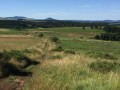
(7) Continue straight ahead, then turn left onto the path running through the middle of the meadows. Cross a small road and head downhill straight ahead along a shaded path. You’ll come out onto a road; turn right onto it to reach the first house in the hamlet of Sardat. Pass this house and leave the road to the left onto a roughly level path that joins another road.
(8) Follow it to the left for about 200 metres, then turn right off it to cross the RN88 via a tunnel. Take the path opposite that goes uphill, turns right and then enters the woodland. Cross a small stream, head up towards the first house in the hamlet of La Chomette, and turn right immediately to cross the Truisson stream. From there, head uphill and follow the path across the meadows to a small road.
(9) Follow this road uphill to the left, cross a main road and enter the hamlet of Villevieille. At the edge of the hamlet, reach the village hall (signposted on the building) and take the small road on the right. Leave this quickly to the left onto a path lined with meadows. You’ll reach a junction with Trail No. 3, identical to the one shown at (4).
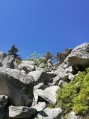
(10) Turning left allows you to avoid the scree slope, whilst the normal route turns right. The section across this scree slope is short and not particularly steep; it is advisable to turn right in all cases, unless you are wearing unsuitable footwear.
The path crosses a small road, passes by an isolated house (marked ‘La Baraque’ on the map), reaches a water intake and turns right into the woods, with no marked path.
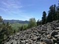
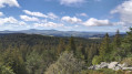
Climb quite steeply, following the markings, cross a large scree slope to reach a cross and a vast panorama. Continue and almost immediately join the bypass route shown in (10).
(11) Climb up to the right and pass just below the summit of the knoll of Jorance, which is difficult to spot amidst the woods.
Carry on and begin a descent leading to a path running at right angles. Take this path to the right to reach a small pass between the Knoll de Jorance and Mont Gros. From there, continue straight on down a steep descent through the forest, then turn left and continue downhill. Climb back up, veering to the left, until you reach the via ferrata equipment at Les Juscles. From there, follow the path back to the car park for this via ferrata and reach the start of the via ferrata at a bend in a small road.
(12) Walk up the road you have just reached and, after a hairpin bend to the left, turn right at the first junction with a wide forest track. This leads to a large open area, where you’ll join Trail No. 3 coming from the right. Turn left onto the trail, which descends to the village of Le Pertuis, marking the end of Trail No. 3. You’ll reach the RN88.
(13) Cross the road and the square beyond, then head uphill towards the cemetery. You will then find the start of Trail No. 2.
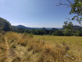
Head uphill alongside the cemetery on the trail, enter the woods and come out again shortly afterwards. Walk through the fields. Just before entering the woods again, and passing under a high-voltage power line, turn right at the edge of the woods
(14) Join a path that descends more and more steeply. Reach the D28, cross it and take the path opposite which continues to descend. At the first junction, take the path on the left and cross the D28 again. The path opposite leads into the woods, turns right and climbs gently along the edge. This brings you to the point where Trail No. 2 heads uphill to the left into the woods (a very difficult climb).
(15) Leave this trail here and continue along the path at the edge of the woodland. After a climb, the path descends towards the meadows. After 50 metres, leave the path that goes straight down and take a very muddy, shaded path on the left. This path eventually dries out and leads to the finish (S/E).




 Visorando Member
 Very difficult
 Easy
Easy 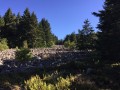
 Moderate