Chamblas Castle and the two Huches

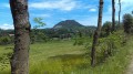
This very pleasant route, enjoyable in all seasons, alternates between sections through the forest and across meadows, whilst offering the chance to discover hamlets and villages typical of the region. It takes you through the Domaine de Chamblas with its château and grounds, and ends at the two ‘huches’: the Huche Plate and the Huche Pointue. A climb to the Huche Pointue completes the route.

Details

189567
Creation:
Last update:
Last review:
  • Walking
    Activity: Walking
  • ↔
    Distance: 10.32 mi
  • ◔
    Average duration: 6h 15 
  • ▲
    Difficulty: Moderate

  • ⚐
    Back to start: Yes
  • ↗
    Ascent: + 1,732 ft
  • ↘
    Descent: - 1,722 ft

  • ▲
    Highest point: 3,392 ft
  • ▼
    Lowest point: 2,211 ft

Photos

Description of the walk

Park at Chambe de Bos, on the left as you approach from the D35 from Le Pertuis; the communal car park can accommodate a large number of vehicles.

(S/E) Return to the D35 and follow it to the right towards Le Pertuis for a good hundred metres. When the road bends to the left, carry on straight ahead along a small road leading to an abandoned house.

(1) Once you have passed this house, do not continue along the small road but take a path that climbs, then turn immediately right onto a wide path following the contour line through the woodland. Once you have emerged from the woods, do not continue along the path which begins to descend, but head uphill to the left, following the yellow markings.

PR Yellow markings

(2) You will then reach a small road. Follow it to the right for about 500 m, passing the first access road to a farm below.

(3) At a second access road on the right, take the stony path marked in yellow which descends steeply between two hedgerows (this is the bed of a small stream!). Join a wider track and continue along it to the left. Pass a pond and continue downhill to reach a small road.

(4) Opposite is a house called “Au pays des Knolls”, which houses a lodge and guest rooms; head up the road to the left, then turn right at the first junction signposting another guesthouse called “La Maison des Chazes”. Take this access road on the right, pass “La Maison des Chazes” and then a detached house to reach a crossroads, all marked in yellow.

(5) Continue straight down; the path joins a small road which soon leads onto the D433. There, take the D433 to the right, then leave it almost immediately by taking a path on the left.

(6) This path leads gently uphill to the hamlet of Roulhac. Cross the Roudesse stream, then, just after the bridge, take a path on the right that runs alongside the stream.

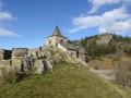
(7) Walk uphill past two houses, then continue along the same path as it enters the woodland. This takes you to Chamblas Castle.

(8) Walk down the road, then leave it via a track on the left that runs alongside the château’s grounds (a lovely view of the château set back in its grounds). Follow this track until you reach a small road, which you take to the left for a few dozen metres.

(9) Leave the road before the bridge by taking an uphill path on the left. Follow this for a few hundred metres until you reach a crossroads.

No signposting

(10) Leave the yellow markings and take the path on the right which leads to the hamlet of Combriol. Once you reach the hamlet, follow the road to the left; about 500 metres further on, on the left, you’ll see a restored old wash house (11).

PR Yellow markings

(11) Here you rejoin the yellow markings. Follow the markings along a small road on the right, which very quickly turns into a track.
Follow this track until you reach a hamlet and its access road. Follow this road to the right until you reach a junction at the entrance to the hamlet of Céaux.

No markings

(12) Leave the yellow markings, which continue straight ahead, and turn right. At the next junction at the entrance to Céaux, turn left onto a small road that leads downhill. At the three-way junction, turn right and cross the Ruisseau de Planhol via a footbridge. Follow the path as it climbs; take the opportunity to admire the cliffs of La Huche Plate and join a path marked in yellow, which you take on the right to continue the ascent.

PR Yellow markings

(13) Enter a wood of strangely twisted pine trees; this is a pine woods which, before the Second World War, were used to fuel bakers’ ovens (see information boards on site). Continue the climb, which takes you round the Huche Plate. You’ll emerge at a crossroads.

No markings

(14) Leave the signposted route, which turns left, and carry on straight ahead to reach the hamlet of Fougères. Cross the road, then, in the centre of the hamlet, take the small road on the left which climbs towards La Huche Pointue. The road turns into a track. When you reach a small concrete platform, turn right onto a path between two hedges. This path joins a track at a hairpin bend. Take the right-hand branch and join a wide track that climbs. Turn left onto it, pass a small pass and head straight on to the hamlet of Chambe de Bos (S/E) where you started.

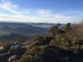
(S/E) Finish the route by climbing to the summit of La Huche Pointue, where the view is unique. To do this, take the D35 on the left for 100 m, then climb up the path on the left, which remains easily passable all the way to the summit.

(15) From there, head back down the same path to finish the route at Chambe de Bos (S/E).

Waypoints

  1. S/E : mi 0 - alt. 2,936 ft - Chambe de Bos municipal path
  2. 1 : mi 0.21 - alt. 3,028 ft - Path leading uphill to the right
  3. 2 : mi 0.75 - alt. 3,173 ft - Route
  4. 3 : mi 1.08 - alt. 3,071 ft - End of the road, stony track to the right
  5. 4 : mi 1.7 - alt. 2,844 ft - Road on the left
  6. 5 : mi 2.21 - alt. 2,769 ft - PR junction
  7. 6 : mi 2.5 - alt. 2,559 ft - Leave the D433 via the path on the left
  8. 7 : mi 2.99 - alt. 2,395 ft - Roulhac
  9. 8 : mi 3.5 - alt. 2,467 ft - Chamblas Castle
  10. 9 : mi 4.2 - alt. 2,392 ft - Before the bridge, take the path on the left
  11. 10 : mi 4.49 - alt. 2,559 ft - Crossroads
  12. 11 : mi 5.18 - alt. 2,585 ft - Washing house
  13. 12 : mi 6.55 - alt. 2,300 ft - Céaux hamlet
  14. 13 : mi 7.47 - alt. 2,438 ft - Pine woods
  15. 14 : mi 8.17 - alt. 2,667 ft - Crossroads
  16. 15 : mi 9.76 - alt. 3,392 ft - Summit of La Huche Pointue
  17. S/E : mi 10.32 - alt. 2,940 ft - Chambe de Bos

Notes

Make sure you wear sturdy footwear as some of the paths are tricky to walk on (lots of stones).
Yellow markings between the points (S/E) and (1) – (2) and (5) – (6) and (7) – (8) and (9).
(11) There is a picnic table right next to the wash house
(14) It appears that, during the season, the path beyond the concrete platform is overgrown. The alternative route involves not turning left in the centre of the hamlet but instead continuing straight on. The small road leads to the hamlet of Palhaires, which you pass through before taking a track on the left at a three-way junction. You then rejoin the route described.

Worth a visit

Pine woods are forests of pines that grow where the ground is poor and there is hardly any soil; these pines were regularly pruned to make bundles of firewood.

(8) Chamblas Castle, which in the mid-19th century was the scene of a murder that made the legal news.

Shortly before (13), admire the cliffs of La Huche Plate, an impressive lava flow (see information boards on site).

At (14), you can take the path on the right, which practically retraces your steps, to head towards the Huche Plate. In that case, go to the far end of this plateau to admire the view.

The view from the summit of the Huche Pointue at (15) is particularly beautiful at the end of the day.

Reviews and comments

4.6 / 5
Based on 3 reviews

Reliability of the description
5 / 5
Ease of following the route
4.7 / 5
Route interest
4 / 5
Florence43700
Florence43700
• Edited:

Overall rating : 4.3 / 5

Date of your route : Sep 24, 2021
Reliability of the description : ★★★★★ Very good
Ease of following the route : ★★★★☆ Good
Route interest : ★★★★☆ Good
Very busy route : No

A lovely long walk, finishing with a climb up the Huche Pointue; the route description is very well done (which is rare) – well done! Beautiful scenery.

Machine-translated

laurent.carraro
laurent.carraro

It’s a real shame to do this walk without climbing up to La Huche Pointue, as the view and the atmosphere there are truly exceptional.
Next time, perhaps?

Machine-translated

Melanierand
Melanierand

Overall rating : 4.3 / 5

Date of your route : Oct 21, 2018
Reliability of the description : ★★★★★ Very good
Ease of following the route : ★★★★★ Very good
Route interest : ★★★☆☆ Average

A rather lovely walk, though not quite exceptional (note that we didn’t climb to the top of the Huche Pointue due to a lack of time, so it’s likely we missed the best view on the walk). There are some lovely views, but you don’t gain much altitude. On the other hand, it’s very rural and you’re not bothered by cars or other walkers. Do watch out for dogs, though, when passing by the farms. We were only scared once, in the village of Fougères, just as we turned left into the village to take the path running alongside the Huche Pointue. There was a dog there that didn’t look friendly at all, and its owner came to fetch it before it could attack us… but this dog is no doubt usually kept locked up on the property…
All in all, a lovely walk through the Yssingelais knolls, which does indeed take you through some beautiful villages with stone houses.

Machine-translated

Travarie
Travarie

Hello Laurent,

You are in no way to blame for the condition of this path at this particular spot. Unfortunately, there are fewer and fewer farmers in our countryside, and many small paths like this one are being left to fall into disrepair. Perhaps it would be worth reporting this to the local council (Rosières? St Etienne Lardeyrol?) because, apart from that, we saw several information boards along the route about points of interest (Chamblas Castle, the forest of twisted pines, etc.). This shows that the local councils are keen to attract the attention of walkers and mountain bikers. Perhaps they could ensure the undergrowth is cleared every now and then for the comfort of walkers? To be continued…

Kind regards,
Gilles

Machine-translated

laurent.carraro
laurent.carraro

I’m glad to hear you enjoyed the walk. I’ll update the description to take your comments on board.
The only point I’m not quite sure about is the comment regarding point 14. Having walked and written up the route at the end of December, the path was very pleasant – obviously with no vegetation!
Kind regards,

Machine-translated

Travarie
Travarie

Overall rating : 5 / 5

Date of your route : May 30, 2017
Reliability of the description : ★★★★★ Very good
Ease of following the route : ★★★★★ Very good
Route interest : ★★★★★ Very good

This was the first time I’d used a walking route suggested by Visorando. Quite honestly, my friend and I absolutely loved this walk around Chamblas Castle and Les 2 Huches.
The route description and the map are completely reliable. I hadn’t brought a military map with me, but despite that, we never had any trouble at all because the information is so precise. Well done to the author.

If I may offer a few small suggestions to the author to make things easier for future walkers:

Point 3): the stony path marked in yellow that winds down between two hedges is actually the bed of a very narrow stream. This should be pointed out as such, especially as the markings are very faint on this section

Point 10): Please specify clearly that the restored old wash house is 500 metres past the exit from Combriol, after a sharp left-hand bend. The phrase ‘shortly afterwards’ does not quite reflect the reality.

Point 12): I think the first sentence and the beginning of the second sentence – ‘leave the yellow signposting, which continues straight ahead, and turn right. At the next junction...’ – should be deleted.
These details could be misleading and lead walkers to pass through Céaux when they should not. It would be better to write directly: “At the entrance to Céaux, take the small road on the left that goes downhill. At the three-way junction, etc.”

Point 14): I suggest amending the end of the route from the hamlet of Fougères. The narrow path proposed from the small concrete platform is particularly narrow, poorly cleared and very stifling. We had to turn back to take a pleasant little road between Fougères and the hamlet of Palhaires, then turn left to follow a wide, uphill track to the finish point at Chambe de Bos,

Apart from these minor adjustments, the rest of the route is remarkably well-detailed and accurate. Thank you.

Machine-translated

Other walks in the area

For more walks, use our search engine .

The GPS track and description are the property of this route's author. Please do not copy them without permission.