Country:

 City:
City:


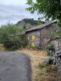
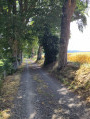
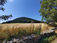
The route starts from the hamlet of Villaret, in the commune of Saint-Julien-Chapteuil. Leave the main D152 road, which runs from Saint-Julien-Chapteuil to Queyrières, by turning right just after a bend, then head up to the left into the hamlet of Villaret to find a small car park in front of some rubbish bins (Rue de Montrachas).
(S/E) Leave the hamlet via the road, which is flat at first but then climbs, heading south-west. Follow a trail route. After a junction (with a road on the left), leave the road to the right and take a path that goes straight on towards the Peyre de Bard. Once you reach the edge of the forest, leave the trail markings that head up to the left.
(1) Continue straight on along a well-marked path. Once in the beech forest, head down to the right, following a track used by mountain bikers, sometimes marked with cairns, sometimes with green ribbons tied to the trees. The track winds down through the forest and joins the D152. Cross the road and, 10 metres to the left, you’ll find the same track continuing to wind downwards. Follow it until you reach a sort of car park set up on a track.
(2) Cross this track, which is part of theGR® 65, and take the wide path opposite, slightly to the left, which descends gently. This will take you to the Moulin de Guérin; follow the path across the Sumène, climb up the opposite side and reach a level path. Turn left, following the sign for “La Chapuze”, and gradually emerge from the forest and the valley known as Combe Noire. You’ll reach a crossroads.
(3) Head up to the right and follow the trail markings. At the next junction, head up to the right again to reach a road and the hamlet of Montchanis. Turn left onto the road and walk through the hamlet. Walk downhill for about 300 metres and leave the road by taking a path that climbs to the right. After about a hundred metres, leave the trail markings, which branch off to the right.
(4) Continue along the wide path which climbs gently, then more or less follows the contour line. It takes you round Mont Chanis through a vast forest. Leave the forest and join a small road, shortly after passing the Maison des Sauvages. Carry on straight ahead when the road descends to the left and take a track lined with tall trees. This will take you to the isolated house of La Chaud du Mas, which has a well and a bread oven. Continue along this track until you reach a Fork in the road where you’ll rejoin the trail markings.
(5) Keep left along the trail and pass close to a mobile phone mast. Continue along this track, ignoring the path on the right. Follow the track uphill to the hamlet of Le Mas and walk through it. This will take you to the D152 road. Follow it for a few dozen metres to the left before coming to a path that climbs to the right. Follow this path uphill, pass a cowshed, then reach a crossroads in the meadows.
(6) Here, you’ll find theGR® path coming from the opposite direction and heading off to the left towards Queyrières. Leave theGR® and take the path on the right, marked with mountain bike signs 20 and 21, which descends gently through the meadows.
(7) Follow these VTT markings as the path enters the forest, widens into a track, passes close to water catchments and emerges back into the meadows, also near a water catchment. Continue along the track, ignoring the paths leading down to the right. This will take you to a small road.
(8) Let the mountain bike markings lead down to the right, then head up the road on the left, which passes close to a house and ends when you reach the next house – the last house in the hamlet of Monedeyres. Continue along what becomes a track until you reach a hairpin bend, about a hundred metres past the house.
(9) Ignore the track heading uphill to the left and carry on straight ahead along a grassy path which leads into the forest through a wetland area. Continue along this path, which turns into a track and climbs increasingly steeply (in the event of heavy rain, the path turns into a torrent… which can be avoided by going round to the right). Complete the climb and join a path running at right angles.
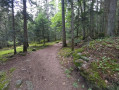
(10) Turn right and descend fairly quickly along this narrow path. The path crosses a stream (a small stone-slab bridge) and enters the forest. Continue along this lovely, almost flat forest path until you reach a barely marked pass. You’ll arrive, almost at the same time, at a crossroads.
(11) Take the path on the right, which gradually begins to descend through the forest. Ignore the tracks on the left but, towards the bottom of the descent, take the only track on the right. It quickly emerges from the woods, turns into a grassy path above the hamlet of Villaret, and leads to the car park (S/E).


 Visorando Member
 Difficult
 Easy
Easy 
 Very difficult