The Sucettes de Borne and the Col de Plainie

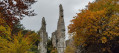
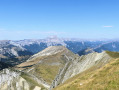
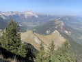
An easy walk along the Borne and Plainie streams and through the Jocou State Forest, which is at its most splendid in autumn, passing by the astonishing rock formations known as the ‘Sucettes de Borne’.

Details

n°28815474
Creation:
Last update:
Last review:
  • Walking
    Activity: Walking
  • ↔
    Distance: 7.64 mi
  • ◔
    Average duration: 5h 25 
  • ▲
    Difficulty: Moderate

  • ⚐
    Back to start: Yes
  • ↗
    Ascent: + 2,231 ft
  • ↘
    Descent: - 2,231 ft

  • ▲
    Highest point: 4,941 ft
  • ▼
    Lowest point: 3,022 ft

Photos

Description of the walk

Access to the start: from Châtillon-en-Diois, take the D539 towards Glandage then, after the Gorges des Gâts, continue on the D624 towards Borne. Park in the first car park on the left after the hamlet of Borne.

(S/E) Cross the road, then the Ruisseau de Borne. Turn left and follow the path that runs alongside the stream.

(1) Turn right onto the path. As you walk along this path, you can admire the famous ‘Sucettes de Borne’.

(2) At the hairpin bend to the right, carry on straight ahead along the Ruisseau de Borne.

(3) At a right-hand hairpin bend, leave the track and follow the path that climbs. This path crosses the track twice. You’ll reach a mountain pasture, then the Tour de Borne refuge. Continue along the track towards the Col de Jiboui. Ignore a path on the left.

(4) At the crossroads, turn left onto the path that climbs gently. Ignore the paths to the right and left. Stay on this path until you reach the junction with the path coming from the Col de Plainie.

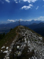
(5) Follow the lovely path on the right up to the Col de Plainie, which is a clearing.

(6) Retrace your steps to the previous junction.

(5) Head down the path on the right, towards Borne.

(7) Walk round the Chalet le Plainie. Follow the path down alongside the Plainie stream. There are several small waterfalls along the way. You may also come across a roe deer or even spot a red deer.

(8) Cross the Plainie stream and continue down the path. The path leads out onto the car park (S/E).


Waypoints

  1. S/E : mi 0 - alt. 3,022 ft - Car park
  2. 1 : mi 1.05 - alt. 3,386 ft - Bridge over the Ruisseau de Borne
  3. 2 : mi 1.91 - alt. 3,930 ft - Start of the path
  4. 3 : mi 2.22 - alt. 4,091 ft - Uphill path
  5. 4 : mi 2.96 - alt. 4,616 ft - Junction
  6. 5 : mi 5.51 - alt. 4,580 ft - Junction
  7. 6 : mi 5.76 - alt. 4,672 ft - Col de Plainie (1430m)
  8. 7 : mi 6.49 - alt. 4,167 ft - Le Plainie chalet
  9. 8 : mi 7.1 - alt. 3,428 ft - Bridge over the Plainie stream
  10. S/E : mi 7.64 - alt. 3,022 ft - Car park

Notes

Shelter near the Refuge de la Tour de Borne.

Reviews and comments

4 / 5
Based on 2 reviews

Reliability of the description
4 / 5
Ease of following the route
4.5 / 5
Route interest
3.5 / 5
aisenmann
aisenmann

Opinions are divided, but I do agree that changing the direction avoids a relatively difficult descent for walkers with knee problems.

Machine-translated

Joel P1.
Joel P1.

Overall rating : 4 / 5

Date of your route : Oct 16, 2023
Reliability of the description : ★★★★☆ Good
Ease of following the route : ★★★★★ Very good
Route interest : ★★★☆☆ Average
Very busy route : No

Hello, as I did this hike with my club, I didn’t have to worry about leading the way…
At the end of the walk, I thought to myself that we should ‘turn’ the other way, because of a very difficult descent at the end of the walk; plus, we’d get a better view of the ‘lollipops’, with a gentle finish...

Machine-translated

nadinechevallier
nadinechevallier

Overall rating : 4 / 5

Date of your route : Jun 25, 2023
Reliability of the description : ★★★★☆ Good
Ease of following the route : ★★★★☆ Good
Route interest : ★★★★☆ Good
Very busy route : No

A lovely walk that we recommend doing in the intended direction, starting at the Sucettes de Borne. The ascent is mostly a gentle climb and offers a varied landscape of forests, mountain pastures, flower-filled meadows and, on the whole, fairly unobstructed views towards the Col de Jiboui and the Jocou. After a short stop at the Borne refuge, where the welcome is particularly warm, the climb continues along a wide path that gradually ascends to reach the Col de Plainie. Whilst this pass does not offer unobstructed views of the surrounding area (our only regret), it is a true haven of peace where you can have a picnic and rest after the climb. The descent then follows a very pretty, steeper path alongside a lovely stream which forms waterfalls as it descends into a deep valley, passing through woods and meadows. Thank you to the author of this guide for enabling us to discover this route, which appears to be little-used yet is very enjoyable.

Machine-translated

Other walks in the area

For more walks, use our search engine .

The GPS track and description are the property of this route's author. Please do not copy them without permission.