The Col de Boulc circular tour from Glandage

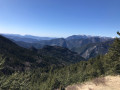
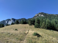
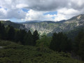
From Glandage, it’s easy to head up to the foothills of La Toussière (1,916 m), then turn back and return to the village via quiet paths after a short detour via the Col de Boulc.

Details

70494677
Creation:
Last update:
Last review:
  • Walking
    Activity: Walking
  • ↔
    Distance: 9.70 mi
  • ◔
    Average duration: 6h 25 
  • ▲
    Difficulty: Difficult

  • ⚐
    Back to start: Yes
  • ↗
    Ascent: + 2,260 ft
  • ↘
    Descent: - 2,287 ft

  • ▲
    Highest point: 4,528 ft
  • ▼
    Lowest point: 2,782 ft

Photos

Description of the walk

Park at the side of the RD539, on leaving the village, near the sports ground (water point, picnic tables, GTV information board).

(S/E) Head towards the village until you reach the war memorial (signpost for Glandage, altitude 860 m).

(1) Turn right, walk past the church and the town hall, then follow Impasse de la Ramée. Go round the house opposite on the left, and continue along the track which follows on from the tarmac and climbs briefly. Stay on the main track heading south-east until you reach the hamlet of Maillefauds.

(2) Carry on straight ahead, still across the meadows, until you reach a crossroads after just over 500 metres.

(3) Turn right towards La Vière, pass under a distinctive arch formed by a very large tree branch, and reach a crossroads marked by a signpost reading ‘La Vière Alt. 1017 m’.

(4) Turn left and pass two remarkable trees at the next junction.

 (5) Follow this good track, continuing south-east.

(6) Cross a ford and, shortly afterwards, reach a junction of tracks marked by the signpost “Les Achiards Alt. 1205 m”.

(7) Follow the sign for Col de Boulc, cross the Ruisseau de la Vière via another ford and continue for a further 1.5 km until you reach a junction with an old track.

(8) Turn left and climb through the woodland to the Cabane du Bois Noir (water source).

(9) Continue south-west, ignoring the paths branching off to the left, until you come out onto a track suitable for vehicles, at a wide hairpin bend. Head up to the left to reach the Col de Boulc (1,285 m).

(10) Retrace your steps to the hairpin bend and turn left down a gentle slope to reach a junction marked by a signpost for “Les Bauches Alt. 1,250 m”.

(11) Continue straight ahead (go through the gate) towards Glandage and the Col Sambue, and stay on this track – which initially climbs – ignoring all side paths. You’ll reach the Col Sambue plateau after just over 4.5 km.

(12) Turn right onto a forest path and, after a few dozen metres, turn right again and continue down a series of hairpin bends to reach a junction near the hamlet of Ferme Pinet.

(13) Turn right, cross the Combe Chauvier as the path heads due north and opens out onto a small clearing (ruins, signpost for ‘La Côte’).

(14) Turn right onto a steeper path, which is rutted in places, and descend to the Ruisseau des Gats, which you cross via a small stone bridge.

(15) Turn left along the meadow and join the RD539; follow this to the right until you reach the car park (S/E

Waypoints

  1. S/E : mi 0 - alt. 2,812 ft - Car park alongside the D539
  2. 1 : mi 0.08 - alt. 2,835 ft - Directional signpost for Glandage, Alt. 860 m
  3. 2 : mi 1.08 - alt. 3,350 ft - Maillefauds
  4. 3 : mi 1.39 - alt. 3,451 ft - Crossroads (signpost)
  5. 4 : mi 1.55 - alt. 3,330 ft - Signpost for La Vière
  6. 5 : mi 1.65 - alt. 3,386 ft - Crossroads, remarkable trees
  7. 6 : mi 3.03 - alt. 3,865 ft - Ford
  8. 7 : mi 3.2 - alt. 3,868 ft - Signpost for Les Achiards
  9. 8 : mi 4.17 - alt. 3,865 ft - Junction of track and path
  10. 9 : mi 4.36 - alt. 4,049 ft - Bois Noir hut and fountain
  11. 10 : mi 4.72 - alt. 4,206 ft - Col de Boulc
  12. 11 : mi 4.98 - alt. 4,081 ft - Signpost for Les Bauches
  13. 12 : mi 7.78 - alt. 4,144 ft - Sambut Pass
  14. 13 : mi 8.41 - alt. 3,566 ft - Trail junction
  15. 14 : mi 8.9 - alt. 3,320 ft - Signpost for La Côte
  16. 15 : mi 9.43 - alt. 2,799 ft - Stone bridge over the Gats stream
  17. S/E : mi 9.7 - alt. 2,808 ft - Car park alongside the D539

Notes

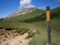
Discreet green and yellow GTV markings, but plenty of signposts.

Water point at the car park (S/E), frost-free in winter

Water point and toilet to the left of the church entrance, frost-free in winter

Water point near the Cabane du Bois Noir

Several other opportunities to top up your water supply along the way, provided you have a suitable filter.

Worth a visit

Gorges des Gats:gorges formed by the Ruisseau des Gats, between Châtillon-en-Diois and Glandage. Walks are possible along cliff ledges on spectacular paths or on old access roads leading to abandoned villages.

Châtillon-en-Diois: exceptional for the richness of its heritage; natural, with the Glandasse mountain, the River Bez and the vineyards; architectural, with its medieval centre and its ‘viols’; botanical, with its collection of plants scattered throughout the village.

Col de Grimone, at an altitude of 1,319 m: links Châtillon-en-Diois to the west and Lus-la-Croix-Haute to the south-east (D 1075, Route des Alpesà laMéditerranée).

Reviews and comments

4.3 / 5
Based on 2 reviews

Reliability of the description
4.5 / 5
Ease of following the route
4 / 5
Route interest
4.5 / 5
bader
bader
• Edited:

Overall rating : 4 / 5

Date of your route : Mar 02, 2026
Reliability of the description : ★★★★☆ Good
Ease of following the route : ★★★★☆ Good
Route interest : ★★★★☆ Good
Very busy route : No

Carried out in good weather, with plenty of snow—30 cm in some sections and around 1,300 metres—and many broken trees across the trails.

Machine-translated

Les Blaireaux de la Rando

Thank you all

Machine-translated

Daniel Maciocia
Daniel Maciocia

Overall rating : 4.7 / 5

Date of your route : May 21, 2025
Reliability of the description : ★★★★★ Very good
Ease of following the route : ★★★★☆ Good
Route interest : ★★★★★ Very good
Very busy route : No

A lovely walk. Especially the first part. Do be careful at point 8 and make sure you don’t miss the path that winds sharply to the left. There are no difficulties, apart from the distance, perhaps. Thanks to the author of the walk.

Machine-translated

Other walks in the area

For more walks, use our search engine .

The GPS track and description are the property of this route's author. Please do not copy them without permission.