Circular Bénevise route via the Pas des Ampes and Tussac

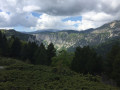
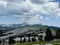
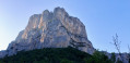
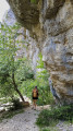
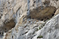
A lovely circular route to Tussac via the Pas des Ampes. This route allows you to admire the Rocher de Combau from its most picturesque angles and to discover the Cirque d’Archiane from commanding yet lesser-known vantage points. This route is relatively shaded in summer, with numerous sections through the woodland.

Details

64981997
Creation:
Last update:
Last review:
  • Walking
    Activity: Walking
  • ↔
    Distance: 7.74 mi
  • ◔
    Average duration: 6h 05 
  • ▲
    Difficulty: Difficult

  • ⚐
    Back to start: Yes
  • ↗
    Ascent: + 2,881 ft
  • ↘
    Descent: - 2,864 ft

  • ▲
    Highest point: 5,620 ft
  • ▼
    Lowest point: 2,841 ft

Description of the walk

The walk starts from the hamlet of Bénevise. Park in the communal car park situated just to the right, above the road, as you enter the hamlet via the RD515. There is a fountain by the side of the road. The car park isn’t very big (around ten spaces) and fills up very quickly during the holidays and at weekends when the weather is fine. In that case, park 400 m before or 500 m after the hamlet; there are areas where you can park.

(S/E) Follow theGR®93, which descends towards Les Nonnières. To do this, leave the hamlet and walk alongside the RD515 for a few hundred metres before turning right under the road and joining a pleasant path carved through the boxwood after crossing the Ruisseau de Combau.

(1) Take the hiking path on the left (yellow/green markings) which climbs towards the Combeau valley. Cross the RD120 twice – the road climbs to the Col de Menée – and take care at both these points. The second time, head left for about 200 m.

(2) Turn right onto a path that climbs up to the RD515, which leads to the Combeau valley. Turn right and follow the road uphill for about 300 m.

(3) Leave the yellow/green markings and take a small, poorly marked path that climbs steeply up the slope on the left. Follow this steep path, which is not very well marked but whose route is fairly easy to make out. At around 1,400 m, the slope levels off before joining a better-marked path (cairn).

(4) Take this path, heading left as you climb. Follow this path to the base of a large scree slope, which you climb whilst staying on the well-marked path: do not take the tracks that head straight up the scree slope.
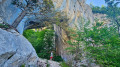
Reach the Pas des Ampes, marked by two monoliths rising amongst the trees on the left.

(5) Follow the path, gradually ascending the long Coureau valley. When you reach the track leading to the Jardin du Roi (cairn), turn left heading south.

(6) Leave the track to the right to reach, some twenty metres higher up, a first viewpoint overlooking the Couron ravine and the vast Cirque d’Archiane. The walk continues southwards. The route is off-trail but fairly obvious, following the cliff at varying distances. Along the way, where the forest opens out a little, you’ll find several unusual viewpoints and vantage points overlooking the Cirque d’Archiane. Walk for about 1 km.

(7) Look for one of the various paths on the left that branch off from the cliff towards the east and follow it to reach a valley leading to the pastures of the hamlet of Tussac. Join the track.

(8) Turn right onto it and continue south. Cross over to the eastern slope of the rocky ridge and descend the slopes above the hamlet of Bénevise.

(9) At the third hairpin bend (cairn), take the path branching off to the right and, further down in the woods, join a faint track. Follow this track downwards via several hairpin bends until you rejoin theGR®93.

(10) Turn left to quickly reach the hamlet of Bénevise (S/E).

Waypoints

  1. S/E : mi 0 - alt. 3,317 ft - Communal car park
  2. 1 : mi 0.91 - alt. 2,841 ft - Leave the GR®93, turning left
  3. 2 : mi 1.44 - alt. 3,209 ft - Path on the right
  4. 3 : mi 2.24 - alt. 3,924 ft - Leave the road, turn left
  5. 4 : mi 2.79 - alt. 4,685 ft - Cairn, on the left
  6. 5 : mi 3.37 - alt. 5,121 ft - Pas des Ampes
  7. 6 : mi 4.49 - alt. 5,515 ft - Viewpoint
  8. 7 : mi 5.17 - alt. 5,331 ft - Path on the left
  9. 8 : mi 5.63 - alt. 5,125 ft - Hamlet of Tussac
  10. 9 : mi 6.61 - alt. 4,373 ft - Cairn, on the right
  11. 10 : mi 7.33 - alt. 3,583 ft - Junction with the GR®93
  12. S/E : mi 7.74 - alt. 3,333 ft - Communal car park

Notes

(S/E) Bénevise stopover lodge.

This route passes through a protected area, which may be subject to special regulations:

Worth a visit

Depending on the season, you may see vultures in flight, or even eagles or bearded vultures.

Always be cautious and plan ahead when you're outdoors. Visorando and the author of this route cannot be held responsible for any accidents occurring on this route.

The GR® and PR® markings are the intellectual property of the Fédération Française de Randonnée Pédestre.

Reviews and comments

4.4 / 5
Based on 4 reviews

Reliability of the description
4.5 / 5
Ease of following the route
4 / 5
Route interest
4.8 / 5
lesignal
lesignal

Overall rating : 4.3 / 5

Date of your route : Jun 26, 2026
Reliability of the description : ★★★★☆ Good
Ease of following the route : ★★★★☆ Good
Route interest : ★★★★★ Very good
Very busy route : No

We completed this route on 26 June 2026 during a heatwave. Despite this, it’s a very pleasant route; the entire climb up to the Pas des Ampes is in the shade. On the plateau, there’s always a bit of a breeze. The landscape is magnificent and wild, and the views of the Cirque d’Archiane and the Glandasse are exceptional. The route across the plateau is a little tricky due to the lack of a marked path, but with GPS this isn’t a problem at all. In fact, it’s best to keep this ‘adventurous’ aspect to avoid the crowds.
On the way back to Benevise, a quick stop at the lodge, which offers some welcome refreshments.

Machine-translated

Gîte de Bénevise
Gîte de Bénevise

Thank you! It is indeed the lack of signposting that makes the hike so charming ;-) and a little challenging. Other beautiful routes are available on request at the lodge.

Machine-translated

Le Dex
Le Dex

Overall rating : 4.3 / 5

Date of your route : Nov 10, 2025
Reliability of the description : ★★★★★ Very good
Ease of following the route : ★★★★☆ Good
Route interest : ★★★★☆ Good
Very busy route : No

We really enjoyed this hike, which remains challenging after the Pas des Ampes due to the lack of signposting.
We started from Les Nonières, which added 2.5 km to the route.
Thanks to the creator.

Machine-translated

VCANET
VCANET

Overall rating : 4.7 / 5

Date of your route : May 12, 2025
Reliability of the description : ★★★★★ Very good
Ease of following the route : ★★★★☆ Good
Route interest : ★★★★★ Very good
Very busy route : No

We had a bit of trouble staying on the trail between points 6 and 7.
Between points 7 and 8, on the left as you head down the path, there is a lovely chalet whose owner leaves the ground floor open to welcome passers-by. (Please read the instructions carefully to help keep this place pleasant and tidy.) It was a welcome break for us on this rainy day.

Machine-translated

did05
did05
• Edited:

Overall rating : 4.3 / 5

Date of your route : May 19, 2025
Reliability of the description : ★★★★☆ Good
Ease of following the route : ★★★★☆ Good
Route interest : ★★★★★ Very good
Very busy route : No

A very lovely route. The section marked in yellow and green could do with some clearing, particularly between the first crossing of the RD 120 and the second crossing of this departmental road. A steep but shaded climb between the RD 515 and the Pas des Ampes. Make sure you follow the GPS route carefully as you make your way along the ridges between the waypoints (6) and (7). Some very lovely views.

Machine-translated

Other walks in the area

For more walks, use our search engine .

The GPS track and description are the property of this route's author. Please do not copy them without permission.