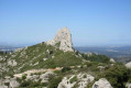
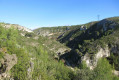
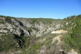
The springs and small waterfalls of Cauvières around the Mauvelle valley

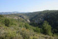
There are lovely tracks overlooking the Mauvelle valley leading to the Sources de Cauvières and several small waterfalls. After climbing out of the valley, the return route via Le Caban takes you back to the lower part of the Mauvelle valley. It is a mix of wide tracks offering stunning panoramic views and steep, wild paths at the bottom of the valley (please read the ‘Practical Information’ section carefully).

Details

20397216
Creation:
Last update:
Last review:
  • Walking
    Activity: Walking
  • ↔
    Distance: 6.37 mi
  • ◔
    Average duration: 3h 50 
  • ▲
    Difficulty: Moderate

  • ⚐
    Back to start: Yes
  • ↗
    Ascent: + 1,086 ft
  • ↘
    Descent: - 1,060 ft

  • ▲
    Highest point: 1,667 ft
  • ▼
    Lowest point: 614 ft

Photos

Description of the walk

From Château-Gombert or Plan-de-Cuques, take the Chemin de la Grave (La Montade neighbourhood). Park at the end of the track by a gate and a DFCI track, where there are plenty of angled parking spaces available.

(S/E) Go through the gate and follow the track. Pass the junction with the path leading to the Vallon de Mauvelle. Continue for about 120 m and, at the right-hand bend, look out for a path on the right.

(1) Take this unmarked path which climbs through the forest, heading north-north-east. The path then levels out, becomes wider and passes several fire stations and under a high-voltage power line.

(2) Turn right at a junction. You’ll reach an open area, partly tarmacked, with the Canal de Provence facilities on your left. Take a detour to the right to get a closer look at the Vallon de Mauvelle.

(3) At the junction, turn right and continue northwards. You’ll reach a place known as Les Quatres Chemins, where there is an underground cistern (no. 173, elevation 387) at a fork in the path.

(4) Head down to the right onto the track and catch a glimpse of the ruins of Cauvières. You’ll reach a hairpin bend.

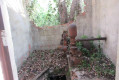
(5) Turn left and head along the clear path, heading north-west. At a sign marked ‘Réserve’, turn right into the bushes to discover the developed Cauvières spring and, a little further down, an old pumping station. Continue along the valley and arrive at a dead end. Head left to the far end to find a small opening in the bushes.

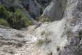
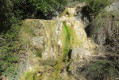
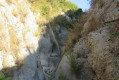
(6) Caution: tricky section. Pass through the bushes to discover a stream bed with small pools filled with water and moss-covered, water-streaked rocks: the first small waterfalls. Climb up the rocks, then cross a wooded section with numerous pools filled with water to reach, at the end, some beautiful, trickling waterfalls. Go round the rocks on the right to reach a track higher up on the left.

(7) Turn right onto this track. Pass by a stone hunters’ shelter, then keep to the left to continue through the valley. Pass by fenced enclosures (hunting reserve). The path then narrows but remains passable. You’ll reach a DFCI track.

(8) Turn right onto the track. Ignore the turn-offs to the left and right to reach the large house at Le Caban. Keep to the right, heading south.

(9) Leave the track to the right to join a wide path further down, lined with numerous plantations. Turn left and stay on this path. Descend into the valley. You’ll reach the three-way junction in the Vallon de Mauvelle. (Please read the ‘Practical Information’ section carefully).

(10) Keep to the left and head down the valley along a very stony path. You’ll reach the main track you took on the way there.

Turn left onto the track and head back to the car park (S/E).

Waypoints

  1. S/E : mi 0 - alt. 614 ft - La Montade DFCI track
  2. 1 : mi 0.27 - alt. 692 ft - The path starts on the right
  3. 2 : mi 0.82 - alt. 1,007 ft - Crossroads
  4. 3 : mi 1.37 - alt. 1,096 ft - Crossroads
  5. 4 : mi 1.77 - alt. 1,270 ft - Les Quatres Chemins
  6. 5 : mi 1.94 - alt. 1,181 ft - Mauvelle valley
  7. 6 : mi 2.16 - alt. 1,253 ft - Small waterfalls
  8. 7 : mi 2.21 - alt. 1,329 ft - Track
  9. 8 : mi 2.87 - alt. 1,667 ft - Top of the valley
  10. 9 : mi 4.52 - alt. 1,280 ft - Start of the path on the right
  11. 10 : mi 5.46 - alt. 840 ft - Three-way junction in the Mauvelle valley
  12. S/E : mi 6.37 - alt. 614 ft - DFCI La Montade track

Notes

For reference: the author’s time for this route was 3 hours (excluding a lunch break).

- Although the Source des Cauvières flows practically all year round, it is best to do this walk at the end of winter to admire the small waterfalls.
- The section between (6) and (7) is very tricky: wet rocks to cross, and a stream bed that is overgrown and may be filled with running water. Take great care, especially if you are not used to negotiating this sort of obstacle.
- Take care during the hunting season, as this area is very popular with hunters.
- To avoid descending the valley from (9), where the vegetation has become overgrown, and thus to avoid getting scratched whilst wearing short clothing, there are two alternatives:
1- Head to point (5), and at the bend, descend the entire length of the Mauvelle valley. You will reach point (10).
2 – Reach the Mauvelle valley from the 409-metre mark at Le Caban by taking the path that descends south-west. Return to the point (10).
Be careful, however, as there are some large potholes to cross, one of which has a metal ladder fitted.

Reviews and comments

3.5 / 5
Based on 4 reviews

Reliability of the description
3.8 / 5
Ease of following the route
3.3 / 5
Route interest
3.5 / 5
Gijean
Gijean

Overall rating : 4.7 / 5

Date of your route : Feb 10, 2025
Reliability of the description : ★★★★★ Very good
Ease of following the route : ★★★★☆ Good
Route interest : ★★★★★ Very good
Very busy route : No

A lovely walk

Machine-translated

phildaix
phildaix

Overall rating : 3.7 / 5

Date of your route : Nov 13, 2024
Reliability of the description : ★★★★☆ Good
Ease of following the route : ★★★☆☆ Average
Route interest : ★★★★☆ Good
Very busy route : No

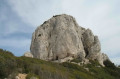
The route is very scenic and varied (with dramatic terrain, views over Marseille, magnificent woodland and, above all, an absolutely splendid climb right at the start). In fact, rather than turning right at point 1, we carried on along the track, which featured some lovely rock formations, and rejoined the route at point 2. Although it was the day after heavy rain, the potholes were dry; it’s a shame – we’ll have to come back in the spring.

Two tricky sections
- between points 6 and 7: scrambling over rocks with thorny bushes everywhere isn’t easy; I can’t imagine how anyone manages to get through when water is running down them???
- after point 10 there’s a proper rock-climbing section; it’s best to warn anyone who’s never done it before. Even if you can manage it without a rope…

Otherwise, in several places the path is very narrow and overgrown with thorny vegetation: don’t venture there without trousers and your arms covered!

Machine-translated

Rcanta
Rcanta
• Edited:

A lovely walk
A few tricky bits
You have to walk through the stream
The return journey is very stony

Machine-translated

Vusky
Vusky
• Edited:

Hello,
Did you use the GPS? If not, you must have taken the wrong route in the Cascadettes area. Whether dry or wet, the path above the Cascadettes is easy and accessible to everyone, provided you follow the directions carefully as far as the hunters’ shelter and the DFCI track. A rope – what for?

Machine-translated

ingarao
ingarao

Overall rating : 1.3 / 5

Date of your route : Jan 08, 2023
Reliability of the description : ★★☆☆☆ Disappointing
Ease of following the route : ★☆☆☆☆ Very disappointing
Route interest : ★☆☆☆☆ Very disappointing
Very busy route : No

Hello, if you see water flowing over the small waterfalls, the walk ends there. If it’s dry, the steps are very difficult to negotiate.
On the way back, there’s a steep descent – take a rope for your safety.
In fact, don’t bother with it – it’s not worth the effort.
Kind regards
Fi

Machine-translated

gillou13
gillou13

Overall rating : 4.3 / 5

Date of your route : Apr 15, 2022
Reliability of the description : ★★★★☆ Good
Ease of following the route : ★★★★★ Very good
Route interest : ★★★★☆ Good
Very busy route : No

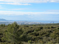
An interesting route with lovely views over Marseille and the Canton Vert.
The GPS track is very accurate and easier to follow than the route description, which isn’t always very clear.
Highly recommended for local walkers equipped with secateurs, as the path – particularly on the descent through the valley (on the return leg) – tends to close in…
Kind regards
GM

Machine-translated

Other walks in the area

For more walks, use our search engine .

The GPS track and description are the property of this route's author. Please do not copy them without permission.