From La Montade to the ridges of the Étoile

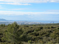
Just a stone’s throw from one of France’s largest urban areas, with wild valleys and picturesque, panoramic ridges.

Details

4370574
Creation:
Last update:
Last review:
  • Walking
    Activity: Walking
  • ↔
    Distance: 7.64 mi
  • ◔
    Average duration: 5h 00 
  • ▲
    Difficulty: Moderate

  • ⚐
    Back to start: Yes
  • ↗
    Ascent: + 1,690 ft
  • ↘
    Descent: - 1,680 ft

  • ▲
    Highest point: 2,080 ft
  • ▼
    Lowest point: 617 ft

Description of the walk

Car park at La Montade at the start of the Chemin de la Grave.

(S/E) Follow the track, which is closed to cars by a gate.

(1) Take the path that climbs up the Vallon de Mauvelle on the right-hand side.

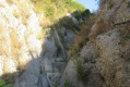
(2) At the junction of the two branches of the valley, take the left-hand one. There is a metal ladder to help you climb a rocky outcrop.

(3) When you reach a 4x4 track, follow it to the right and, a few dozen metres further on, take a path to the right.

(4) Cross the flat area in front of the Caban house, take the path that descends eastwards and join a DFCI track. Walk a few metres to the left.

(5) Turn left to head up the bottom of the Vallon du Pilon du Roi (green markers).

(6) Leave the valley floor and follow a track that climbs to the left.

(7) When you reach the main ridge of the Chaîne de L’Étoile at 556 m, at La Colle, take the path to the left (blue markings).

(8) Leave the marked path (cairns) and head up to the left along a well-trodden track to the highest point at altitude 635 on a secondary ridge, which you follow south-eastwards. You’ll reach a lookout post (take care during the hunting season!), where a track suitable for vehicles leads back to Caban.

(4) Follow the DFCI track straight ahead towards the south.

(9) At the fork, take the track on the right.

(10) At the bottom of the valley, head left into it, heading due south.

(2) Join the route taken on the way out, which will take you back to the start (S/E).

Waypoints

  1. S/E : mi 0 - alt. 617 ft - Car park at La Montade
  2. 1 : mi 0.2 - alt. 663 ft - Lower part of the Mauvelle Valley
  3. 2 : mi 0.91 - alt. 846 ft - Confluence of the two branches of the Vallon de Mauvelle
  4. 3 : mi 1.84 - alt. 1,119 ft - Junction (top of the western branch)
  5. 4 : mi 2.11 - alt. 1,345 ft - Caban
  6. 5 : mi 2.31 - alt. 1,076 ft - Pilon du Roi valley
  7. 6 : mi 3.62 - alt. 1,562 ft - Junction leading to the ridges
  8. 7 : mi 3.79 - alt. 1,818 ft - Pas de la Colle
  9. 8 : mi 4.03 - alt. 1,919 ft - Leave the marked path, turning left
  10. 9 : mi 5.88 - alt. 1,181 ft - Junction of tracks
  11. 10 : mi 6.01 - alt. 1,175 ft - Bottom of the valley (top of the eastern branch)
  12. S/E : mi 7.64 - alt. 623 ft - Car park at La Montade

Notes

No water source.

Concrete tables and benches on the Caban terrace. The house is usually locked (used by hunters).

Worth a visit

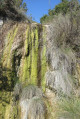
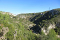
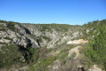
Fine examples of torrential erosion at the bottom of the Vallon de Mauvelle, particularly in its western branch: potholes and concave depressions.

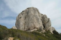
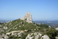
A very picturesque setting on the main ridge of the Chaîne de l’Étoile: ruiniform relief (dolomitic terrain), Scots pines.

Wide-ranging views across the ridges (the massif’s main ridge and the south-eastern ridge at an altitude of 635 metres).

Reviews and comments

4.6 / 5
Based on 3 reviews

Reliability of the description
4.7 / 5
Ease of following the route
4.7 / 5
Route interest
4.3 / 5
rando13mart
rando13mart

Overall rating : 5 / 5

Date of your route : Apr 26, 2021
Reliability of the description : ★★★★★ Very good
Ease of following the route : ★★★★★ Very good
Route interest : ★★★★★ Very good
Very busy route : No

A superb hike, but not one to undertake in very hot weather.

Machine-translated

manonroro
manonroro

Overall rating : 4 / 5

Date of your route : Feb 03, 2021
Reliability of the description : ★★★★☆ Good
Ease of following the route : ★★★★☆ Good
Route interest : ★★★★☆ Good
Very busy route : No

The route from point 1 to point 3 wasn’t easy, but the scenery from point 5 to point 8 was magnificent. On the way back, to avoid the rough main track leading from point 2 to point 1, we continued along the DFCI track at point 9

Machine-translated

Pluc
Pluc
• Edited:

I’m pleased to see that you’ve followed my route and rather enjoyed it.
Having revisited it recently, I was a little worried that I hadn’t sufficiently warned potential hikers about the rugged nature of much of the route. Some walkers do, in fact, prefer well-marked and signposted paths.
The valley floors are very overgrown in places and walking through them must be a real nuisance in light clothing. So be careful in the warmer months, especially if a wet and mild spring has encouraged the vegetation to grow!
I have a vague plan (I’m still thinking it over, as it wouldn’t be a simple task) to clear the undergrowth and remove the stones from the lower section and the eastern branch of the Vallon de Mauvelle, so that I can cycle through there again on a mountain bike, something we used to do before the great fire of 25 July 1997, which ravaged 3,500 hectares of the Chaîne de l’Étoile and completely transformed the landscape. I went back there for the first time since then precisely to assess the situation.
An interesting feature of my route is that it follows almost exclusively trails, in a mountain range where, if you simply follow the official signposts, you spend most of your time walking or cycling on DFCI tracks. Anyone unfamiliar with the area can see this for themselves by looking at the VTTrack map; recent circumstances have given yours truly the opportunity to complete the ‘trails’ layer for the area in what I believe to be exhaustive detail (for mountain biking).

Machine-translated

Campagne bessons
Campagne bessons

Overall rating : 4.7 / 5

Date of your route : Dec 10, 2020
Reliability of the description : ★★★★★ Very good
Ease of following the route : ★★★★★ Very good
Route interest : ★★★★☆ Good
Very busy route : No

A lovely walk, though the first section isn’t exactly easy. To find the junctions, you need to keep a close eye on the distances, as this walk takes you along some little-known paths.
A lovely walk – I’d say it’s of medium to above-average difficulty.

Machine-translated

Other walks in the area

For more walks, use our search engine .

The GPS track and description are the property of this route's author. Please do not copy them without permission.