The Vallon des Escombes via the Chemin de Caban

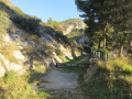
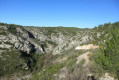
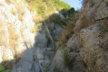
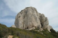
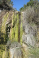
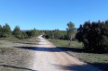
This walk offers contrasting scenery: on the one hand, the wide Caban track, flanked from east to west by the Étoile massif; and on the other, the wild, steep-sided Vallon des Escombes with its rocky slabs, water-filled potholes, narrow, overgrown paths and tunnel of vegetation.
Important note: please take careful note of the practical information before setting out on this walk.

Details

17610763
Creation:
Last update:
Last review:
  • Walking
    Activity: Walking
  • ↔
    Distance: 4.60 mi
  • ◔
    Average duration: 2h 45 
  • ▲
    Difficulty: Moderate

  • ⚐
    Back to start: Yes
  • ↗
    Ascent: + 725 ft
  • ↘
    Descent: - 696 ft

  • ▲
    Highest point: 1,257 ft
  • ▼
    Lowest point: 564 ft
  • ⚐ Country: France
  • ⚐ City: Allauch (13190)
  • ⚑
    Start/End: N 43.361235° / E 5.476905°
  • ❏
    IGN map(s): Ref. 3145ET
  • Hour-by-hour weather

Photos

Description of the walk

From Plan de Cuques, take the D 908 towards Logis Neuf. On Avenue Salvador Allende, turn left onto Chemin de Bon Rencontre, then 900 metres further on, turn left onto Chemin du Vallon des Gages. Follow the track to the end to reach a car park at the start of the walk.

(S/E) Go through the gate and follow the track. You’ll come to a water retention dam. Cross the concrete slab and then walk alongside the rocks.

(1) Turn sharply left to climb up above the rocks. Cross smooth, slippery slabs – take great care in wet weather. Join a path that climbs and passes next to a fire station. Keep to the right at a junction.

(2) Turn right after the electricity pylon. The path passes a fire station and enters a wooded area. Keep to the left at the Y-junction. You’ll reach a crossroads in a large open area.

(3) Turn right onto the track (Chemin de Caban), heading north. Stay on this track, passing fire tank no. 632 and, further on, underground fire tank no. 128.

(4) After the tank, turn right onto the track which descends in wide bends.

(5) At the bottom, at the hairpin bend, turn right onto the path that descends into the valley, winding its way through the vegetation.

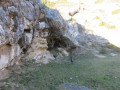
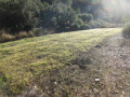
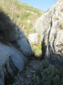
(6) Turn right at the Y-junction heading due south. You will reach the Vallon des Escombes. The path becomes more challenging with numerous rocky slabs and potholes filled with water. The path then levels out and becomes pleasant, leading to a grassy, open area. Note the Jas Bonifay on the right.

(7) From this point, the path narrows considerably as it winds its way through dense vegetation and bushes. Watch out for scratches. Cross a very narrow rocky section, then arrive at a long tunnel of vegetation where you’ll need to crouch to get through. Once you reach a rock face, the tunnel becomes impassable. Do not proceed.

(8) Turn left onto a barely visible path that winds its way round the dense vegetation to reach a water retention dam. Follow the track that runs to the left of the dam.

(1) Once you reach the second dam, follow the route back the way you came to return to the car park (S/E)

Waypoints

  1. S/E : mi 0 - alt. 564 ft - Les Gages
  2. 1 : mi 0.11 - alt. 653 ft - Junction of the circular loop
  3. 2 : mi 0.51 - alt. 892 ft - Turn right after the pylon
  4. 3 : mi 1.07 - alt. 1,053 ft - Turn right onto the main Caban track
  5. 4 : mi 1.83 - alt. 1,250 ft - Turn right after fire hydrant no. 128
  6. 5 : mi 2.43 - alt. 1,076 ft - Descent into the valley
  7. 6 : mi 2.72 - alt. 1,024 ft - Descend to the right towards the bottom of the valley
  8. 7 : mi 3.52 - alt. 869 ft - Dense vegetation
  9. 8 : mi 4.17 - alt. 719 ft - Climb up on the left
  10. S/E : mi 4.6 - alt. 564 ft - Les Gages

Notes

Important note: the Vallon des Escombes, like many other valleys in the Chaîne de l’Étoile, is not marked on IGN maps as a signposted path but as a stream bed. You should therefore take precautions if you are walking through this valley. The route suggested here is shown on the IGN satellite base map.
- There are plenty of stones along the route and numerous obstacles that may hinder progress.
- Narrow, overgrown sections (wear long clothing).
- Large, flat limestone slabs that are often damp. Take care not to slip.
- Take care after a thunderstorm, as the stream may be flowing strongly.

For reference: the author’s estimated time for this route is 2 hours 30 minutes (excluding a lunch break).

Worth a visit

A bit of history: in the very overgrown area of the Vallon des Escombes (above the point (8)), Captain Ike B. Webb Jr.’s aeroplane crashed after being shot down by German fighter planes on 24 October 1943 (there is a memorial on the Chemin de Mimet near the Provence Nemrod shooting range).

Reviews and comments

4.5 / 5
Based on 2 reviews

Reliability of the description
4.5 / 5
Ease of following the route
4.5 / 5
Route interest
4.5 / 5
juliemolto
juliemolto

Overall rating : 4 / 5

Date of your route : Jun 14, 2025
Reliability of the description : ★★★★☆ Good
Ease of following the route : ★★★★☆ Good
Route interest : ★★★★☆ Good
Very busy route : No

Since the last comment, some time has passed and just before climbing the rock, I had to find the path, which wasn't easy because a bush had grown right in the middle of it.
Then, indeed, there is a good climb, but the view is really nice! And the rest is very easy until point 7, which indicates dense vegetation, and it's true that this wasn't the most pleasant part.

Machine-translated

Aquariel
Aquariel

Overall rating : 5 / 5

Date of your route : Dec 19, 2021
Reliability of the description : ★★★★★ Very good
Ease of following the route : ★★★★★ Very good
Route interest : ★★★★★ Very good
Very busy route : No

We really enjoyed this short walk.
- The start is a bit of a challenge with its surprisingly steep climb up the large, sloping rock. After that, it’s easier until you reach the turning point in the valley, and the view is superb.
- The descent into the valley is just as described: very rugged, varied and great fun!
- Do remember to take a look at the Jas Bonifay on the right
- You can see the spot where you cross the Canal de Provence thanks to a marker post high up on the right-hand side
- We were greeted by a friendly little herd of goats
- The tunnel of vegetation posed no difficulty; it seems that branches had been freshly cut back to clear the way a little.
- The path, which is barely visible at point 8, is actually quite clear. At the top, there’s a small cave and a beautiful rock face.
- The water retention dam is easy to find (a lovely spot for a picnic)

We did the route in the morning, not too late; there was still frost, especially in the valley. It then started to melt and left us soaked – no big deal, but bear this in mind.

Machine-translated

Other walks in the area

For more walks, use our search engine .

The GPS track and description are the property of this route's author. Please do not copy them without permission.