The Monts-d’Or trails starting from Chasselay

A walk through the woodland; wear suitable footwear and bring walking poles, as there are steep, slippery and muddy sections in wet weather. Only one kilometre on the road, with the option to walk on the hard shoulder without any problems.

Details

3463426
Creation:
Last update:
Last review:
  • Walking
    Activity: Walking
  • ↔
    Distance: 6.51 mi
  • ◔
    Average duration: 4h 10 
  • ▲
    Difficulty: Moderate

  • ⚐
    Back to start: Yes
  • ↗
    Ascent: + 1,365 ft
  • ↘
    Descent: - 1,345 ft

  • ▲
    Highest point: 1,873 ft
  • ▼
    Lowest point: 778 ft

Photos

Description of the walk

Start from the Chasselay Pond car park.

(S/E) Take Rue de l’Étang uphill. At the first junction, turn left. You’ll reach Rue des Darbonnières; follow it to the right. Then take thefirst dirt track on the left. At the T-junction, follow the Chemin de la Forêt to the right

(1) At a junction in the woodland, take the path on the left that leads uphill. The path soon turns right: continue southwards, ignoring the paths to the right and left.

(2) At a Fork in the road, veer to the right. At the next junction, turn right towards La Madone. Once you arrive, leave La Madone behind you and head up to the right, following a track. Join a path and follow it to the right.

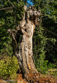
(3) At a fork in the road, follow the path on the left. Take several hairpin bends and ignore the side tracks. At a T-junction with a V-shaped tree, turn left.

(4) At the next junction, turn left. Follow the path towards La Colas, ignoring a path branching off to the left. A little further on, you’ll reach the Chemin de Chasselay (marker 403 on the IGN map) and follow it to the right towards Poleymieux.

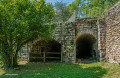
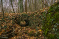
(5) About 150 m further on, take a short detour to the Ermitage Saint-Antoine and the Serminon tanning pit.

(5) Continue along the path towards the east. You’ll come out onto a tarmac road; follow it to the left. At the Y-junction, turn right towards Mont Py. Carry on straight ahead (south-west), ignoring the side paths. At the end of the path, veer to the right and you’ll immediately reach a crossroads.

(6) Take the path between the ‘military ground’ sign and the ‘Stop’ sign.
You’ll reach the Croix du Mont Verdun (rest area) and follow the road on the right towards Limonest.

(7) After about a hundred metres, take a path on the left marked by a large stone. At a three-way junction, turn right and head downhill. At the next junction, turn right towards the Gîte de la Glande. Walk past the lodge and continue until you reach a road.

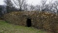
(8) Follow the road to the left towards Limonest. About 150 metres further on, you’ll pass an old lime kiln (well worth a visit). Continue along the road towards Limonest.

(9) At the start ofthe second left-hand bend, leave the road and take a path on the right (marked for mountain biking). Head downhill and, at the junction at the bottom, veer to the right. At the next junction, which comes shortly afterwards, turn right.

(10) At the next junction, turn left onto the geological trail towards Chasselay. Follow this trail, heading north-north-west or north depending on the section, and ignore the offshoots on the left.

(11) At the three-way junction, turn left. Head straight on (north) and pass the buildings. Just before Rue du Promenoir, turn right onto Rue de l’Étang and you’ll immediately reach the car park (S/E).


Waypoints

  1. S/E : mi 0 - alt. 787 ft - Start: the car park by the lake
  2. 1 : mi 0.67 - alt. 1,066 ft - Start of the path on the left
  3. 2 : mi 1.1 - alt. 1,381 ft - Fork in the road
  4. 3 : mi 1.21 - alt. 1,329 ft - Fork in the road
  5. 4 : mi 1.76 - alt. 1,516 ft - Junction
  6. 5 : mi 2.43 - alt. 1,401 ft - Access to the Hermitage of Saint-Antoine
  7. 6 : mi 3.49 - alt. 1,745 ft - Crossroads – Path between the signposts
  8. 7 : mi 3.89 - alt. 1,818 ft - Start of the trail
  9. 8 : mi 4.49 - alt. 1,716 ft - Chemin des Aviateurs
  10. 9 : mi 4.77 - alt. 1,667 ft - Mountain bike trail
  11. 10 : mi 5.16 - alt. 1,496 ft - Geological trail on the left
  12. 11 : mi 6.22 - alt. 909 ft - Three-Way Junction
  13. S/E : mi 6.51 - alt. 787 ft - Arrive at the Étang car park

Worth a visit

The Madone viewpoint and its rest area.
The Hermitage of Saint-Antoine and the Serminon lime kiln.
At point (6): the view of Mont Blanc on a clear day.
After the Glande lodge, the lime kiln.

Reviews and comments

3.9 / 5
Based on 4 reviews

Reliability of the description
3.3 / 5
Ease of following the route
4 / 5
Route interest
4.3 / 5
Monsieur Chupon
Monsieur Chupon

Overall rating : 4.5 / 5

Date of your route : Aug 27, 2023
Reliability of the description : Not used / Not applicable
Ease of following the route : ★★★★★ Very good
Route interest : ★★★★☆ Good
Very busy route : No

A walk completed this afternoon in 2 hours and 45 minutes.
The route is very easy to follow on the GPS, and the scenery, whilst not exceptional, is very pleasant. Lots of greenery and a refreshing change in this sweltering summer.

Machine-translated

Nano22
Nano22

Overall rating : 5 / 5

Date of your route : Feb 24, 2021
Reliability of the description : ★★★★★ Very good
Ease of following the route : ★★★★★ Very good
Route interest : ★★★★★ Very good
Very busy route : No

A superb hike. The GPS track on the phone is spot on. Take care on the stretch of road next to the lime kiln. Some lovely views

Machine-translated

del G
del G

Overall rating : 2 / 5

Date of your route : Sep 13, 2020
Reliability of the description : ★★☆☆☆ Disappointing
Ease of following the route : Not used / Not applicable
Route interest : Not used / Not applicable
Very busy route : No

Hello, there were no signposts all the way to La Madonne, which we found by some miracle (it must have been the Blessed Mother who guided us), helped too by some walkers we came across; then there was nothing – no path and still no signposts – so we found our way back using the GPS on our phone
In the end, we covered roughly the distance stated for this walk, without ever actually following the marked route
A lovely walk all the same, as we came across several horses with their riders

Machine-translated

polo1408
polo1408

Overall rating : 3 / 5

Date of your route : Sep 11, 2020
Reliability of the description : ★★★☆☆ Average
Ease of following the route : ★★☆☆☆ Disappointing
Route interest : ★★★★☆ Good
Very busy route : No

The description between points 1 and 3 needs reviewing. I went back and forth several times, following various paths. Eventually, using my altimeter and compass, I reached the path marked in yellow, as well as red and blue. I followed it, turning left when I joined it. A few hundred metres further on, I found myself at point 4 (the rocks).
So I didn’t see the Madonna!
When you say to follow the direction of La Colas, how do you know which way to go?
I found the signpost marked ‘La Colas’ near point 5.
At point 9, you say to take the path on the right (MTB sign). There are no more MTB signs, and the path is very narrow. I carried on along the road for 300 metres, then turned right onto the farm track which, further on, crosses the famous MTB track.
At point 11, replace “just before Rue du Promenoir” with “go down Rue Plantin”.
I did visit all the places you recommended!
I’m going to do this walk again, starting from Rue du Plantin, which I’ll leave to continue along the geological trail; I’ll leave that at the first junction to follow the forest track that will take me to La Madone, which I’d like to see!

Machine-translated

Other walks in the area

For more walks, use our search engine .

The GPS track and description are the property of this route's author. Please do not copy them without permission.