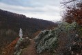
Circular route through the Monts d’Or via Mont Py and Col du Mont Verdun

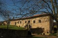
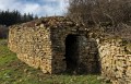
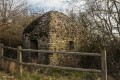
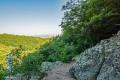
A walk in the Monts d’Or starting and finishing in Chasselay, with a few steep sections that can be slippery in wet weather. A few drystone shelters (limestone quarries) and the lime kiln. You’ll pass close to military installations where photography is prohibited.

Details

1008943
Creation:
Last update:
Last review:
  • Walking
    Activity: Walking
  • ↔
    Distance: 7.42 mi
  • ◔
    Average duration: 4h 45 
  • ▲
    Difficulty: Moderate

  • ⚐
    Back to start: Yes
  • ↗
    Ascent: + 1,529 ft
  • ↘
    Descent: - 1,522 ft

  • ▲
    Highest point: 1,936 ft
  • ▼
    Lowest point: 778 ft

Photos

Description of the walk

(S/E) From the car park by the pond, walk up Rue de l’Étang for 190 metres, then turn left onto Rue des Darbonnières. At the junction, turn right onto Rue de Génévréant, which continues to the left as Chemin de Poleymieux for 650 metres; ignore the paths to the right and left.

(1) Turn right onto Chemin de Chasselay and follow it for 750 metres.

(2) When you reach a fork in the road, take the right-hand hairpin bend and continue for 900 metres.

(3) Turn right at the hairpin bend onto the path closed to vehicles, for 1,200 metres.
When you reach the entrance to the quarry, go down the road to the Chemin du Robiat.
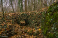
Take this track to the left; as you go, you’ll see a drystone shelter on your right.

(4) At the sign for Poleymieux-au-Mont-d’Or, turn onto the path on the right until you reach Chemin de la Maby. Continue until you reach a drystone shelter.

(5) Follow Chemin de la Maby to the right for 350 metres until you reach a track; turn right onto it at an acute angle. On your left is a very beautiful drystone shelter, and there are two more on the right.

(6) At the T-junction, turn right between two fields and carry on until you reach the Route des Gambins. Turn right for about 80 metres and, at the bend, take the path branching off to the right.

(7) Turn right onto the mountain bike track through the woodland; this is a very steep track, which can be difficult in wet weather. You’ll come to a small forest road; cross it and continue straight ahead through the woodland, cross another track and carry on under the fir trees. You’ll reach the junction (roundabout) of the D92 and the Route de Poleymieux. Cross over and head towards Limonest for about 80 metres.

(8) Take the path branching off to the right, which goes round the speed camera and Fort Mont Verdun.

(9) Turn onto the path on the left, walk for about 200 metres and take the path on the right towards the Gîte de la Glande; pass the Gîte de la Glande and head towards the Route de la Glande. Reach the road and follow it to the left for about 300 metres.

(10) Pass a lime kiln and continue along this road. After the bend to the left, take the path leading down to the right.
Follow the path, keeping to the right, until you reach the ruined farm at Borde.

(11) Turn left onto the geological trail towards Chasselay, for 1.8 km.
When you reach the Montée du Plantin, turn right onto Rue de l’Étang to reach the car park (S/E).

Waypoints

  1. S/E : mi 0 - alt. 787 ft - L'Étang car park
  2. 1 : mi 0.77 - alt. 896 ft - Turn right at the junction
  3. 2 : mi 1.25 - alt. 1,214 ft - A hairpin bend to the right
  4. 3 : mi 1.83 - alt. 1,467 ft - Hairpin bend to the right
  5. 4 : mi 2.76 - alt. 1,660 ft - sign for Poleymieux-au-Mont-d’Or
  6. 5 : mi 3.06 - alt. 1,611 ft - Drystone shelter
  7. 6 : mi 3.53 - alt. 1,463 ft - Turn right at the T-junction
  8. 7 : mi 4.3 - alt. 1,572 ft - Mountain bike trail on the right
  9. 8 : mi 4.72 - alt. 1,913 ft - Path on the right
  10. 9 : mi 5.08 - alt. 1,873 ft - Path on the left
  11. 10 : mi 5.49 - alt. 1,703 ft - Lime kiln
  12. 11 : mi 6.08 - alt. 1,493 ft - Borde Farm
  13. S/E : mi 7.42 - alt. 784 ft - L'Étang car park

Reviews and comments

3.2 / 5
Based on 8 reviews

Reliability of the description
2.4 / 5
Ease of following the route
3.1 / 5
Route interest
3.9 / 5
GD69690
GD69690

Overall rating : 2.7 / 5

Date of your route : Nov 22, 2023
Reliability of the description : ★★☆☆☆ Disappointing
Ease of following the route : ★★☆☆☆ Disappointing
Route interest : ★★★★☆ Good
Very busy route : No

You can’t do this hike without a GPS.
We’re used to relying on the route description and a paper map, and that’s usually enough.
But that’s impossible on this route: no signposting, no trail name signs, and lots of unmarked paths…
Without the GPS track, we would have got lost within the first 2 km.
Otherwise, it’s a lovely route, best done in summer as there’s a lot of undergrowth and it’s very slippery.

Machine-translated

outback21
outback21

Overall rating : 5 / 5

Date of your route : Oct 30, 2023
Reliability of the description : ★★★★★ Very good
Ease of following the route : ★★★★★ Very good
Route interest : ★★★★★ Very good
Very busy route : No

A very pleasant walk, mostly through woodland. No particular difficulties.

Machine-translated

Shinrei
Shinrei

Overall rating : 4.5 / 5

Date of your route : Sep 16, 2023
Reliability of the description : Not used / Not applicable
Ease of following the route : ★★★★☆ Good
Route interest : ★★★★★ Very good
Very busy route : No

GPX route tracked using a Garmin watch; no major difficulties in following it.
The walk features varied terrain and a good elevation gain for those wishing to train for trail running, and will also appeal to walkers. The route can be completed in under 2 hours as a trail run.

Machine-translated

Cricri6954
Cricri6954

Overall rating : 3 / 5

Date of your route : Oct 13, 2019
Reliability of the description : ★★☆☆☆ Disappointing
Ease of following the route : ★★★☆☆ Average
Route interest : ★★★★☆ Good

Without a GPS or a compass – and even with the IGN map – it is very difficult to follow the route description; directions on which paths to take or avoid would be very helpful.

Machine-translated

henri57
henri57 ★
• Edited:

Hello,

At the very least, you need the map and the route description (and even that might not be enough!).

Visorando provides a detailed route description (which could be improved) and an IGN route map at a scale of 1:25,000.

Perhaps a compass as well, and that should be enough.

...but it’s impossible to do without the GPS and the Visorando route on a smartphone

Indeed, for those who find it a bit tricky to find their way around, Visorando offers a free virtual waypoint system: a GPS app.

See you soon

Machine-translated

Brigitte jarguel
Brigitte jarguel

Overall rating : 3.3 / 5

Date of your route : Feb 22, 2019
Reliability of the description : ★★☆☆☆ Disappointing
Ease of following the route : ★★★☆☆ Average
Route interest : ★★★★★ Very good

A lovely walk, but impossible to do without a GPS and the Visorando route on a smartphone. At the very least, you’ll need a map and the route description (and even then!).

We didn’t use them at the start and got lost as soon as we reached point 2. It’s very poorly signposted and the route description isn’t detailed enough....

Despite having to walk an extra 4 km, we thoroughly enjoyed ourselves as the route is very interesting.

Machine-translated

grandin
grandin ★

It is true that starting out in towns and cities is less straightforward, as the 1:25,000 scale is not suitable for built-up areas. It is sometimes worth consulting a map of the town or village. One could also ask the authors to refine the descriptions a little further in such cases...
However, I notice that you haven’t used the route map. It’s an essential tool, even when the route description is detailed.
Do give another walk a go before you leave us, though…

Machine-translated

izzet69
izzet69

Overall rating : 1 / 5

Date of your route : Jul 02, 2018
Reliability of the description : ★☆☆☆☆ Very disappointing
Ease of following the route : Not used / Not applicable
Route interest : ★☆☆☆☆ Very disappointing

You need to review the description and details, as we were completely lost right from the first point. I’ve uninstalled the app and I don’t think I’ll be using your site any more.

Machine-translated

sunrise gric
sunrise gric

Hello,
It’s not the Route des Bambins, but the Route des Gambins. Once you’ve taken the path that climbs through the woodland and you reach the road, you’ll see signposts for Limonest and the D92. As for the path that branches off to the right 80 metres after you’ve joined the road towards Limonest, it passes beneath the radar station and the Mont Verdun fort.
Enjoy your walk.

Machine-translated

gazok54
gazok54 ★

Thanks, marclyon
You shouldn’t use the route description without the route marked on an IGN map. I think that’s why you’re getting ‘Average’ ratings.

Machine-translated

marclyon
marclyon

Overall rating : 3 / 5

Date of your route : Jun 03, 2018
Reliability of the description : ★★★☆☆ Average
Ease of following the route : ★★★☆☆ Average
Route interest : ★★★☆☆ Average

The advantage is that it is easily accessible from Lyon.
The description would benefit from being more precise, particularly between points 7 and 8; you’ll need a 1:25,000 map or to import the GPS track, which is very reliable.
There are a few sections of the path where passing mountain bikers is tricky, particularly on Sunday mornings as it gets quite busy. In wet weather, it’s best to bring walking poles as some of the narrower sections can be slippery. But you can manage without them.
Overall, a pleasant hike with some lovely views of the area around Lyon.
It took us 4 hours 30 minutes, including a 30-minute break for lunch.

Machine-translated

gerlandboy69
gerlandboy69

Overall rating : 2.7 / 5

Date of your route : Apr 29, 2018
Reliability of the description : ★★☆☆☆ Disappointing
Ease of following the route : ★★☆☆☆ Disappointing
Route interest : ★★★★☆ Good

Poor signage during the walk, particularly near the fort.
Routes for little ones!! How are we supposed to know it’s the D92? Nothing’s signposted!! Towards Limonest?? Without a sat-nav, it’s really tough…
Out of over a hundred walks, this is the one with the poorest signage… a shame

Machine-translated

marcsejour
marcsejour

I haven’t done this walk yet; as of today, 19 March 2018

Machine-translated

Other walks in the area

For more walks, use our search engine .

The GPS track and description are the property of this route's author. Please do not copy them without permission.