Country:
 City:
City:


Park in the town hall car park and head to the starting signpost near the bus stop.
Follow the red signposts.
(S/E) Take the path heading west which leads down to the village ponds. Walk alongside the first pond on your left, continue between the two ponds and head down opposite the sewage treatment plant. Carry on south along the tarmac path until you reach the road.
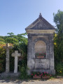
(1) Turn left towards the village. At the wayside cross, turn right onto Rue Lucien Thomas. At the stop sign, turn right onto the tarmac path of La Saulaie, pass the stadium on your right and continue to Le Bout du Monde, where you’ll join the D65.
- At this point, you’ll find the main route on the right and an alternative route on the left. In both cases, you’ll walk a few dozen metres along the D65. Please take great care.
(2) Turn right onto it for 40 metres, then turn left onto the path towards La Drageonnerie, La Charpenterie, the Froger poultry farm and L’Étang. Continue for 300 metres after passing through the village of L’Étang.
(3) Just before the first orchard, take the hairpin bend to the left heading south. Along the way you’ll come across gates; go through them and don’t forget to close them behind you. You’ll reach the road at Bois Girault.
(4) Turn left onto it and walk through the village. Pass the road leading to Les Gardes and the wayside cross on your right and carry on straight ahead. Take great care on this narrow, busy road until you reach the Chemin du Bois Girais.
(5) Turn right onto this path and walk through the village. Carry on straight ahead along the path towards l’Aubrière until you reach the Chemin de l’Aubrière.
(6) Follow it to the left until you reach the junction with the track leading to L’Oliverie. Turn right for about 25 metres and take the dirt track on the left leading to Le Bois Oger. When you reach the village of Le Bois Oger, head up into the village on the right, cross through it and continue along the track until you reach the D265 road. Take the opportunity to admire the panoramic view of Mont des Alouettes and St Michel Mont Mercure. Turn left onto the D265 at the junction by the water tower.
(7) Opposite, take the Chemin du Pâtis Sauvage, keeping the water tower on your right, and continue along the dirt track towards La Denéchère for 500 m.
(8) About 200 m before La Denéchère, turn left onto the tree-lined path and head down to Le Coteau, where you’ll find a magnificent view of the city of Angers and its cathedral. Follow the tarmac road down to Le Plessis. At the junction in the middle of the village, continue straight ahead, then turn left.
(9) Turn right at La Joblerie. Carry on to the stop sign. Turn left onto the road, pass Charbonneau on your right and arrive at: La Prée.
(10) Take the grassy track on the left and follow it until you reach Bellevue at a crossroads.
(10) Turn right onto the tarmac road, which will take you to the outskirts of the village.
(11) When you get there, take the first road on the right. Just before Le Cormier, turn left onto Impasse de Roguenette; at the end of the cul-de-sac, continue along the forest track. Walk past the vicar’s garden on your right, which you are welcome to visit if you wish. Continue between the church and the cemetery, then turn right onto Rue du Maréchal Juin and head towards (S/E)

 Tourist office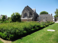

 Easy
Easy  Very difficult