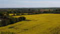
The Chantoiseau to Melay route

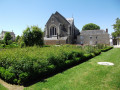
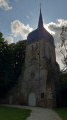
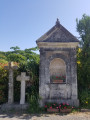
Discover the Church of Saint-Pierre de Melay, then pause for a moment at the Chapel of the Martyrs, built in memory of the men, women and children massacred during the Wars of the Vendée.

You’ll pass by the Jardin du Curé and the Collegiate Church of Saint-Martin, of which only ruins remain but which is also steeped in history, and halfway along the route, take a moment to relax by the Étang de Coulvée.

Details

3881237
Creation:
Last update:
Last review:
  • Walking
    Activity: Walking
  • ↔
    Distance: 7.24 mi
  • ◔
    Average duration: 3h 25 
  • ▲
    Difficulty: Moderate

  • ⚐
    Back to start: Yes
  • ↗
    Ascent: + 131 ft
  • ↘
    Descent: - 131 ft

  • ▲
    Highest point: 413 ft
  • ▼
    Lowest point: 259 ft
  • ⚐ Country: France
  • ⚐ City: Melay (49120)
  • ⚑
    Start/End: N 47.182562° / W 0.697011°
  • ❏
    IGN map(s): Ref. 1423SB, 1424SB, 1523SB
  • Hour-by-hour weather

Photos

Description of the walk

Park in the town hall car park and head to the starting point sign near the bus stop; follow the yellow markings.

(S/E) Take Rue des Sports, keeping the town hall on your right. At the corner where the buildings meet, turn right towards the parish garden.

(1) In the middle of the garden, turn left onto the grassy path. At the end, turn left and walk past Place Du Bellay.

(2) Turn right into Rue Cathelineau. Then turn left onto Chemin de la Bretonnerie. Cross Chemin de la Girardière on the right-hand side and you’ll come out onto the D756.

(3) Cross the road carefully and head straight ahead. At the junction where the tarmac ends (marker 113), carry on straight ahead.

(4) Turn left a little further on. After about 500 m, turn right. Walk alongside the ponds on your left. At the end of the path, follow the road to the left.

(5) Take thefirst right, before a farmhouse. Walk past the farm buildings and go through the hamlet of La Gastée, turning left. Carry on until you reach a tarmac road.

(6) Follow the road to the left, passing the Petites Biaitries buildings on your right. Cross a road and carry straight on along a dirt track.

(7) At the junction, carry on straight ahead. Reach the village of Chemillé and ignore the side streets on the right. Carry on straight ahead, passing a supermarket on the right. Follow Rue des Coteaux de Chizé and, at the end, turn left into Rue de la Raquette. Cross Chemin du Verzeau on your left, go round the roundabout on the left and head slightly left towards a pond. Walk along the right-hand side of the pond and cross the Ruisseau de Chizé.

(8) Immediately afterwards, turn left and follow the stream on your left. Further on, the path continues south-east and moves away from the stream.

(9) At the end of the path, follow a small road to the right. At the next junction, turn left. At the T-junction, turn right. Cross the access road to the hamlet of La Houdrière on your left.

(10) A few dozen metres further on, turn left onto a dirt track. Leave the hamlet of La Houdrière on your left and head east. The track then veers to the right (south-east).

(11) Turn right, then left to head south. At the end of the path, turn left onto Rue des Sources. Carry straight on, ignoring the streets on your left.

(12) Go round the roundabout on the left and cross Avenue de Verdun. Follow it to the left for about fifty metres and take the path that runs between the first two houses towards the south-west. Continue along Rue des Étangs. When you see the play area hut, take the path on the right that runs alongside the street. Then leave the street, walk alongside a pond on your right and turn left to return to the starting point (S/E).

Waypoints

  1. S/E : mi 0 - alt. 390 ft - Town Hall car park
  2. 1 : mi 0.11 - alt. 404 ft - Jardin du Curé
  3. 2 : mi 0.33 - alt. 400 ft - Rue Cathelineau
  4. 3 : mi 0.62 - alt. 407 ft - D756 road
  5. 4 : mi 1.2 - alt. 354 ft - Intersection
  6. 5 : mi 1.96 - alt. 354 ft - Gourdoire
  7. 6 : mi 2.5 - alt. 338 ft - Junction of path and road
  8. 7 : mi 3.28 - alt. 328 ft - Crossroads
  9. 8 : mi 4.35 - alt. 262 ft - Les Forges
  10. 9 : mi 4.92 - alt. 322 ft - Intersection
  11. 10 : mi 5.52 - alt. 305 ft - Start of the trail
  12. 11 : mi 6.23 - alt. 371 ft - Turn right
  13. 12 : mi 6.8 - alt. 367 ft - Roundabout
  14. S/E : mi 7.24 - alt. 390 ft - Town Hall car park

Worth a visit

The Vicar’s Garden:
This is a very old garden which for many years provided for the needs of the parish and the clergy who lived there, until 1970 when part of it was made available to local residents. Having been partially neglected, it has been restored to its former glory since 2004: today it is a pleasant spot set amongst vegetable patches, ornamental flowers and boxwood…

The Martyrs’ Chapel:
The local residents wished to preserve the memory of the martyrs of 1794. In 1874, they undertook an excavation of the ditch that had served as their mass grave. The bones found were placed in a tomb which was temporarily situated at the back of the church. In 1875, the Martyrs’ Chapel was built in the cemetery to house their relics. In 1978, a wayside cross was erected beneath one of the chestnut trees that had witnessed the tragedy, in memory of the martyrs.

The old mills:
Throughout the route, you may come across the remains or localities marked by the presence of windmills. This is the case at Coissin, La Bouchetière and Le Cerisier. The River Hyrôme, together with its tributaries, has long played a vital role in the economic development of Chemillé. More than 29 mills (water- or wind-powered) have been recorded along its course, dating back to the 11th century. During the 19th century, some of these would become the town’s first textile mills.

Reviews and comments

4.8 / 5
Based on 2 reviews

Reliability of the description
5 / 5
Ease of following the route
5 / 5
Route interest
4.5 / 5
Isabelle Grimault
Isabelle Grimault

Overall rating : 5 / 5

Date of your route : Jan 20, 2026
Reliability of the description : ★★★★★ Very good
Ease of following the route : ★★★★★ Very good
Route interest : ★★★★★ Very good
Very busy route : Yes

Very beautiful hike

Machine-translated

Allbane
Allbane

Hello,
I have rather mixed memories of this route because, after the supermarket, I couldn’t find any signposts or street names. In the end, I made my way back to the starting point via the country road.

Machine-translated

Cejume
Cejume

Overall rating : 4.7 / 5

Date of your route : Feb 22, 2021
Reliability of the description : ★★★★★ Very good
Ease of following the route : ★★★★★ Very good
Route interest : ★★★★☆ Good
Very busy route : Yes

Very good signage.

Machine-translated

Other walks in the area

For more walks, use our search engine .

The GPS track and description are the property of this route's author. Please do not copy them without permission.