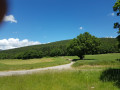
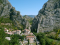
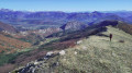
The four passes starting from the hamlet of Château in La Piarre

A lovely walk through the Baronnies Provençales Regional Nature Park, taking in four mountain passes.

Details

12242539
Creation:
Last update:
Last review:
  • Walking
    Activity: Walking
  • ↔
    Distance: 7.16 mi
  • ◔
    Average duration: 4h 55 
  • ▲
    Difficulty: Moderate

  • ⚐
    Back to start: Yes
  • ↗
    Ascent: + 1,893 ft
  • ↘
    Descent: - 1,896 ft

  • ▲
    Highest point: 4,649 ft
  • ▼
    Lowest point: 3,281 ft

Description of the walk

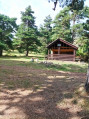
From the village of La Piarre, head towards the Col de Carabès until you reach the hamlet of Le Château and park after the wash house or, a little further up on the right, at the start of a track.

(S/E) From the wash house, head up towards the Col de Carabès; take care on the road. Walk for about 170 metres and take the marked path on the right. There is a yellow and red marker on a pine tree a little way up the slope after the start of this path.

(1) Walk up to the hairpin bend on the D27. Continuing uphill, walk for about 400 metres along the road.

(2) Take the signposted path on the right. There is a post with yellow and red markings indicating the direction of the Col des Combes.

(3) Follow the grassy track to the right and cross a path on the left.

(4) Take the signposted path and climb up to the Col des Combes.

(5) Continue to the left to reach the Col de Carabès.

(6) Cross the road carefully. There is a track and two footpaths; take the footpath furthest to the right and head uphill, following it along the ridge. This footpath is marked in yellow. Watch out for mountain bikes, which may be using the path. Reach the Col de la Selle.

(7) Continue along this path until you come to a track; follow it to the left until you reach the signpost indicating the Col de Charron.

(8) Just after the pass, take the track on the left, signposted ‘La Piarre’. Stay on the main track and wind your way down, then carry on straight on to Les Granges, following the Torrent de Courencq.

(9) Take the grassy track on the left; before you reach the Maison des Granges, it turns into a footpath a little further on. Follow it and take the descent leading into a field of grass, which you’ll need to cross to reach the road.

(10) Turn left onto the D27 and stay on it until you reach the car park at the Château wash house (S/E).

Waypoints

  1. S/E : mi 0 - alt. 3,383 ft - Parking at the wash house
  2. 1 : mi 0.1 - alt. 3,442 ft - Marked trail
  3. 2 : mi 0.61 - alt. 3,848 ft - Marked trail
  4. 3 : mi 1.08 - alt. 4,226 ft - Grassy track
  5. 4 : mi 1.28 - alt. 4,298 ft - Marked trail
  6. 5 : mi 1.8 - alt. 4,649 ft - Col des Combes
  7. 6 : mi 2.39 - alt. 4,137 ft - Col de Carabès
  8. 7 : mi 3.33 - alt. 4,213 ft - Col de La Selle
  9. 8 : mi 4.54 - alt. 4,331 ft - Col du Charron
  10. 9 : mi 6.53 - alt. 3,471 ft - Path on the left
  11. 10 : mi 6.9 - alt. 3,281 ft - D27 on the left
  12. S/E : mi 7.16 - alt. 3,379 ft - Parking at the wash house

Notes

There is a drinking water point at the Château wash house.
Between the Col des Combes and the Col de Carabes, the descent is quite steep; walking poles are useful, and I’d advise avoiding this section in wet weather.
The route follows a few short sections of road; although the road is quiet, caution is still advised.
The route is marked in yellow and red in its first section, but do pay attention to points (1) and (4), as the trailheads are inconspicuous despite the markings.

Worth a visit

About 7 km from the castle lies the source of the River Drôme at La Bâtie-des-Fonds – the water is drinkable and refreshing – as well as a short interpretive trail recounting the history of the 1936 landslide, which swept away part of the village. You can have a meal at a picnic table opposite the town hall.

Reviews and comments

4.2 / 5
Based on 3 reviews

Reliability of the description
5 / 5
Ease of following the route
4.7 / 5
Route interest
3 / 5
vincentlc
vincentlc

Overall rating : 4.3 / 5

Date of your route : May 06, 2025
Reliability of the description : ★★★★★ Very good
Ease of following the route : ★★★★★ Very good
Route interest : ★★★☆☆ Average
Very busy route : No

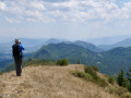
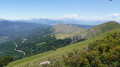
I agree with the previous comments: a very easy route to follow, best avoided in very wet weather (steep descents with muddy ground and leaves), and as you’re mainly in the forest, there aren’t many views (don’t miss the one that’s very clearly signposted just before the Col de Combes).

Thanks to GG05 and Calou.

Machine-translated

dominique.sicard1
dominique.sicard1

Overall rating : 4.3 / 5

Date of your route : Nov 25, 2022
Reliability of the description : ★★★★★ Very good
Ease of following the route : ★★★★★ Very good
Route interest : ★★★☆☆ Average
Very busy route : No

Parts of the trail are very pleasant, but three or four sections are real climbs, and the return journey down to the valley floor along a muddy track is rather uninteresting. The route is very well signposted.

Machine-translated

bonnemarche
bonnemarche

Overall rating : 4 / 5

Date of your route : Sep 02, 2022
Reliability of the description : ★★★★★ Very good
Ease of following the route : ★★★★☆ Good
Route interest : ★★★☆☆ Average
Very busy route : No

The appeal of this route is that it runs almost entirely through woodland, so there are few views

Machine-translated

Other walks in the area

For more walks, use our search engine .

The GPS track and description are the property of this route's author. Please do not copy them without permission.