La Chaume Abbey

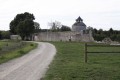
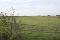
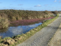
As you walk, you’ll be treated to a variety of landscapes: market gardens, woodland, sandy paths and grassy tracks, as well as some unusual sites steeped in history. La Chaume Abbey, founded in the 11th century, has had a very turbulent history; the trapezium-shaped Merovingian sarcophagi in the cemetery, carved from La Chaume limestone; and finally, the 19th-century racecourse.

Details

706186
Creation:
Last update:
Last review:
  • Walking
    Activity: Walking
  • ↔
    Distance: 4.62 mi
  • ◔
    Average duration: 2h 10 
  • ▲
    Difficulty: Easy

  • ⚐
    Back to start: Yes
  • ↗
    Ascent: + 20 ft
  • ↘
    Descent: - 20 ft

  • ▲
    Highest point: 33 ft
  • ▼
    Lowest point: 10 ft
  • ⚐ Country: France
  • ⚐ City: Machecoul (44270)
  • ⚑
    Start/End: N 47.003072° / W 1.822021°
  • ❏
    IGN map(s): Ref. 1224SB
  • Hour-by-hour weather

Photos

Description of the walk

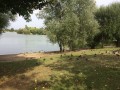
Park at the Grand Étang car park.

(S/E) Head towards the roundabout using the cycle and footpath. Cross it using the pedestrian crossings. Turn right and walk along the left-hand side of the D13 (pedestrian section).

(1) Turn left and follow the path on the left leading into the housing estate. Cut across Avenue de la Rochejaquelin to reach Avenue Hoche. Turn right, cross the road straight ahead and you’ll arrive on Rue de Pornic.

(2) Turn right and then immediately left onto Boulevard de la Chapelle after crossing the level crossing. Then carry on straight ahead until you reach the racecourse.

(3) At the Stop sign, carry on straight ahead (slightly to the right), pass between the two houses, and turn right immediately. Follow the small path until you reach the road (Avenue de l’Hippodrome).

(4) First turn right then left and carry on along the road, which curves sharply to the left further on.
When you reach the houses, turn right and follow the road alongside them. At the end of the road, turn right for 150 metres, then left and carry on straight ahead. Then turn left until you reach the stone house in the middle of the field, and turn right at a 90° angle.

(5) Turn right as you leave the market garden, then veer slightly left and follow the dirt track to the end.

(6) When you reach the hamlet of Les Basses Noës, immediately after the house, turn right onto the small path between the hedge and the market gardens. Follow this path to the wall in front of you and turn right. Ignore a path on the left and continue to the hamlet of Les Rivières.

(7) Turn left, pass between the houses and follow the path to the ruins of La Chaume Abbey.

(8) When you reach Abbaye de la Chaume, veer slightly to the left and follow the path to the road (Rue de Pornic). Turn right and head towards the level crossing.

(2) After the level crossing, turn left and head back towards the Grand Étang (S/E).

Waypoints

  1. S/E : mi 0 - alt. 30 ft - Grand Étang car park
  2. 1 : mi 0.28 - alt. 26 ft - Turn left into the housing estate
  3. 2 : mi 0.51 - alt. 23 ft - Level crossing, junction of the circular loop
  4. 3 : mi 1.06 - alt. 23 ft - Stop, go straight on, veering slightly to the right
  5. 4 : mi 1.16 - alt. 23 ft - On Avenue de l’Hippodrome, first turn right then left
  6. 5 : mi 2 - alt. 20 ft - Amongst the market gardens, on the right
  7. 6 : mi 2.7 - alt. 13 ft - Les Basses Noës, path on the right
  8. 7 : mi 3.24 - alt. 13 ft - Les Rivières, on the left
  9. 8 : mi 3.62 - alt. 20 ft - La Chaume Abbey
  10. S/E : mi 4.62 - alt. 30 ft - Grand Étang car park

Notes

Route accessible all year round.

Worth a visit

Visit to La Chaume Abbey.
Visit to the Hippodrome.
Contact theTourist Office

Reviews and comments

4.1 / 5
Based on 4 reviews

Reliability of the description
4.3 / 5
Ease of following the route
4.3 / 5
Route interest
3.8 / 5
chimval
chimval

Overall rating : 4.3 / 5

Date of your route : May 11, 2026
Reliability of the description : ★★★★☆ Good
Ease of following the route : ★★★★★ Very good
Route interest : ★★★★☆ Good
Very busy route : Yes

an interesting route

Machine-translated

User 23706996

not great, lots of roads and houses during the hike. The only highlight is passing by the horses. I wouldn't do it again.

Machine-translated

Bazdek
Bazdek

Overall rating : 5 / 5

Date of your route : Mar 28, 2021
Reliability of the description : ★★★★★ Very good
Ease of following the route : ★★★★★ Very good
Route interest : ★★★★★ Very good
Very busy route : No

Please disregard the non-existent abbey.

Machine-translated

guyleb
guyleb

Overall rating : 3.3 / 5

Date of your route : Sep 19, 2018
Reliability of the description : ★★★★☆ Good
Ease of following the route : ★★★★☆ Good
Route interest : ★★☆☆☆ Disappointing

The only remaining trace of the abbey is a dovecote, which, incidentally, cannot be approached.

Machine-translated

greemlins
greemlins

Overall rating : 3.7 / 5

Date of your route : Jan 26, 2018
Reliability of the description : ★★★★☆ Good
Ease of following the route : ★★★☆☆ Average
Route interest : ★★★★☆ Good

The route itself is nice, but the path isn’t clear, especially in the middle of the route; we were unsure where to go at several points

Machine-translated

Other walks in the area

For more walks, use our search engine .

The GPS track and description are the property of this route's author. Please do not copy them without permission.