Country:

 City:
City:


Park in the car park at the top of the village of Bonneval; for road access, see the ‘Practical Information’ section.
(S/E) Walk uphill along Rue des Cortis and turn left onto Chemin sous les Pins. Continue along the path, then turn right into the forest to reach the houses at Le Replat. Here, enjoy your first panoramic view of the Beaufortain foothills and the Vanoise glaciers.
(1) Head up through the forest, cross the road and follow the path which joins it at a hairpin bend.
(2) Walk alongside the road for a few metres, then turn right onto the path. Continue uphill to reach the crossroads in the hamlet of Mont d’en Haut, which consists of a cluster of pretty alpine chalets.
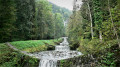
(3) Take the wide track through the Bois de la Darbella, then follow it to the Ruisseau du Tartet.
(4) Cross the stream and its tributary immediately afterwards, then continue the ascent, keeping to the left on the
forest track to reach the Plan de Lay car park, the highest point of the route.
(5) Continue down the forest track to reach the hamlet of Gélon.
(6) Leave the track here and turn left – almost 180° – onto the path running parallel to the Ruisseau de Villard, a stream that is always very fast-flowing. Pass La Ramée, then, at Combe Noire, take a few hairpin bends to reach the junction with the road leading to the Freidaz d’en haut alpine chalets.
(7) Cross the road and continue straight ahead, passing the chalets of La Freidaz d’en Bas. Stay on the main path, ignoring any offshoots to the right or left. You’ll emerge at the junction with the D 213 road in the village of Villard-Soffray.
(8) Turn left onto the road, taking care of the traffic, which can be heavy on fine summer days. Walk past the town hall. Then leave the road and turn left onto the footpath, heading towards the church, before reaching the car park at the top of Bonneval (S/E).

 Tourism professional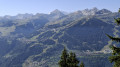
 Difficult
 Local authority
 Visorando Member