Circular Feissons starting from Feissons-sur-Isère Castle

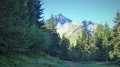
A half-day family walk through the forest, with a viewpoint overlooking the Grande Maison Valley.

Details

n°17215288
Creation:
Last update:
Last review:
  • Walking
    Activity: Walking
  • ↔
    Distance: 5.48 mi
  • ◔
    Average duration: 4h 30 
  • ▲
    Difficulty: Moderate

  • ⚐
    Back to start: Yes
  • ↗
    Ascent: + 2,231 ft
  • ↘
    Descent: - 2,257 ft

  • ▲
    Highest point: 3,835 ft
  • ▼
    Lowest point: 1,591 ft

Description of the walk

Park in the car park at Feissons-sur-Isère Castle.

(S/E) Follow the road down a short slope to reach the forest path.

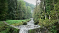
(1) Enter the forest at a place called Les Côtes. Continue along the shaded path. Pass under the power lines and reach the hamlet of Le Chagniet.

(2) Keep to the left on the path and, after a few hairpin bends through a forest of hundred-year-old beech trees, reach the hamlet of Grand Glaize.

(3) Continue along a well-cleared path to reach the Tillet hut.

(4) Carry on to reach the locality known as Sur le Tillet.

(5) Turn left and, as you descend, you’ll reach the junction with the path leading up to Feissons Castle.

(6) Leave this path on your left and carry on straight ahead, passing under a penstock before reaching the hamlet of Planchamp.

(7) Go round the hamlet and turn left onto the narrow path to join the track. Walk alongside the hamlet of Le Mont. Then continue along the forest path towards Feissons Castle. Walk along the road for the last few metres to reach the castle car park (S/E).

Waypoints

  1. S/E : mi 0 - alt. 1,667 ft - Car park - Château de Fessons
  2. 1 : mi 0.22 - alt. 1,631 ft - Les Côtes
  3. 2 : mi 0.95 - alt. 2,280 ft - Le Chagniet
  4. 3 : mi 2.15 - alt. 3,409 ft - Grand Glaize
  5. 4 : mi 2.46 - alt. 3,773 ft - Le Tillet
  6. 5 : mi 2.62 - alt. 3,819 ft - On the Tillet
  7. 6 : mi 3.16 - alt. 3,474 ft - Path junction
  8. 7 : mi 3.92 - alt. 2,762 ft - Planchamp
  9. S/E : mi 5.48 - alt. 1,667 ft - Car park - Château de Fessons

Notes

Access by road:
- From Moutiers, follow the N 90 towards the D 990 at Feissons-sur-Isère. Take exit 36 and leave the N 90. Drive through the centre of the village of Feissons-sur-Isère. After passing the town hall (on the left), take thefirst right and continue along the road to the castle.
- From Albertville, follow the N 90 towards the D 990 at Feissons-sur-Isère. Take exit 36 and continue on the D 990 to the right. Take thefirst left and enter the village. At the end of the street, turn left, then, at the next junction, take the road on the right and continue to the castle.

Worth a visit

(1) An engraved stone stands by the side of the path; the engraving was made on 22 June 1815 by Austrians.
(3) A viewpoint offering a view over the Grande Maison valley.
Between (5) and (6), at the penstock, take in the unobstructed view of the foothills of the Lauzière Massif,
Canyoning school in La Léchère

Reviews and comments

5 / 5
Based on 1 review

Reliability of the description
5 / 5
Ease of following the route
5 / 5
Route interest
5 / 5
gresy73
gresy73

Overall rating : 5 / 5

Date of your route : Apr 08, 2026
Reliability of the description : ★★★★★ Very good
Ease of following the route : ★★★★★ Very good
Route interest : ★★★★★ Very good
Very busy route : No

An interesting route that can be done in any season and in half a day; the ascent takes you through the forest and on the way back you’re treated to unobstructed views, with lovely vantage points over the peaks on the left bank of the Isère.
It is very easy to follow the route because the signposting is very clear (though I’m not allowed to mention that...) and also because the IGN map provided by Visorando is at a scale of 1:125,000.

Machine-translated

Other walks in the area

For more walks, use our search engine .

The GPS track and description are the property of this route's author. Please do not copy them without permission.