


Refine your search for walks in Our (rivière) affluent de la Sûre - Allemagne
Our (rivière) affluent de la Sûre - Allemagne walks


 Circular route in the Our Valley starting from Vianden
 Visorando Member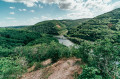
 12.41 mi
 +2,795 ft
 -2,822 ft
 8h 10
8h 10
 Difficult
 Departure from Vianden (Luxembourg (Country))
This hike combines two routes in the Our Nature Park.
Expect an elevation gain of around 850 metres.
Panoramic views of the Our Valley in Burg-Reuland
 8.61 mi
+1,184 ft
-1,168 ft
5h 00
8.61 mi
+1,184 ft
-1,168 ft
5h 00
 Moderate
Departure from Burg-Reuland (Province de Liège)
Moderate
Departure from Burg-Reuland (Province de Liège)
Although I’m not a big fan of tarmac roads on my walks, they are soon forgotten as magnificent landscapes unfold once you reach the ridge. We then reach the banks of the Irmisch, the river that forms the border with Germany. Finally, we return to the ridge on the other side, where a remarkable shelter for walkers and a final descent take us back to the imposing fortress of Burg-Reuland.
Circular along the Our River in Vianden
4.78 mi
+837 ft
-837 ft
2h 55
Moderate
Departure from Vianden (Luxembourg (Country))
Here is a hike around the Vianden region. Along the way, you will find points of interest and get a semi-complete tour of the region! If you want to see or take other trails, refer to the possibilities on the basic maps!
Three borders circuit in Ouren
 11.48 mi
+1,486 ft
-1,460 ft
6h 35
Moderate
Departure from Burg-Reuland (Province de Liège)
11.48 mi
+1,486 ft
-1,460 ft
6h 35
Moderate
Departure from Burg-Reuland (Province de Liège)
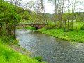
A long walk in the heart of the Eifel countryside, passing through three European countries: Belgium, Germany and the Grand Duchy of Luxembourg. You will discover the memorial dedicated to the founding of the Europe of Six.In addition to the landscapes of the Our valley and some of its tributaries, you will discover the incomparable Welchenhausen museum and its "sculpture trail".
Walks near Our (rivière) affluent de la Sûre - Allemagne
Losheimergraben – Nidrum
 10.42 mi
+456 ft
-814 ft
5h 10
Moderate
Departure from Belgium
10.42 mi
+456 ft
-814 ft
5h 10
Moderate
Departure from Belgium
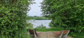
This24th stage takes us from the tranquillity of the forests of the Eastern Cantons to the livelier atmosphere of the shores of Lake Bütgenbach, before returning to the countryside in Nidrum. For your feet, it means switching from forest paths with ‘natural’ surfaces to the tarmac of small country roads, town streets and the Ravel. A complete change of scenery is guaranteed.
Nidrum – Eupen
 18.26 mi
+869 ft
-1,732 ft
9h 10
Difficult
Departure from Bütgenbach (Province de Liège)
18.26 mi
+869 ft
-1,732 ft
9h 10
Difficult
Departure from Bütgenbach (Province de Liège)
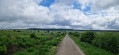
Here is another remarkable stage. It begins in the meadows of the Belgian highlands and then ‘flirts’ with Belgium’s highest elevations in the Hautes Fagnes, reaching a peak of 638 m; from there, the path descends steadily to Eupen and the Vesdre at an altitude of 263 m. It’s a route that also has a few surprises in store, particularly along the stretch beside the River Helle (Hill in German), where the path zigzags between wooden duckboards and muddy, mostly rocky ground – an environment it seeks to avoid by veering off upwards to… well, I’ll let you discover that for yourselves. A bit of suspense never hurt anyone.