Les Mayons – Castel des Maures – Pin Pignans

A short walk starting in Les Mayons with plenty of great views. The route is a bit steep in places, but the paths are in good condition. From Les Mayons, the path leads towards the La Fouquette vineyard to the ruins of the Castel des Maures. From there, it follows the Pin Pignans path back to Les Mayons.

Details

73047629
Creation:
Last update:
Last review:
  • Walking
    Activity: Walking
  • ↔
    Distance: 4.36 mi
  • ◔
    Average duration: 3h 00 
  • ▲
    Difficulty: Moderate

  • ⚐
    Back to start: Yes
  • ↗
    Ascent: + 1,168 ft
  • ↘
    Descent: - 1,335 ft

  • ▲
    Highest point: 1,266 ft
  • ▼
    Lowest point: 574 ft

Photos

Description of the walk

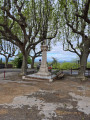
(S/E) The route starts in Les Mayons at the “Place de Victoire”.
You’ll also find a good place to park here by the little bistro.

From the Place de Victoire, the walk begins heading north-west along the gently ascending street, Rue Saint-Pierre. We follow the course of the street, which is renamed ‘Le Repos’ just before the end of the village.

Initially, the route climbs briefly through the village, then leads through the woods.

Once past the last houses, we stay on the forest path straight ahead and ignore the turnings to the left.

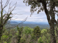
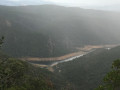
(1) About 100 metres further on, there is a magnificent view over the Gonfaron plain.

A little further on, we continue straight ahead again, ignoring two turnings to the right.

(2) At the signpost marked “Saint Bernard”, the footpath to Collobrières crosses our route. We continue straight on.

(3) At the signpost marked “La Fouquette”, turn left until you reach the next junction marked “DFCI D 27”.

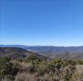
(4) There, we turn left onto the path, Chemin de la Croix de David/Piste de la Fouquette, which continues uphill. The path becomes a little steeper here, but you’ll be rewarded with wonderful views. We ignore all the turnings and continue straight ahead on this path.

(5) After another right-hand bend, we reach a Y-junction. We follow the path to the right, continuing along the Piste de la Fouquette.

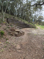
(6) At “Castel des Maures est”, you’ve reached the highest point of the walk. Here you can find the remains of an old fortification, as well as a small amphitheatre. From here, the path leads downhill again.

(7) At the “Pin Pignans” crossroads, several paths intersect; we take the path leading downhill to the sharp left, marked “Pin Pignans”. The route descends through a sparsely wooded area to a small stone hut with seating.

(8) The “Souvenir Dédé Magnin” hut is ideal for a short break or a light picnic. We then continue on to a Y-junction.

(9) Here, we keep to the left and, after a slight right-hand bend, ignore the path coming from the left and continue straight on until we return to the village of Les Mayons.

(10) Just before the first houses, we come to the Chemin des Souvières, which we follow to the left.

(11) At the entrance to the village, you can admire ‘Le Grand Père Chataignier’, the Grandfather Chestnut Tree. This chestnut tree is considered one of the oldest in France, something the residents of Les Mayons are very proud of. 

If you continue along the path, after a slight bend to the right you’ll reach the Rue du Plus Haut Château. We follow this road to the junction where you can see the church on the right. Here we turn left into the Grande Rue, which brings us back to the start of the walk, the Place de Victoire in the centre of the little village. (S/E

Waypoints

  1. S/E : mi 0 - alt. 764 ft - Start: Place de Victoire
  2. 1 : mi 0.32 - alt. 787 ft - Bellevue
  3. 2 : mi 0.47 - alt. 758 ft - Saint Bernard
  4. 3 : mi 0.84 - alt. 748 ft - La Fouquette
  5. 4 : mi 0.99 - alt. 650 ft - DFCI D 27 turn-off
  6. 5 : mi 1.82 - alt. 1,161 ft - Y-junction
  7. 6 : mi 2.11 - alt. 1,260 ft - Castel des Maures est
  8. 7 : mi 2.71 - alt. 1,066 ft - Pin Pignon turn-off
  9. 8 : mi 3.13 - alt. 991 ft - Souvenir Dédé Magnin
  10. 9 : mi 3.37 - alt. 938 ft - Y-junction
  11. 10 : mi 3.83 - alt. 797 ft - First houses
  12. 11 : mi 4.06 - alt. 817 ft - Grand Père Chataignier
  13. S/E : mi 4.36 - alt. 574 ft - Destination: Place de Victoire

Worth a visit

Les Mayons is a small village in the Massif des Maures, largely overlooked by tourists. In the village there is a small grocery shop where you can stock up on essentials for your hike. There is also a small bistro that serves wood-fired pizza on Tuesdays and Fridays.

Between (4) and (6), you have a wonderful view of the Domaine de la Fouquette vineyard. The Domaine de la Fouquette is fully committed to organic farming. In particular, the rosé wine – which you can also buy directly from the producer in the shop on the road from Les Mayons to Gonfaron – is a regular winner of gold medals.

Reviews and comments

5 / 5
Based on 2 reviews

Reliability of the description
5 / 5
Ease of following the route
5 / 5
Route interest
5 / 5
DENISFRAN
DENISFRAN

Overall rating : 5 / 5

Date of your route : Oct 28, 2025
Reliability of the description : ★★★★★ Very good
Ease of following the route : ★★★★★ Very good
Route interest : ★★★★★ Very good
Very busy route : No

A very pretty little circular around Les Mayons, easy level: 7.7 km and 222 m elevation gain. At this time of year, the Maures mountains offer us arbutus trees overflowing with fruit and flowers, and Grand Père châtaignier continues to produce despite his advanced age. A pretty village and beautiful views stretching to the mountains, everything you could wish for... thank you!

Machine-translated

User 26042096

Overall rating : 5 / 5

Date of your route : Jun 02, 2025
Reliability of the description : ★★★★★ Very good
Ease of following the route : ★★★★★ Very good
Route interest : ★★★★★ Very good
Very busy route : No

A very beautiful walk with lots of views. The village of Les Mayons is magnificent too!

Machine-translated

Other walks in the area

For more walks, use our search engine .

The GPS track and description are the property of this route's author. Please do not copy them without permission.