The Favière des Maures circular loop

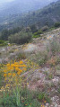
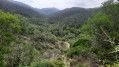
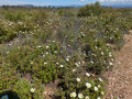
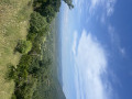
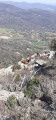
A lovely walk to discover the rich diversity of the Maures State Forest. Following a track winding through cork oak trees, you’ll reach a ridge road where you can enjoy a magnificent view of the Maures massif. You’ll then descend through the valleys, passing through the old chestnut groves for which the region is renowned. The vegetation is typical and rich in diversity as you progress, featuring wetlands, maquis, limestone outcrops and old-growth woodland.

Details

50635735
Creation:
Last update:
Last review:
  • Walking
    Activity: Walking
  • ↔
    Distance: 10.74 mi
  • ◔
    Average duration: 6h 40 
  • ▲
    Difficulty: Moderate

  • ⚐
    Back to start: Yes
  • ↗
    Ascent: + 1,955 ft
  • ↘
    Descent: - 1,946 ft

  • ▲
    Highest point: 2,139 ft
  • ▼
    Lowest point: 436 ft

Photos

Description of the walk

Park in the Ubac des Maures car park, about 3 km from the junction of the D558 and D75, heading towards Les Mayons.

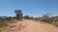
(S/E) Take the Piste des Cinq Sedes, which starts at the far end of the car park.

(1) Look out for the return path on the right and carry on straight ahead along the track, which winds for nearly 5 km.

(2) Near the summit, take the path on the right which cuts across a hairpin bend and rejoins the track: take care not to damage the vegetation. Join the Route des Crêtes Marc Robert.

(3) Turn right and carry on straight ahead for about 4 km.

(4) Let the Piste du Jas de la Moutte branch off to the left and carry on straight ahead for 300 m.

(5) Take a track on the right which descends through the old chestnut groves and follow it straight on.

(6) Stay on the main track, which turns sharply to the left. Cross a ford at the bottom of the valley and continue along the track known as the Lonjon track, which winds its way and reaches a junction just after the Vallon des Mourres.

(7) Stay on the main track, which climbs to the right and then turns left. Continue straight on.

(8) Before reaching a car park on the D76, take the path on the right and carry on straight ahead, ignoring the paths branching off to the left and right. You will reach the junction with the Piste des Cinq Sedes (or Cedes).

(1) Turn left to return to the car park where you started (S/E).

Waypoints

  1. S/E : mi 0 - alt. 440 ft - Car park
  2. 1 : mi 0.32 - alt. 577 ft - Junction of the circular loop
  3. 2 : mi 3.61 - alt. 1,867 ft - Path on the right
  4. 3 : mi 3.75 - alt. 1,893 ft - Marc Robert ridge road, on the right
  5. 4 : mi 5.81 - alt. 2,133 ft - Junction with the Jas de la Moutte track, straight ahead
  6. 5 : mi 5.96 - alt. 2,139 ft - Track on the right
  7. 6 : mi 6.51 - alt. 1,660 ft - Main track, left-hand bend
  8. 7 : mi 8.87 - alt. 492 ft - Main track, right-hand bend
  9. 8 : mi 9.58 - alt. 449 ft - Path on the right
  10. S/E : mi 10.74 - alt. 436 ft - Car park

Notes

Summer months: check for fire risk and mountain closures.
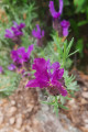
May to June is recommended, as there are many species of wildflowers in bloom.
The first part of the circular route follows forest tracks and a ridge road, whilst the final section follows footpaths that can be replaced by a route along the Route des Mayons.
Crossing a ford.

Worth a visit

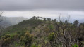
The Marc Robert ridge road with views of the Maures massif between La Garde-Freinet and Collobrières.
Ancient oak and chestnut groves, reflecting the region’s agricultural heritage.
Gonfaron’s ‘Turtle Village’ https://www.tortue-de-terre.net/le-villa etc.
The village of Les Mayons: the Departmental Nature Centre, the remarkable ‘Grand Père Châtaignier’ tree.
Plaine des Maures Nature Reserve: Lake Escarcet, unique geology and vegetation.
Collobrières: Chestnut Festival on Sundays in October.
Wine estates: Château Saint Roux www.chateausaintroux.com, Château Bertrand www.chateaudesbertrands.com

Reviews and comments

4.7 / 5
Based on 2 reviews

Reliability of the description
5 / 5
Ease of following the route
5 / 5
Route interest
4 / 5
User 23532888

Overall rating : 5 / 5

Date of your route : Aug 22, 2025
Reliability of the description : ★★★★★ Very good
Ease of following the route : ★★★★★ Very good
Route interest : ★★★★★ Very good
Very busy route : No

I completed this superb route in 2 hours and 55 minutes. The scenery in the Maures mountains is stunning, I highly recommend it, it was magnificent!
There is a bit of elevation and rocky terrain on the descent, but nothing too difficult

I'll definitely do this hike again with great pleasure

Machine-translated

james13
james13

Overall rating : 4.3 / 5

Date of your route : Oct 24, 2024
Reliability of the description : ★★★★★ Very good
Ease of following the route : ★★★★★ Very good
Route interest : ★★★☆☆ Average
Very busy route : No

It’s hunting season, so there are hunters and dogs everywhere; it’s a shame I couldn’t really enjoy the walk.

Machine-translated

Other walks in the area

For more walks, use our search engine .

The GPS track and description are the property of this route's author. Please do not copy them without permission.