La Sauvette via the southern ridge from Collobrières

A magnificent route along marked paths and then hunting trails, leading to the ridge at the highest point of the Maures. A fairly difficult hike due to the very rugged terrain.
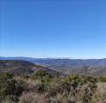
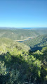
Breathtaking views of the Îles de Hyères, the Bay of Toulon and the Gulf of Saint-Tropez.

Warning! This route is intended for experienced walkers. It requires a good sense of direction and the ability to navigate the terrain.
The section between (4) and (5) is difficult to navigate as the path is almost completely obscured by vegetation. Use of the Visorando app is recommended.

Details

n°32604665
Creation:
Last update:
Last review:
  • Walking
    Activity: Walking
  • ↔
    Distance: 7.18 mi
  • ◔
    Average duration: 5h 20 
  • ▲
    Difficulty: Moderate

  • ⚐
    Back to start: Yes
  • ↗
    Ascent: + 2,310 ft
  • ↘
    Descent: - 2,333 ft

  • ▲
    Highest point: 2,546 ft
  • ▼
    Lowest point: 591 ft

Description of the walk

For parking, there are two options:
- at the Soleiado lodge
- at the Terres Rousses car park in Collobrières.

(S/E) Follow theGR®® 90 trail towards Notre-Dame des Anges. At the Sainte-Marguerite oratory, carry on straight ahead and then follow the Route de Vaudrèches. TheGR®® cuts across the first left-hand bend via a barely visible path. You’ll reach a crossroads with a footpath.

(1) Leave theGR®® here and turn right onto the yellow-markedPR®® towards La Garde Freinet – Les Mayons. ThisPR®® starts as an uphill track before becoming, to the right of a gate, a well-marked path running alongside a fence. You’ll reach a small pass below the hamlet of Les Pourcieux.

(2) Wind your way down through the woods and chestnut groves until you cross the Ruisseau de la Sauvette. Climb up the other side. The path, which is poorly maintained, may require you to take the parallel track. You’ll emerge onto the D12 at the hamlet of Maurès.

(3) Head north along the road towards Gonfaron for about a hundred metres, then turn right onto the Piste des Condamines, which is closed to public traffic. A few metres further on, leave this track and take a new track on the left. Continue until you rejoin the Piste des Condamines.

(4) Turn left onto it to reach a path junction near a small farmhouse. Take the poorly marked and unmaintained path on the left, which climbs straight up through the chestnut grove, whilst staying on the right-hand side of the valley. On a very steep section, cross several horizontal tracks. Carry on above the chestnut grove and cross another track. The last one is also the muddiest. Turn right onto this track. After 20 metres of overgrown terrain, it becomes easily passable and climbs to a pass.
(5) You’ll come across the remains of an old chestnut grove. At the pass, the track turns into a game trail that leads back down. Do not follow it. Do not take the steeper tracks either, which branch off at a 90° angle to the left. Head north-north-east for 200 m along a slightly ascending traverse to follow the upper edge of the chestnut grove. You’ll reach a clearly marked clearing used as a hunting post, which allows you to climb steeply up a hunters’ track for a vertical ascent of about 50 metres. It then climbs northwards until it joins the ridge line at an altitude of around 650 metres. From there, a path on the north-western flank of the ridge leads to the summit.
Remember to look back over the final 400 metres to enjoy the panoramic view towards Toulon and Hyères, and to take in the viewpoints on the right towards Saint-Tropez and Île du Levant over the Crête du Treps. Reach the Crête de la Sauvette.

(6) Follow the route back in the opposite direction to return to the car park you chose at the start (S/E).

Waypoints

  1. S/E : mi 0 - alt. 614 ft - Collobrières car park
  2. 1 : mi 0.45 - alt. 630 ft - GR 90 – PR junction
  3. 2 : mi 1.02 - alt. 892 ft - Small pass at the top of the Pourcieux
  4. 3 : mi 1.84 - alt. 1,027 ft - Maurès
  5. 4 : mi 2.52 - alt. 1,490 ft - Piste des Condamines
  6. 5 : mi 2.84 - alt. 1,873 ft - Small pass
  7. 6 : mi 3.59 - alt. 2,546 ft - Summit of - La Sauvette (776m)
  8. S/E : mi 7.18 - alt. 614 ft - Collobrières car park

Notes

This hike is over varied terrain and requires sturdy, grippy footwear and a good sense of direction.
There is no water along the entire route, which is often in the shade

Always be cautious and plan ahead when you're outdoors. Visorando and the author of this route cannot be held responsible for any accidents occurring on this route.

The GR® and PR® markings are the intellectual property of the Fédération Française de Randonnée Pédestre.

Reviews and comments

2.8 / 5
Based on 6 reviews

Reliability of the description
2.3 / 5
Ease of following the route
1.7 / 5
Route interest
4.3 / 5
Remi_22
Remi_22

Overall rating : 2.7 / 5

Date of your route : May 04, 2026
Reliability of the description : ★★☆☆☆ Disappointing
Ease of following the route : ★☆☆☆☆ Very disappointing
Route interest : ★★★★★ Very good
Very busy route : No

It’s a really lovely, rugged hike! I loved it; the view from the summit of La Sauvette is truly magical. That said, the route is very difficult to follow and involves some off-trail walking through the forest. With a bit of hesitation, you’ll find your way using your phone’s GPS and a good sense of direction. You have to enjoy off-trail walking and branches. Personally, I really like it. That’s what I was hoping for when I set off, so I’m not complaining. It was great fun and I managed to find the path to the summit.
There’s a better path that starts from the D39 near the Monier Michel earthworks (see Google Maps) and goes straight to the summit of La Sauvette. I took it to come down from the summit so I wouldn’t have to struggle through the trees and branches on the way down. I’d advise anyone to take that one straight away and not follow the suggested route.

Machine-translated

Frfoxy
Frfoxy

Overall rating : 2.3 / 5

Date of your route : May 01, 2026
Reliability of the description : ★☆☆☆☆ Very disappointing
Ease of following the route : ★☆☆☆☆ Very disappointing
Route interest : ★★★★★ Very good
Very busy route : No

FORGET THIS ROUTE, BUT I’VE GOT TWO OTHERS FOR YOU
I did it today and the trail is practically invisible along the entire southern slope, so you end up in the thicket mimicking wild boars whilst keeping an eye on the GPS… no way!!!
I managed to reach the top and, yes, it’s definitely worth it, but I gave up on the descent and found an alternative route, which means I can suggest two hikes to get to the top of La Sauvette on trails worthy of the name.

1) Short version……… Head straight to point N43.2690146, E6.3220055, which corresponds to the Magnan stream catchment.
There’s a small car park, ideal for parking your car!
From there, take the path heading eastwards; it climbs steeply, even very steeply
At the very top, turn left (you’re between 5 and 6 on the original route) and it climbs right to the summit
Given the gradient, I’d rate it as Moderate+ or even difficult; it requires a lot of effort (I did it on the way down! 🤣).
Descend via the same route in the opposite direction
In my opinion, the approximate duration for the round trip is 2 hours

2) Remixed version…… You set off as for the original hike up to point 3 (a lovely walk along a country lane)
When you reach point 3, turn left onto the D39 (sorry…) for 1.8 km
Once you reach the Magnan stream catchment point, continue as in the short version and do the same on the way back
Approximate duration: 4 hours round trip

These routes ensure you can reach Mont Sauvette in complete safety!!!

Machine-translated

Frfoxy
Frfoxy

Overall rating : 2.3 / 5

Date of your route : May 01, 2026
Reliability of the description : ★☆☆☆☆ Very disappointing
Ease of following the route : ★☆☆☆☆ Very disappointing
Route interest : ★★★★★ Very good
Very busy route : No

FORGET THIS ROUTE, BUT I’VE GOT TWO OTHERS FOR YOU
I did it today and the trail is practically invisible along the entire southern slope, so you end up in the thicket mimicking wild boars whilst keeping an eye on the GPS… no way!!!
I managed to reach the top and, yes, it’s definitely worth it, but I gave up on the descent and found an alternative route, which means I can suggest two hikes to get to the top of La Sauvette on trails worthy of the name.

1) Short version……… Head straight to point N43.2690146, E6.3220055, which corresponds to the Magnan stream catchment.
From there, take the path heading eastwards; it’s steep, even very steep.
At the very top, turn left (you’re between 5 and 6 on the original route) and continue climbing right to the summit
Given the gradient, I’d rate it as Moderate+ or even difficult; it requires a lot of effort (I did it on the way down! 🤣).
Descend via the same route in the opposite direction
In my opinion, the approximate duration for the round trip is 2 hours

2) Remixed version…… You set off as for the original hike up to point 3 (a lovely walk along a country lane)
When you reach point 3, turn left onto the D39 (sorry…) for 1.8 km
Once you reach the Magnan stream catchment point, continue as in the short version and do the same on the way back
Approximate duration: 4 hours round trip

These routes ensure you can reach Mont Sauvette in complete safety!!!

Machine-translated

User 26227619

Overall rating : 1.7 / 5

Date of your route : Jun 25, 2025
Reliability of the description : ★★★☆☆ Average
Ease of following the route : ★☆☆☆☆ Very disappointing
Route interest : ★☆☆☆☆ Very disappointing
Very busy route : No

Never go on this hike; we almost died.

Machine-translated

pennyo50760
pennyo50760 ★

Overall rating : 4 / 5

Date of your route : Apr 02, 2024
Reliability of the description : ★★★★☆ Good
Ease of following the route : ★★★☆☆ Average
Route interest : ★★★★★ Very good
Very busy route : No

A really lovely walk, but you absolutely must use your smartphone to follow the route as the path has almost disappeared. I loved it

Machine-translated

eric83
eric83

Overall rating : 3.7 / 5

Date of your route : May 29, 2023
Reliability of the description : ★★★☆☆ Average
Ease of following the route : ★★★☆☆ Average
Route interest : ★★★★★ Very good
Very busy route : No

We did this route on 29 May 2023.
The view from the ridge and the summit is magnificent
A few precautions, however: this route is intended for experienced walkers; it requires a good sense of direction and the ability to navigate the terrain.
The section between (4) and (5) is quite difficult to navigate as the path is almost completely hidden by the vegetation… we managed it fine, though…
Thanks to the VisoRando app on our smartphones, which helped us find our bearings in ‘moments of doubt’
From (5) onwards along the ridge, the route is much clearer, and the signposting from the Trail des Maures the day before was a great help!
We didn’t regret it: a beautiful, wild route with stunning views, particularly from the ridge

Machine-translated

Other walks in the area

For more walks, use our search engine .

The GPS track and description are the property of this route's author. Please do not copy them without permission.