Boucle Vaugany - Le Collet par Pourchery

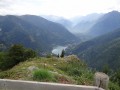
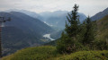
This circular route starting from Vaujany offers a beautiful view of Allemond, Lac du Vernet, and the confluence of the Eau d’Olle and Fare valleys.
Most of the route is through woodland.

Details

773083
Creation:
Last update:
Last review:
  • Walking
    Activity: Walking
  • ↔
    Distance: 5.73 mi
  • ◔
    Average duration: 4h 50 
  • ▲
    Difficulty: Moderate

  • ⚐
    Back to start: Yes
  • ↗
    Ascent: + 2,543 ft
  • ↘
    Descent: - 2,523 ft

  • ▲
    Highest point: 5,597 ft
  • ▼
    Lowest point: 3,251 ft

Photos

Description of the walk

The route starts from the car park near the cable car but can be started from any other car park in Vaujany.

(S/E) Take the D43a road towards the valley. Pass through Petit Vaujany.

(1) On leaving the hamlet, just after the cemetery, take the signposted path on the left towards Pourchery. Follow it south-west.

(2) The path leads to a hairpin bend on the D43a at the entrance to the hamlet of Le Perrier.
Follow the road downhill for about 200m and take the path on the left towards Pourchery.
The path rejoins the D43a again, just opposite the little chapel at Pourchery. Follow the D43a for about 250m.

(3) Take the signposted path on the right towards Le Collet. The path winds its way between houses and turns left, running alongside properties. Follow this almost flat path for about 1 km.

(4) Leave the path that continues straight ahead and turn right to take the path towards Le Collet. Follow this path to Le Collet. Yellow markings help you follow the path, which is not always clearly marked.
After the first few hairpin bends, the path crosses a fairly narrow section, the bed of a stream that is dry in summer.

(5) In this section of the climb, sections have been fitted with a cable to hold on to.

(6) The path leads out onto a clearing with an unsightly concrete structure on the left and a small road on the right.
The concrete structure is part of the Grand Maison hydroelectric complex.
Take the small road for about 250m to reach the small pass and its orientation table.

(7) After admiring the view, head back along the road to the junction.

(6) On the right-hand side of the open area, take the path that heads into the forest towards Vaujany. This path crosses a small road several times.

(8) Ignore the path towards Grand Beau Rocher and Col du Sabot. Follow the signs for Vaujany. This path leads into mountain pastures. Please ensure you close the gate properly behind you.
On arriving in Vaujany, the path passes in front of a museum dedicated to the region’s wildlife.
Shortly after the museum, turn right to join the D43a and the starting point (S/E).


Waypoints

  1. S/E : mi 0 - alt. 4,068 ft - Cable car car park
  2. 1 : mi 0.36 - alt. 3,970 ft - Marked path on the left
  3. 2 : mi 0.96 - alt. 3,619 ft - Le Perrier
  4. 3 : mi 1.39 - alt. 3,294 ft - Pourchery
  5. 4 : mi 2.11 - alt. 3,284 ft - Crossroads. Start of the climb
  6. 5 : mi 3.53 - alt. 5,292 ft - Handrail
  7. 6 : mi 3.91 - alt. 5,597 ft - Balance beam
  8. 7 : mi 4.06 - alt. 5,564 ft - Orientation table
  9. 8 : mi 4.92 - alt. 4,793 ft - Junction towards Col du Sabot
  10. S/E : mi 5.73 - alt. 4,068 ft - Cable car car park

Notes

The climb between points (4) and (6) is quite steep in places and can be slippery in wet weather.
The path crosses very steep terrain.

This route is best done in summer.

Reviews and comments

3.2 / 5
Based on 4 reviews

Reliability of the description
3.3 / 5
Ease of following the route
3 / 5
Route interest
3.3 / 5
Seiran
Seiran

Overall rating : 2.3 / 5

Date of your route : Apr 11, 2026
Reliability of the description : ★★★☆☆ Average
Ease of following the route : ★☆☆☆☆ Very disappointing
Route interest : ★★★☆☆ Average
Very busy route : No

A little-used route that was still heavily snow-covered in April – even though it was marked as ‘snow-free’!!
Even setting aside the snow that we had to go round several times without equipment (we nearly died...), I found it quite difficult to follow the route and the markings.
For your information: We’re generally quite fit, so I wouldn’t recommend this to beginners, and I think the difficulty is underestimated, at least for April.

Machine-translated

NathDelh
NathDelh

Overall rating : 3.3 / 5

Date of your route : Aug 26, 2024
Reliability of the description : ★★★☆☆ Average
Ease of following the route : ★★★☆☆ Average
Route interest : ★★★★☆ Good
Very busy route : No

We went for a walk today as a family (with children aged 10 to 16) on this route, which isn’t very well signposted and isn’t very clearly marked between points 4 and 6.
A little-used path, very steep with some very technical and slightly challenging sections despite a few handrails.
A very enjoyable route for experienced and knowledgeable hikers.

Machine-translated

Flo—31
Flo—31

Overall rating : 3 / 5

Date of your route : Jul 27, 2023
Reliability of the description : ★★★☆☆ Average
Ease of following the route : ★★★★☆ Good
Route interest : ★★☆☆☆ Disappointing
Very busy route : No

We did this hike as a family. It was a real ordeal for my wife. The ascent is very technical. The slope is incredibly steep; it’s almost like rock climbing.
What’s more, it’s in the forest, so there’s very little visibility of the otherwise magnificent views.

Machine-translated

jlf13
jlf13

Overall rating : 4 / 5

Date of your route : Aug 27, 2019
Reliability of the description : ★★★★☆ Good
Ease of following the route : ★★★★☆ Good
Route interest : ★★★★☆ Good

A lovely walk in dry but misty weather, which spoiled the view at point 7. As mentioned in the practical information, the climb is quite steep between points 4 and 6, with a path that is sometimes narrow and in poor condition, so it’s best to avoid it in wet weather.

Machine-translated

Other walks in the area

For more walks, use our search engine .

The GPS track and description are the property of this route's author. Please do not copy them without permission.