Country:

 City:
City:


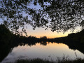
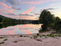
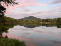
The starting point is at Champ Thiébaut, in La Chapelle-devant-Bruyères. To get there, take the road towards La Chapelle-devant-Bruyères; it is quiet, making for a pleasant and safe journey. Parking is available at the edge of the forest.
(S/E) Follow the small road south-west (marked with Red Discs). At the first Fork in the road, turn right, then ignore another road on the right. Just before the D60, leave the road and take a path on the right, following a stream on your left.
(1) After about 200 m, carry on straight ahead, keeping a pond on your right (Ponds Trail, green markings, recommended direction of travel). Shortly afterwards, veer left and walk alongside another pond on your right.
(2) At a three-way junction, turn right and pass between the pond you have just walked alongside and a smaller pond on the left. Then cross a sandpit.
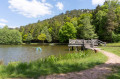
(3) You’ll reach the edge of the Plan d’Eau du Moulin and walk almost all the way round it in a clockwise direction. At the northern tip of the lake, carry on straight ahead and walk past two smaller lakes on your right.
(4) Cross the La Neuve stream and walk alongside a pond on your right.
(5) Turn left to follow the Grand Parcours. Walk all the way round the Vieux Moulin pond.
(5) Turn right, walk past a pond on your right and you’ll soon come to a junction you passed at the start of the walk.
(1) Follow the grassy path to the left, then take the road on the left to return to the car park at Champ Thiébaut (S/E).
 Tourist office
 Visorando Member
 Difficult
  Moderate