


 Country:
 City:


Car park: Allée des Balsamines or Place François Faniel (near the church).
(S/E) Opposite the church, take Rue Joseph Delhalle to the left of the church. Follow it to the end and, shortly after crossing the Mehaigne, keep left into Rue Vieille Hesbaye: this continues as a concrete path running behind the properties; follow it to the left until you reach a large roundabout.
(1) Turn left onto Rue du Val Notre-Dame. After passing Val Notre-Dame (boarding school, former abbey), take the road leading uphill to the right (Rue Léon Verlaine). At the top, as the road curves to the right opposite a house (No. 9), keep to the left onto the side road. Ignore the path on the right (a narrow track between two hedges) and walk a few steps towards the house visible ahead.
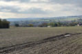
(2) Before reaching the house, turn right onto the track climbing the hillside (this track is heavily eroded by surface runoff!). At the top, it continues as a street. Turn left at the end of Rue de Wanzoul and carry on straight ahead along Rue de Fumal, which begins to descend.
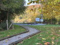
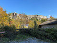
(3) At the fork in the road, take the farm track on the left, just after No. 5 Rue de Fumal. The track (now gravelled) curves to the left and runs for 1 kilometre alongside the embankment overlooking the quarry. At the end, keep to the right and continue along the concrete footpath. Follow it for 250 metres, then turn right diagonally onto the grassy path leading up into the copse. The path comes out onto an open area: go round the tennis courts on the right, then walk alongside the basketball court to reach the top of Rue des Communes.
(4) Turn left and walk down Rue des Communes to the bottom.
(5) At the end, continue downhill to the right along Rue Georges Hublin. Walk down this street to the bottom, cross the N652 (Rue du Val Notre-Dame) with care, cross the Mehaigne and turn into Rue du Centre opposite.
(6) Turn right at the first junction and walk alongside Place Jules Galloy. Before crossing the Ruisseau de Fosseroule, turn left into Rue du Madot.
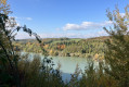
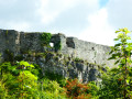
(7) This road runs alongside the stream (the ruins of Moha Castle are visible). At the end of the tarmac road, continue for a few metres, then turn left onto the farm track climbing up the hillside of the valley.
(8) Don’t miss the viewpoint over the nature reserve just before the summit. At the top, at the junction, continue to the right along the grassy track running alongside the field of solar panels. At the end, head down to the left to rejoin Rue Raide Vallée.
(9) Turn left onto this street for about thirty metres, then turn right into Rue Saint-Sauveur. Next, turn left into Rue du Cimetière (passing in front of Moha cemetery).
(10) At the end of the street, carefully cross the N652 and Rue de l’Église, then turn right onto Rue de l’Église and follow it for 200 metres, before turning left onto the diagonal street leading to a house. The road continues as a narrower path which leads to Rue Nerva. Turn left onto this street and follow it to the end.
(11) At the end (small chapel), take the footpath on the right. This runs alongside the Naxhelet golf course. Carry on straight ahead at the first junction (entrance to the golf course) and again at the second, leading (downhill) past the Wanze cemetery and onto the N643a.
(12) First turn left then right to cross the road carefully and continue downhill along Rue des Wallons (street sign missing). This street continues as a grassy path leading to Rue des Œillets; cross it and continue downhill alongside the woodland.
(13) At the bottom, keep to the right to climb the embankment, then follow the railway line to the road. Turn left onto it to reach the church, the finish point (S/E).
 Visorando Member




 Easy

