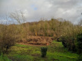
A walk through the Compiègne Forest and to the ruins of Champlieu

Set amidst woodland and history, this easy walk takes you to the ruins of the Gallo-Roman town of Champlieu, on the Chaussée Brunehaut, and to the ruins of a medieval chapel. There are some lovely stretches through the forest. The walk is suitable for families or for walking your dog.

Details

30079472
Creation:
Last update:
Last review:
  • Walking
    Activity: Walking
  • ↔
    Distance: 6.70 mi
  • ◔
    Average duration: 3h 20 
  • ▲
    Difficulty: Moderate

  • ⚐
    Back to start: Yes
  • ↗
    Ascent: + 279 ft
  • ↘
    Descent: - 279 ft

  • ▲
    Highest point: 456 ft
  • ▼
    Lowest point: 174 ft

Description of the walk

Start from the Hourvari Forest House at the Carrefour Desbouis. Access by car via the Route du Maupaset; parking available on site.

(S/E) With your back to the forest ranger’s house, take thesecond left (east-southeast) onto the Route du Grand Octogone. At the junction (elevation 58), turn right (south). Continue to the Carrefour des Prés du Rosoir.

(1) Continue straight on, still heading south. At the next junction, go straight on and climb a steep hill. Continue on roughly level ground until you reach the Carrefour des Grueries.

(2) Then take thesecond path on the left, heading due west (red and white markings forthe GR® 12 and 655). At the next junction, go straight on.

(2) At the Carrefour d’Acaste, take thefirst path on the right. You’ll come out onto a wide path; follow it to the left, still following theGR® markings. Keep going straight on and ignore the turn-offs to the left. Cross a small car park (information board), join a small road (Chaussée Brunehaut, an ancient Roman road) and follow it to the right. You’ll reach the Gallo-Roman ruins of Champlieu.

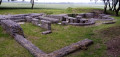
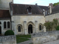
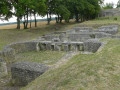
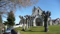
(4) Turn left to walk around the site, noting in particular the well-preserved amphitheatre. Return to the road and follow it to the left until you reach the ruins of a Romanesque chapel.

(5) Continue straight on along the road.

(6) After about 800 m, leave the road and turn right onto a path that leads across the fields towards the forest.

(7) At the edge of the forest, first turn left then right onto a forest track heading north-west. Stay on this track in this direction until you reach a T-junction.

(8) Join theGR® 12 and 655 trails (marked in red and white) and follow them to the right. Continue straight on until you reach the Carrefour des Gruries, which you took on the way out.

(2) Leave the marked trail and take thesecond path on the left, at a 90° angle. Keep heading north-west and, after about 500 m on level ground, descend into the path which becomes a ravine.

(9) At the Carrefour de la Sente aux Poireaux, go straight on (north-north-west). At the next junction, continue straight on.

(10) At the junction that appears immediately, turn right onto the Route de la Sente aux Poireaux. Continue straight on (north-north-east) until you reach the Hourvari Forest House (S/E).

Waypoints

  1. S/E : mi 0 - alt. 177 ft - Hourvari Forest House - Carrefour Desbouis
  2. 1 : mi 0.67 - alt. 200 ft - Carrefour des Prés du Rosoir
  3. 2 : mi 1.46 - alt. 433 ft - Junction of the two circular loops - Carrefour des Grueries
  4. 3 : mi 2.08 - alt. 410 ft - Carrefour d'Acaste
  5. 4 : mi 2.75 - alt. 446 ft - Roman ruins at Champlieu
  6. 5 : mi 3.31 - alt. 417 ft - Ruins of the - Chapelle Saint-Jacques (Champlieu)
  7. 6 : mi 3.85 - alt. 404 ft - Start of the trail
  8. 7 : mi 4.08 - alt. 397 ft - Junction – Forest track
  9. 8 : mi 4.48 - alt. 400 ft - T-junction
  10. 9 : mi 5.8 - alt. 223 ft - Carrefour de la Sente aux Poireaux
  11. 10 : mi 6.02 - alt. 197 ft - Junction
  12. S/E : mi 6.7 - alt. 177 ft - Hourvari Forest House - Carrefour Desbouis

Worth a visit

(4) Gallo-Roman ruins at Champlieu.

(5) Ruins of the Romanesque chapel at Champlieu.

Always be cautious and plan ahead when you're outdoors. Visorando and the author of this route cannot be held responsible for any accidents occurring on this route.

The GR® and PR® markings are the intellectual property of the Fédération Française de Randonnée Pédestre.

Reviews and comments

4.8 / 5
Based on 2 reviews

Reliability of the description
4.5 / 5
Ease of following the route
5 / 5
Route interest
5 / 5
xavmuch
xavmuch

Overall rating : 4.7 / 5

Date of your route : Oct 28, 2025
Reliability of the description : ★★★★☆ Good
Ease of following the route : ★★★★★ Very good
Route interest : ★★★★★ Very good
Very busy route : No

Very beautiful and varied hike. Didn't see a single person along the way. Definitely worth doing again

Machine-translated

legodvicien
legodvicien

Overall rating : 5 / 5

Date of your route : Sep 10, 2023
Reliability of the description : ★★★★★ Very good
Ease of following the route : ★★★★★ Very good
Route interest : ★★★★★ Very good
Very busy route : No

A few changes in elevation, varied scenery, an exceptional Gallo-Roman site, a ruined church to explore, very few people in the forest – in short, perfect for us!
A few details: just over 11 km according to our GPS, and the start of the route was on a track rutted by forestry work for barely 1 km.
Thanks to the author of this lovely walk, which we’ll happily do again

Machine-translated

Other walks in the area

For more walks, use our search engine .

The GPS track and description are the property of this route's author. Please do not copy them without permission.