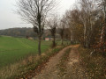
Haccourt
The name Haccourt is thought to derive from the Celtic name Aaz, meaning ‘water’. Aazacos… Hacus to the Romans became Hacue in 1067. Before the Renaissance, it changed to Haccuria; the magistrates of the Court of Justice then regarded the suffix ‘cour’ as indicating a judicial jurisdiction. Source: Toussaint PIROTTE, Historian: Seven communes with a rich past.
Although the history of Haccourt cannot be reduced to the history of the ‘macrâles’, we have chosen them as a symbol of this walk.
Even today, beliefs persist regarding the powers of witches – mythical figures dressed in black, wearing long, pointed hats and riding their ‘ramon’ (broomstick). They embody the Devil and fuelled the fears of our childhood.
Macrále: the macrále is a wicked witch and her appearance is repulsive.
Indeed, she is old and ugly, with sagging cheeks and eyes ringed with red. She is more or less hunchbacked, has a tuft of hair on her chin, whilst her remaining teeth look menacing.
The macrále loves to shapeshift: she takes on the form and appearance of a goat, a cat or a wolf. She can also cast evil spells and make herself invisible to approach her future victims or avoid retaliation.
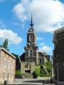
(2) Saint-Hubert Church and its ramparts
The original church was built between 1278 and 1288 on the ruins of an ancient lowland fortified castle situated on a hillock.
This fortified castle was destroyed in 1231 and all that remains today is part of the tower, which was oval in shape. However, the present tower dates from 1830. In 1887, it was topped with a bulbous finial known locally as ‘the coffee pot’. The wall features a beautiful pointed arch gateway through which the portcullis could be lowered.
Over the course of its history, the church has undergone various alterations, one of which broke with the rule that churches should be built with the chancel facing east.
Indeed, in the 1770s, as the number of parishioners grew, Father Xhaufflair wished to enlarge the building.
Due to a lack of space running east-west, it was decided to demolish the chapel, leaving only the tower – the last remaining part of the original church dating from 1288. Using this tower as a base, a larger church was built, perpendicular to the original one. This explains why the present-day church no longer faces east, but north.
(3) Valoir Mill
This mill is first mentioned as early as 1417. It was not until the 1970s that its wheel ceased to turn after coming off its axis; its normal operation had probably been hampered by branches and various objects carried by the Aaz stream during a storm. Recently, the internal machinery has been dismantled, but the wheel has found a new purpose: generating electricity. On the south façade, one can make out the original gable, built of tuffeau blocks, on which there is a sundial. The entrance porch dates from 1863, whilst the chapel, which is more recent, was built in 1896.
(5) Croix d’Amry
Damaged and in a precarious condition, it was fully restored in a workshop and re-erected on this site. The Latin inscription R.I.P. clearly indicates that a death occurred. It is also known as the ‘Croix d’Occis’. Around 1865–1870, a dispute is said to have broken out between rival farmers, involving several men. A brawl is said to have ensued, which unfortunately ended tragically for one of the men involved. The police were apparently unable to track down the murderer(s), as, when faced with the law, the solidarity amongst the local farmers proved stronger than their rivalry: no one spoke out! Following this rural tragedy, a family erected this cross in 1875 as a pious memorial.
(7) Hauts de Froidmont
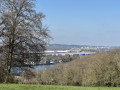
Along with Hemlot, this site is one of the ‘highlights’ of our municipality, and we can be proud of it. This spot marks the southern boundary of the Montagne Saint-Pierre and is also one of its highest points.
Human activity here dates back tothe 4th century BC. The ruined barn dates fromthe 13th century. The farm known as Petite Froidmont was sadly destroyed in 1673, following the stay of Louis XIV’s French army during the siege of Maastricht.
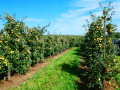
At this site, you can enjoy a superb view and well-maintained facilities: a barbecue, an educational orchard and information boards. You are situated within the Montagne Saint-Pierre Interreg network and its wonderful opportunities.
(10) Li Pazè dè Curé
This path once linked Maccourt and Liche directly across the countryside. The section you are currently walking along is part of this route, formerly used by the priests of the mother church in Lixhe who conducted services in the chapels at Haccourt and Hallembaye. When you reach the swimming pool, a few dozen metres to your right, you will see the imposing silhouette of the d’Artagnan farm.
Artagnan Farm: according to legend, Captain d’Artagnan is said to have stayed there during the siege of Maastricht. This farm, which was once a quadrangle dating fromthe 16th and17th centuries, features some interesting architectural elements: the wings, with their older central sections, have openings dating back to the Age of Enlightenment. To protect their heritage, the owners have taken up the rearing of Mulard ducks and certified geese, selected for the production of foie gras. They have also resumed the sale of PekOupeye (apple Péket).



 Country:
 City:



 Visorando Member
 Moderate

 Local authority
 Difficult