Country:
 City:
City:


Meet at the roundabout in the centre of Reyrieux, in front of the Jacques Fert primary school, at the “Chateauvieux” car park.
(S/E) Follow the D4f, Route de Veissieux le Bas, towards Massieux and Parcieux.
(1) At the junction with the Chemin du Trèves d’Ars, carry on straight ahead and enter Parcieux via the Route de Reyrieux. Ride past the private château and leave the Chemin du Trêve Magnin on your left. Continue to the next junction.
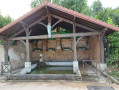
(2) Go straight on along Route de la Fontaine and admire the pretty fountain.
Carry on along the same road. Pass the church on your right and continue for 150 metres until you reach a junction with Rue de l’Église.
(3) Take Chemin du Fagot opposite, then turn left immediately onto Montée du Calvaire, heading towards the cemetery at Bernoud Saint-Jean de Thurigneux, and continue to its eastern corner.
On the uphill stretch, keep the Calvaire on your left.
(4) At the cemetery, turn left onto Chemin Mont Peloux, then right onto Chemin du Pillet. You’ll reach Route de Civrieux. Turn left onto it to walk alongside the Massieux Eco-Park on your right.
(5) Cross Route de Civrieux with care, opposite the Massieux Eco-Park. Turn left and follow the path that branches off to the right. Continue along this path to pass under the motorway.
At the top, turn slightly right onto Route de Massieux and, at the junction, carry on straight ahead to enter Genay.
(6) At this junction, first turn left then right (Rue de Proulieu, towards Place du Fortin, Le Plâtre / before the “Montée des Champs” building). Walk down to Rue de la Gare. Turn left onto it, towards the bell tower, until you reach the junction with Rue des Écoles.
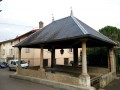
(7) Continue straight on along Rue de la Mairie, passing Genay Town Hall on your right. Take a moment to admire the Halle Marchande. Leave it on your left and take the small flight of steps opposite.
At the top, turn left then right to continue along Rue des Mignotières. At the Fork in the road, continue along Rue des Mignotières, keeping slightly to the left. Continue along the country lane towards Neuville-sur-Saône.
(8) At the end of the country lane, at the roundabout, turn slightly right towards Le Monteiller.
Start the descent and quickly turn left onto Route des Escargots, which becomes a footpath. Walk alongside the “Hauts de Neuville” estate on your right. Enjoy this short, shaded path as it descends to Chemin de Monteiller, then turn left onto it.
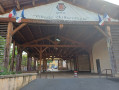
(9) Cross the disused railway line; at the roundabout, turn left, then immediately take the small flight of steps leading down to the right. Walk alongside the car park until you reach the porch.
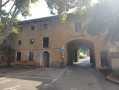
(10) Pass underneath and arrive at Place de la Voûte. Leave the M.J.C. and the Town Hall on your right.
Admire the chapel of Ombreval Castle on your left, then enter the old town opposite via the pedestrian street, Rue de la République. You’ll arrive behind the church; turn right onto Rue Camille, running alongside the church.
(11) In front of the church is a small square with shops, an ice-cream parlour and a drinking fountain on the left.
Take the path opposite the church to reach the Saône. Cross the road (Quai Pasteur) with care. You’ll arrive at the Quai de Saône (towpath).
(12) Turn right to follow the Saône along its left bank for several kilometres. Pass under the A46.
Discover the moored houseboats, the marinas, the available industrial ports, the lock keeper’s house with toilet facilities and a water point, the relaxation areas and the open-air cafés.
Continue to Port Bernalin, at PK27.
(13) Then turn right at the restaurant, towards Parcieux Town Hall. Walk past the car park along Chemin du Port Bernalin, and continue to the roundabout.
Cross the D933 with care, and take Chemin du Trève d’Ars opposite, towards Parcieux.
This road runs along the boundary between the two villages, with a sign marking the entrance to each village on either side.
(14) At the junction, turn left onto Chemin des Minimes. (You can continue for a few metres and follow the disused railway line to the left.)
At the end of the Chemin des Minimes, turn right and, just after the railway line, take the path on the left.
Carry on until you reach a fork in the road at the Calvaire de la Croix de Saint-Marc, then head right for 50 metres.
(15) Carry on straight ahead towards the village. At the junction with Rue du Stade, cross carefully and turn right onto the footpath; you will soon reach the Chateauvieux car park (S/E).



 Visorando Member
 Easy
Easy 
 Tourist office
 Difficult