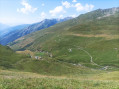
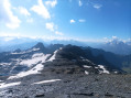
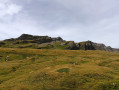
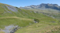
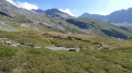
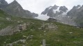
Mont Miravidi from the Chézari Bridge

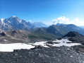
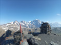
A fantastic panorama of the Mont Blanc massif, on the Italian side, awaits you at the summit of Mont Miravidi.

Details

60340661
Creation:
Last update:
Last review:
  • Walking
    Activity: Walking
  • ↔
    Distance: 6.10 mi
  • ◔
    Average duration: 5h 40 
  • ▲
    Difficulty: Difficult

  • ⚐
    Back to start: Yes
  • ↗
    Ascent: + 3,323 ft
  • ↘
    Descent: - 3,323 ft

  • ▲
    Highest point: 10,056 ft
  • ▼
    Lowest point: 6,722 ft

Photos

Description of the walk

Access via the Tarentaise. At Bourg-Saint-Maurice, head towards the Cormet de Roselend and, after 5 km, turn right towards Bonneval and Versoy. The road is very narrow; it’s impossible for vehicles to pass each other except on hairpin bends and in designated areas. Then there are another 10 km of road, just as narrow, alternating between tarmac and gravel (it’s perfectly passable) as far as the Pont de Chézari. Car park on the left after the bridge.

(S/E) Head due south, towards the Ferme des Crottes, ignoring the signposts. At the hairpin bend, carry on straight ahead. Just before the first building, a path branches off to the left behind the car park.

(1) Follow this path through the tall grass until you reach a ford.

(2) Continue climbing southwards, leaving the Col de Forclaz path on your right and carrying on.

(3) The track makes a 180° turn, climbing straight up the slope alongside a fence, then crosses northwards to reach the base of the Méchandeur valley. Pass beneath the very slender Aiguille de Beaupré and arrive beneath the Aiguille des Veis without difficulty, guided by the cairns.

(4) Then head left, north/north-west, on an ascending traverse, aiming for a thalweg that climbs due north. There are still large snowfields and the snow is hard. Climb up a small, snow-free couloir that opens out onto a flat area. Continue towards the Col des Veis.

(5) At the pass, the summit is very close. Head left.

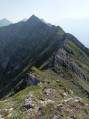
(6) From up there, the summit offers a magnificent panorama of the Mont Blanc massif, from the Aiguille des Glaciers to the Grandes Jorasses. The return is via the same route, in the opposite direction (S/E).

Waypoints

  1. S/E : mi 0 - alt. 6,732 ft - Pont de Chézari car park - Versoyen (cours d'eau)
  2. 1 : mi 0.3 - alt. 6,768 ft - Ferme des Crottes
  3. 2 : mi 0.42 - alt. 6,798 ft - Ford
  4. 3 : mi 0.51 - alt. 6,906 ft - Col de Forclaz Trail
  5. 4 : mi 2.15 - alt. 9,114 ft - Below the Aiguille des Veis
  6. 5 : mi 2.81 - alt. 9,770 ft - Col des Veis (2978m)
  7. 6 : mi 3.03 - alt. 10,056 ft - Mont Miravidi ou de Mirande (3066m)
  8. S/E : mi 6.1 - alt. 6,732 ft - Start car park

Notes

There are a few streams along the route, particularly just after the Crottes farm. Sometimes it’s not possible to cross the ford, but you simply need to head back up a little, jump over three streams and then rejoin the track.
Be careful not to lose sight of the cairns after the (4), even though the crossing over the boulders isn’t difficult.
For 13 August, there are still plenty of snowfields, which come in very handy on the descent when the snow softens.

Worth a visit

From the pass, it is easy to reach the 3031m point heading towards the Aiguille des Veis. To do this, take the clearly visible track that winds between the makeshift shelters and, once you reach the last shelter leaning against the cliff, take a hidden ledge on the right. This ledge will take you past the 3,031m point and, via a short, easy climb, onto the narrow ridge and to the summit.

Reviews and comments

4.1 / 5
Based on 4 reviews

Reliability of the description
4.5 / 5
Ease of following the route
3.5 / 5
Route interest
4.3 / 5
User 16023708

Overall rating : 3.7 / 5

Date of your route : Aug 09, 2025
Reliability of the description : ★★★★☆ Good
Ease of following the route : ★★☆☆☆ Disappointing
Route interest : ★★★★★ Very good
Very busy route : No

A beautiful hike, with impressive views of Mont Blanc from the summit. There are no trees, so there is little shade and the landscape is very rocky above 2,500 metres.
We had noted that the road was long and complicated, but with our little 4x4 Panda and without encountering any other cars, it went well.
As for the route, the first part is easy to follow because the path is clear, but every time there is a scree slope, the path disappears and you have to follow cairns. After a while, we lost the cairns and followed the GPS tracks on scree slopes (under the cliffs), which made our progress very difficult. For the descent, we realised that there was another parallel path with lots of hiker tracks and very well marked with cairns that descended to the same place. Even though we lost the trail after a while and returned to the path we had taken on the way up, this path further away from the cliffs made our lives much easier, so we recommend it.

Machine-translated

Rubicapra
Rubicapra

Overall rating : 4 / 5

Date of your route : Aug 10, 2025
Reliability of the description : ★★★★☆ Good
Ease of following the route : ★★★★☆ Good
Route interest : ★★★★☆ Good
Very busy route : No

We only encountered one person along the way... very wild.
We would have liked to finish at the Col du Breuil, but it was complicated and not very appealing given the conditions on the glacier.
For the route, it is best to follow the cairns as they appear without straying too far, as there are many of them. Experience of walking in high mountain terrain is essential.
Good weather is essential.
The road is winding and narrow but in good condition. There are places to park if you need to pass, but you need to be used to driving on this type of road!

Machine-translated

fletcher_fr
fletcher_fr

Hello, I did note in the description the difficulties in passing each other on this narrow road.
Don't worry, you're not the only one who lost sight of the cairns after point 4.

Machine-translated

YOKE
YOKE

Overall rating : 4 / 5

Date of your route : Jul 13, 2025
Reliability of the description : ★★★★★ Very good
Ease of following the route : ★★★☆☆ Average
Route interest : ★★★★☆ Good
Very busy route : No

Be careful on the access road, which is long and very narrow. We encountered a milk truck coming down at 7:15 a.m. and had to back up 150 metres on a winding road before we could let it pass and continue... luckily, we didn't encounter any more trucks.
Halfway along the route, there are no longer any signposts, and we had to cross some scree blindly, as well as on the descent, where we took a slightly different route... The sky was a little overcast that day, so we didn't get the 360° view we had hoped for, but the panorama is still magnificent. I recommend it!

Machine-translated

fletcher_fr
fletcher_fr

Hello,
What’s this got to do with Forez?

Machine-translated

bouchet.philippe
bouchet.philippe

Overall rating : 4.7 / 5

Date of your route : Aug 26, 2024
Reliability of the description : ★★★★★ Very good
Ease of following the route : ★★★★★ Very good
Route interest : ★★★★☆ Good
Very busy route : Yes

A lovely walk in the Forez region, in Chateldon.

Machine-translated

Other walks in the area

For more walks, use our search engine .

The GPS track and description are the property of this route's author. Please do not copy them without permission.