Country:

 City:
City:


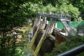
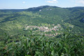
Park your car at Mouthier-Haute-Pierre, in the car park by the Syratus waterfall. To get there, coming from Besançon via the D67, 200 metres before the entrance to the village, take the small road on the right which leads to the banks of the Loue (Rue de la Marsotte, Rue du Pont, Rue des Guenbards and finally the Chemin des Moulins until it ends in a cul-de-sac.
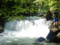
(S/E) As soon as you step out of your car, you’ll be able to admire the charming little Syratus waterfalls on your left. To start the walk, look out for the Upper Loue Valley route (signposted and marked with yellow-and-blue markers), heading towards “Passerelle Entre-Roche, Grotte de Baume Archée”. The well-graveled path climbs the hillside in an S-shape and, after 700 metres, crosses the tarmac road leading to the power station.
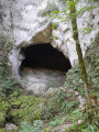
(1) Cross the road and continue uphill (signposted “Haute Vallée de la Loue”), following the markers. After 200 metres, at a bend, leave the path which continues to climb and head straight on along a track that will take you to the Grotte des Faux Monnayeurs, which opens out into the vertical rock face. You’ll come to signs for “Source du Pontet, Source de la Loue” directing you downwards. However, carry on straight ahead, heading up towards a pretty rocky passage. After this, on the left, a small iron ladder leads you to the cave. After your visit, retrace your steps for about a hundred metres, then head down towards the sign for “Source du Pontet, Source de la Loue”. After a 200-metre descent, at another fork in the path marked by a sign,
(2) take the left-hand path leading down to the Source du Pontet and its small waterfalls, set within the rock. When the flow is low, it seems you can access the back of the cave. I haven’t checked this myself, so please be careful! Its wooded surroundings provided the setting for Courbet’s painting *La Remise au Chevreuil*. The Pontet joins its bigger sister, the Loue; do the same by turning back and turning left at the previous signpost.
A first footbridge takes you across the Pontet, whilst a second spans the Loue. On the opposite bank, a bench invites you to take a short rest. A signpost points left towards the sources of the Loue.
(3) You then head up the Gorges de Nouailles. Its particularly winding course can be seen from the promontories. The emerald-green Loue is punctuated by rapids and waterfalls, the most remarkable of which is the “Grand Saut”. Take care: the stony path can be slippery in wet weather. For safety reasons, due to the formation of patches of ice along the route, the municipality of Mouthier advises against hiking here during the winter months. Overhanging, with constant ups and downs and dotted with vantage points, the path climbs steeply towards the source. Warning! As the automatic opening of the dam creates sudden eddies and a rapid rise in water levels, it is dangerous to venture near the dam’s sluice gates or to stand on the banks, islands or gravel banks.
(4) You’ll reach the dam, which stores a reserve of potential energy that can be used at any time. The water collected here powers the Mouthier power station, situated below the Pontet waterfall.
(5) Shortly after the dam, you’ll reach this major Franche-Comté tourist attraction, one of the Doubs’ most significant natural sites: the Source de la Loue. Then walk up the concrete path that passes in front of the café-restaurant Le Châlet de la Loue. Enter the car park, following the sign for the Haute Vallée de la Loue – Renédale Viewpoint. At the far end of the car park, take Rue de la Combe, marked with yellow-and-red signposts, and immediately after a ‘No Entry’ sign, look out for a small wooden staircase on the hillside (marker post, Route No. 10).
(6) Take the steps and follow this marked path, which turns right and then left. You’ll climb up to the edge of the woodland, at a place known as ‘Derrière le Lord’, leading out onto meadows and a tarmac path. Turn right, heading towards the ‘Haute Vallée de la Loue Route – Renédale Viewpoint’, a narrow path (yellow-red markings) that runs along the edge of the forest, then the edge of the cliffs (take care!). The path joins a stony track; continue straight on (yellow-red or yellow-blue markings).
At an ONF sign no. 6, hidden slightly behind a tree, you’ll find a new signpost; continue to follow the direction of the Renédale Viewpoint to the right, leaving the stony path behind. After about 200 metres, roughly the same distance from the cliff edge, turn left and continue along the cliffs overlooking the Nouailles Gorges. The path joins a wider, gravelly track; at a signpost, turn right towards the viewpoints, which you will reach shortly. The viewing points overlook the Nouailles Gorges, a deep, winding canyon in the heart of the limestone massif, with barren ledges and rocky cliffs.
(7) Continue along the path. About one kilometre from the viewpoint, the path opens out into a small clearing
(8) Cross the clearing. At the far end, look out for a signpost and its signs; take the path to the left for route no. 10, the Belvédère du Moine, continuing to follow the edge of the cliffs. Be sure to follow the signposts carefully, avoiding any paths marked with a cross.
(9) You’ll come to a wider, stony path; on the right, there’s another signpost and sign. Head towards the inn. Fifty metres further on, you’ll reach another stony path, which you’ll take to the left. The path leads out opposite the inn; climb up to the right towards the Belvédère du Moine de la Vallée. Two viewpoints: one on the right overlooking the Gorges de Nouailles and the other on the left overlooking Mouthier-Haute-Pierre, the Roche de Haute-Pierre and the Loue valley towards Ornans.
(10) Turn back to point (9).
(9) Head down to the left towards Mouthier. Take care: the path is stony and the stones roll underfoot (yellow-blue marker). 1.5 km from the inn, near the cliffs at a left-hand bend in the path and a sign for ‘Le Moine de la Vallée – Renédale’, you can carefully take a small path branching off to the right to reach an unsecured viewpoint (so take care!) of the Petite Roche overlooking the village of Mouthier and the gorges.
(11) Retrace your steps and continue downwards until you reach a concrete road that descends steeply to the right. Take care: despite the grooves in the surface, the road is very slippery in wet weather.
(12) You’ll arrive in Mouthier. Take a moment to admire the old houses and fountains. After the bridge, turn right onto Rue des Guenbards and follow the River Loue to the car park (S/E).
 Visorando Member
 Very difficult
 Moderate
 Association / Club / Walk leader