The Dampierre Ironworks

This short circular walk starting from Dampierre-sur-Blévy follows part of the disused GR®351 route. It first follows the River Blaise, then takes you to explore the former Dampierre Forges – once a major steelworks – and its pond. The return route takes you through copses and farmland, occasionally offering lovely views of the valley. The end of the walk takes you to the beautiful site of the Ferme des Moulins.

Details

n°31948448
Creation:
Last update:
Last review:
  • Walking
    Activity: Walking
  • ↔
    Distance: 5.73 mi
  • ◔
    Average duration: 2h 45 
  • ▲
    Difficulty: Easy

  • ⚐
    Back to start: Yes
  • ↗
    Ascent: + 105 ft
  • ↘
    Descent: - 105 ft

  • ▲
    Highest point: 623 ft
  • ▼
    Lowest point: 512 ft
  • ⚐ Country: France
  • ⚐
    Area: Perche
  • ⚐ City: Maillebois (28170)
  • ⚑
    Start/End: N 48.62803° / E 1.125716°
  • ❏
    IGN map(s): Ref. 1915SB, 1916SB, 2015SB, 2016SB
  • Hour-by-hour weather

Photos

Description of the walk

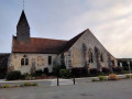
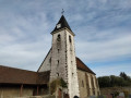
Park in the car park near the church in Dampierre-sur-Blévy, in the commune of Maillebois.

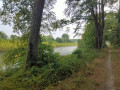
(S/E) Head towards the pond and take the path on the left (private but open to the public) which runs alongside the river and leads onto the D20 at the entrance to the Dampierre Forges.

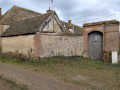
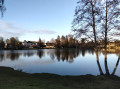
(1) Carefully follow the road to the left:you’ll have a view of the furnaces and buildings of the old forges, as well as the pond where the River Blaise resurfaces after flowing more or less underground. Thenturn right onto the small road towards Le Gord. Continue along the path that follows it to reach the end of the Dampierre Pond.

(2) Head up the path on the left towards the Boulay-Sauveloup farm. Walk past it and continue along the access road to rejoin the D20.

(3) Cross carefully and follow the path opposite. At the T-junction, turn left, walk alongside the woodland and reach a crossroads where four paths meet.

(4) Follow the path opposite, which becomes a road near the houses at La Butte Perrine. At Les Châtelets, carry on towards Maillebois.

(5) After the last houses, leave the road and follow a path to the left which leads into a woodland. Then turn right onto the path leading to the Ferme des Moulins.

(6) This is private property: do stay on the path. Follow the small access road leading to the D20. Cross carefully, then continuestraight ahead along the gently ascending path.

(7) At the crossroads, turn left onto the path that takes you back to the entrance to Dampierre. Follow the D20 to the right along the right-hand verge, cross at the pedestrian crossing and follow Rue de la Blaise. At the pond, turn left to return to the car park near the church (S/E). 

Waypoints

  1. S/E : mi 0 - alt. 525 ft - Car park
  2. 1 : mi 0.19 - alt. 538 ft - Entrance to the Dampierre Forges
  3. 2 : mi 1.35 - alt. 564 ft - End of the - Étang de Dampierre (Dampierre-sur-Blévy)
  4. 3 : mi 2.36 - alt. 620 ft - D20
  5. 4 : mi 3.34 - alt. 587 ft - Crossroads
  6. 5 : mi 4.22 - alt. 587 ft - Les Châtelets
  7. 6 : mi 4.78 - alt. 518 ft - Ferme des Moulins
  8. 7 : mi 5.15 - alt. 561 ft - Crossroads
  9. S/E : mi 5.73 - alt. 522 ft - Car park - Blaise (rivière) - Affluent de l'Eure

Worth a visit

Always be cautious and plan ahead when you're outdoors. Visorando and the author of this route cannot be held responsible for any accidents occurring on this route.

The GR® and PR® markings are the intellectual property of the Fédération Française de Randonnée Pédestre.

Reviews and comments

5 / 5
Based on 1 review

Reliability of the description
5 / 5
Ease of following the route
5 / 5
Route interest
5 / 5
FILIMAR
FILIMAR

Overall rating : 5 / 5

Date of your route : May 17, 2025
Reliability of the description : ★★★★★ Very good
Ease of following the route : ★★★★★ Very good
Route interest : ★★★★★ Very good
Very busy route : No

A superb walk

Machine-translated

Other walks in the area

For more walks, use our search engine .

The GPS track and description are the property of this route's author. Please do not copy them without permission.