From Briare to Beaulieu-sur-Loire

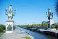
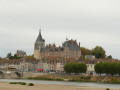
This hike begins with a crossing of the magnificent Briare Canal Bridge. This crossing is a privilege and if you are there early in the morning, you are sure to experience a range of emotions.
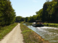
It continues along paths that run alongside the canal parallel to the Loire, offering bucolic panoramas.

This walk is part of a multi-day hike: De Gien à Cosne-Cours-sur-Loire

Details

1347912
Creation:
Last update:
Last review:
  • Walking
    Activity: Walking
  • ↔
    Distance: 10.23 mi
  • ◔
    Average duration: 4h 55 
  • ▲
    Difficulty: Moderate

  • ⚐
    Back to start: No
  • ↗
    Ascent: + 226 ft
  • ↘
    Descent: - 85 ft

  • ▲
    Highest point: 614 ft
  • ▼
    Lowest point: 413 ft
  • ⚐ Country: France
  • ⚐ City: Briare (45250)
  • ⚑
    Start: N 47.64144° / E 2.735888°
  • ⚑
    End: N 47.528182° / E 2.797011°
  • ❏
    IGN map(s): Ref. 2421SB, 2422SB
  • Hour-by-hour weather

Photos

Description of the walk

The starting point is Boulevard Buyser, which is easy to reach if you arrive by train at Briare station.

(S) Head south-east, follow the boulevard and take the bridge over the canal.

(1) (2) Cross the Trézée and continue along Rue de la Liberté, which is a continuation of the same road.

(3) Just before the canal, turn right onto Quai Mazoyer. Just before the canal bridge, turn left to cross the canal.

(4) Then turn right onto the canal bridge, which is clearly visible, and cross the Loire.

(5) At the end of the canal bridge, turn left to follow the raised path, with the Loire on your left. This path leads to the D951. Cross it and continue along the same path opposite to reach the Canal Latéral à la Loire, which you will only see at the last moment.

(6) Then turn left. Follow the canal on your right for about 3.5km to reach a road at Châtillon-sur-Loire.

(7) Cross the road and continue along the canal opposite. The canal makes two bends and you will see a port on the canal. A little further on, the path is between two canals. Continue on to lock no. 40, known as La Folie.

(8) At the next bridge, about 1.5 km from the Folie lock, leave the canal by crossing the bridge on the right. Stay on the main path, which turns left and then right towards the hamlet of Assay.

(9) In the centre of the hamlet, turn left towards Château d'Assay. Pass in front of the château and, at the fork, turn left. At the next crossroads, turn left and then immediately right onto the path.

(10) At the next crossroads, continue straight ahead (leaving theGRP®® trail on your left). You will come to a vineyard that was abandoned when we passed through (summer 2018).

(11) Turn right and follow a barely visible path through the vineyard. This path descends towards the road below. Cross the road and continue along the tarmac path opposite, towards the "Les Médards" estate.

(12) At Les Médards, turn left. Ignore a turn-off on the left (elevation 183) and, at Les Grands Teurots, first turn right then left to keep heading south-east then south. Cross a small road, walk along a pond on your right and reach the hamlet of Les Brosses, where you will find a pyramid-shaped barn, typical of the old buildings in the region.

(13) Continue straight ahead along the path, leaving the buildings on your right. At a T-junction, turn left. At the next junction (elevation 172), go straight ahead. Cross a tarmac road and continue along the road opposite. After about 400m, you will reach the lodge at La Boulaye (E).

Waypoints

  1. S : mi 0 - alt. 449 ft - Boulevard Buyser
  2. 1 : mi 0.1 - alt. 430 ft - Canal de Briare (Le)
  3. 2 : mi 0.13 - alt. 427 ft - Trézée (rivière) - Affluent de la Loire
  4. 3 : mi 0.45 - alt. 459 ft - Quai Mazoyer
  5. 4 : mi 0.73 - alt. 463 ft - Start of the Canal Bridge - La Loire
  6. 5 : mi 1.23 - alt. 449 ft - End of the Canal Bridge - Pont Canal de Briare
  7. 6 : mi 2.01 - alt. 449 ft - Canal latéral à la Loire
  8. 7 : mi 4.18 - alt. 466 ft - Route D50
  9. 8 : mi 6.6 - alt. 459 ft - Pont d'Assay
  10. 9 : mi 7.09 - alt. 551 ft - Fork towards the Château d'Assay
  11. 10 : mi 7.6 - alt. 564 ft - Crossroads
  12. 11 : mi 7.77 - alt. 551 ft - Abandoned vineyard
  13. 12 : mi 8.3 - alt. 558 ft - Les Médards
  14. 13 : mi 9.27 - alt. 551 ft - Les Brosses
  15. E : mi 10.23 - alt. 594 ft - La Boulaye

Notes

Worth a visit

Briare: the canal bridge.

Reviews and comments

4.5 / 5
Based on 2 reviews

Reliability of the description
4.5 / 5
Ease of following the route
4.5 / 5
Route interest
4.5 / 5
LucBell
LucBell

Overall rating : 4.3 / 5

Date of your route : Oct 23, 2021
Reliability of the description : ★★★★☆ Good
Ease of following the route : ★★★★☆ Good
Route interest : ★★★★★ Very good
Very busy route : No

A beautiful hike between the Loire, the magical Briare canal bridge and canals, which we shortened to make a circular loop by returning along the other bank of the Loire, at the bridge (under construction) in Chatillon sur Loire, via the old canal.
At this point, after crossing the bridge, the GR is marked at the lock, but then, in the direction indicated, we lost the trail and didn't know which way to go. We took the path along the Loire, which wasn't the right option, forcing us a few hundred metres further on to take a perpendicular path that took us back to the old canal towards Briare. No risk of getting lost, though! Just one more mark would need to be added at the lock.

Machine-translated

ovil
ovil

Overall rating : 4.7 / 5

Date of your route : Sep 25, 2018
Reliability of the description : ★★★★★ Very good
Ease of following the route : ★★★★★ Very good
Route interest : ★★★★☆ Good

We set off from Briare station and left the route at point 8 to follow the GRP to Bonny and return to Briare via the GR 3.
An easy hike on wide paths.
Assay Castle is surrounded by high walls and only the roofs are visible. It's a shame.

Machine-translated

Other walks in the area

For more walks, use our search engine .

The GPS track and description are the property of this route's author. Please do not copy them without permission.