The Buzerie ponds via La Grange au Rouge

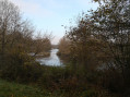
Discover the two small ponds at La Buzerie via La Grange au Rouge. A family walk, without any particular difficulty, mostly along forest tracks. The first pond is fenced off, but you can easily walk around the second one.
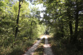
On the agenda: the tranquillity of the woods, birdsong, a few wild ducks and, if you’re lucky, some roe deer, a few horses grazing, and a breath of fresh air!

Details

n°10405582
Creation:
Last update:
–
Last review:
  • Walking
    Activity: Walking
  • ↔
    Distance: 5.00 mi
  • ◔
    Average duration: 2h 25 
  • ▲
    Difficulty: Easy

  • ⚐
    Back to start: Yes
  • ↗
    Ascent: + 112 ft
  • ↘
    Descent: - 112 ft

  • ▲
    Highest point: 427 ft
  • ▼
    Lowest point: 312 ft

Photos

Description of the walk

At the end of Rue Neuve, you can park near the level crossing to start the walk.

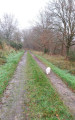
(S/E) The path, which is slightly sunken, climbs gently towards the hamlet of La Grange au Rouge. Ignore the side paths.

(1) Carry on straight ahead and pass through the hamlet of La Grange Rouge (ignore theGR®41, which crosses at right angles). The path levels out; walk through the hamlet of La Grange au Rouge. There are a few pretty Sologne-style farmhouses to admire before you reach the woods again. At the junction (marker 121), carry on straight ahead until you reach a T-junction.

(2) Turn left. Carefully cross the tarmac road known as the Grandes Vallées and walk alongside the first pond (unnamed) on your right. You’ll reach a crossroads.

(3) Turn right towards the nearby Buzerie ponds. At the crossroads, walk about fifty metres to the left (note the first fenced-off pond on the right, which is therefore inaccessible).

(4) Walk round the second pond in either direction (a good spot for a break or a picnic; please take your rubbish with you).

(4) Return to the main path heading south-east and, after about 50 metres, turn right.

(3) Turn left. Cross the Route des Grandes Vallées again with care. You’ll reach the T-junction from the outward journey.

(2) Carry on straight ahead. Cut across a side track. Join theGR® 41.

(5) Follow theGR® straight on (south-east). At the next junction, continue in the same direction and enter the hamlet of Les Tréchis via the Chemin du Coteau.

(6) Take thefirst right (leave theGR®). Immediately afterwards, at a right-hand bend, leave the road and take a path on the left. Stay on the main path, which heads west, and ignore any turn-offs to the right. The path gradually approaches the railway line and returns to the starting point (S/E).


Waypoints

  1. S/E : mi 0 - alt. 315 ft - Rue Neuve. Near the - Canal de Fontblisse
  2. 1 : mi 0.51 - alt. 397 ft - La Grange Rouge
  3. 2 : mi 0.97 - alt. 394 ft - T-junction
  4. 3 : mi 1.5 - alt. 367 ft - Crossroads
  5. 4 : mi 1.76 - alt. 367 ft - Étang de la Buzerie
  6. 5 : mi 3.46 - alt. 427 ft - GR41 junction
  7. 6 : mi 3.98 - alt. 420 ft - Les Tréchis – Junction
  8. S/E : mi 5 - alt. 315 ft - Rue Neuve

Notes

Good walking shoes (depending on the season, there may be some damp ruts), water, a tasty snack to make the walk last longer, a map or a GPS (as there are numerous paths and some of them lead nowhere).
Alternative route: you can easily avoid the hamlet of La Grange au Rouge by following this alternative route. At the junction with theGR®, simply turn right and then join the path on the left which will take you back to point (3).

Worth a visit

In the immediate vicinity, the Canal de Berry offers its banks to walkers wishing to extend their walk. The section to the west, between the Route de Saint-Julien and the village of Gièvres, is well worth exploring.
In the village of Villefranche, there is a lovely little 12th-century church.

Always be cautious and plan ahead when you're outdoors. Visorando and the author of this route cannot be held responsible for any accidents occurring on this route.

The GR® and PR® markings are the intellectual property of the Fédération Française de Randonnée Pédestre.

Reviews and comments

4.2 / 5
Based on 2 reviews

Reliability of the description
4 / 5
Ease of following the route
4.5 / 5
Route interest
4 / 5
User 28482798

Overall rating : 4 / 5

Date of your route : Jun 15, 2026
Reliability of the description : ★★★★☆ Good
Ease of following the route : ★★★★☆ Good
Route interest : ★★★★☆ Good
Very busy route : No

A really good app – easy to use and reliable 👍

Machine-translated

Zarys
Zarys

Overall rating : 4.3 / 5

Date of your route : Mar 15, 2024
Reliability of the description : ★★★★☆ Good
Ease of following the route : ★★★★★ Very good
Route interest : ★★★★☆ Good
Very busy route : No

A pleasant walk.

Machine-translated

Other walks in the area

For more walks, use our search engine .

The GPS track and description are the property of this route's author. Please do not copy them without permission.