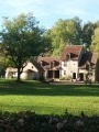
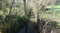
The Eaux Bleues de Tavers and the Pierre Tournante dolmen

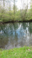
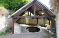
This walk, which mainly follows small roads, will take you past a prehistoric megalith and a number of geological features: the Lien Valley and its wash houses, which have partially dried up due to the river gradually sinking into the karst network of the Beauce limestone, as well as the Eaux Bleues resurgence at Tavers.

Details

n°3927080
Creation:
Last update:
Last review:
  • Walking
    Activity: Walking
  • ↔
    Distance: 5.26 mi
  • ◔
    Average duration: 2h 30 
  • ▲
    Difficulty: Easy

  • ⚐
    Back to start: Yes
  • ↗
    Ascent: + 98 ft
  • ↘
    Descent: - 102 ft

  • ▲
    Highest point: 367 ft
  • ▼
    Lowest point: 262 ft
  • ⚐ Country: France
  • ⚐ City: Tavers (45190)
  • ⚑
    Start/End: N 47.756853° / E 1.614822°
  • ❏
    IGN map(s): Ref. 2120E, 2120O
  • Hour-by-hour weather

Photos

Description of the walk

Start at the car park near the church in Tavers

Yellow signposts

(S/E) With your back to the church, turn right onto Rue des Eaux Bleues. Pass the first junction, then keep left at the Fork in the road onto Rue des Hautes Guignères.

(1) Take the first street on the left, Rue du Pouet, then turn right onto the path that runs alongside the River Lien and its wash houses. Turn off onto the first path on the right to rejoin Rue des Hautes Guignères, which you’ll follow to the left. Follow this street until you approach the A-road. Keep to the right at the Fork in the road about a hundred metres before the A-road, then turn left onto Rue des Eaux Bleues, and cross the B-road with care. Cross the railway line.

(2) Turn left immediately after crossing the railway bridge onto Chemin de Feularde. Pass the 1870 War memorial; continue along the track until you come to the first farm buildings.

(3) Turn right onto the grassy track just before a farm shed. Turn left at the junction with a cross-track, then left again onto the next track at the edge of a small wood. The ‘La Pierre Tournante’ dolmen is 200 metres to the right. You can reach it by entering the wood via a wide entrance. You rejoin the path by turning left at the dolmen. Another menhir is visible on the left-hand side of the path, a few dozen metres into a field. Although it is on private land, you can reach it by walking along the boundary of two plots, taking care not to damage the crops. Back on the wide, grassy path, turn left once you’ve rejoined the Chemin de Feularde.

(3) Once the circular route is complete, turn right onto the grassy path when you reach the junction near the farm shed. Turn left onto the track, which soon becomes tarmac, leading into the Vallée des Buis. The small road follows the strip of vegetation running alongside the River Lien.

(4) At L’Étang, turn left onto the cross street, then immediately right. Keep to the right at the Fork in the road just after crossing the railway line. Cross the A-road with care, head left along the A-road, then turn right onto Rue de Foussard.

(5) You can get closer to a wash house on the River Lien by keeping left at the Fork in the road onto Rue du Moulin. You’ll rejoin Rue de Foussard by taking the stone steps. Stay on this street until you reach Rue de Lestiou, a side street, which you’ll take to the left.

(6) After about a hundred metres, turn right onto the path that runs alongside the River Lien, with the Paillard wash house on your left. Once you reach Les Eaux Bleues, continue towards the Fontanils spring, passing the chicanes and following the River Lien on your left. The grassy path becomes more clearly marked and turns left immediately after the spring.

(7) Turn left onto the wide cross-path leading to Tavers. Turn right onto Rue des Eaux Bleues to return to the church, the starting point of the walk (S/E).

Waypoints

  1. S/E : mi 0 - alt. 312 ft - Tavers church car park
  2. 1 : mi 0.11 - alt. 302 ft - Turn left onto Rue du Pouet
  3. 2 : mi 0.81 - alt. 331 ft - Turn left immediately after crossing the bridge
  4. 3 : mi 1.54 - alt. 338 ft - Crossroads of the circular loop
  5. 4 : mi 3.62 - alt. 315 ft - Turn left onto the side street
  6. 5 : mi 4.07 - alt. 295 ft - On the left, the washhouse on the River Lien
  7. 6 : mi 4.51 - alt. 272 ft - Turn right onto the path that runs alongside the River Lien
  8. 7 : mi 4.89 - alt. 269 ft - Turn left onto the wide cross-country path
  9. S/E : mi 5.26 - alt. 315 ft - Tavers church car park

Notes

This short walk can be enjoyed in all seasons.

Worth a visit

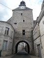
Don’t miss the nearby medieval town of Beaugency.

Along the route is a memorial to the battle fought on 9 December 1870, at the end of which the Prussians were driven out of the valley, which is now part of a protected natural area. Access to the memorial is therefore, in principle, prohibited.

Reviews and comments

4.7 / 5
Based on 1 review

Reliability of the description
5 / 5
Ease of following the route
5 / 5
Route interest
4 / 5
AnneBihan
AnneBihan

Yes, we didn’t dare go near it: signs indicate that it is a protected natural area and prohibit entry. But I’m sure it’s still possible to access the memorial.

Machine-translated

Jean-Louis Pinault
Jean-Louis Pinault

Thank you, Anne,
I forgot to mention in the walk description the memorial to the 1870 war, which is located near the road, just past the railway line. It is of historical interest, as the valley has retained the scars of the war at this spot.
I’ve just added these details.
Have a lovely day,
Jean-Louis

Machine-translated

AnneBihan
AnneBihan

Overall rating : 4.7 / 5

Date of your route : May 13, 2021
Reliability of the description : ★★★★★ Very good
Ease of following the route : ★★★★★ Very good
Route interest : ★★★★☆ Good
Very busy route : No

The highlight of this walk is exploring the dolmen and the ‘Eaux Bleues’ site. The village of Tavers is also well worth a visit. However, once you’ve passed the railway line, some sections of the path aren’t particularly attractive. Thank you, Jean-Louis, for showing us around.

Machine-translated

Other walks in the area

For more walks, use our search engine .

The GPS track and description are the property of this route's author. Please do not copy them without permission.