The Tour des Bordes in Lailly-en-Val

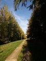
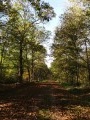
Following beautiful forest paths through the Bois de Vernou and its ponds, then skirting the Val d’Ardoux, this circular route takes you past the mills at Vezenne and then Chaffin, reminders of a rich history of activity in days gone by.

Details

845548
Creation:
Last update:
Last review:
  • Walking
    Activity: Walking
  • ↔
    Distance: 9.22 mi
  • ◔
    Average duration: 4h 15 
  • ▲
    Difficulty: Moderate

  • ⚐
    Back to start: Yes
  • ↗
    Ascent: + 46 ft
  • ↘
    Descent: - 46 ft

  • ▲
    Highest point: 335 ft
  • ▼
    Lowest point: 262 ft

Photos

Description of the walk

The start is at the car park near the Auberge des Trois Cheminées, at the junction of the Route de Blois (main road D951) and Rue de Vezenne, in Lailly-en-Val.

(S/E) Take Rue de Vezenne, ignoring the adjacent paths. When you reach the Moulin de Vezenne, continue straight on along the forest track until you reach a junction with a tarmac track (Chemin des Cochons).

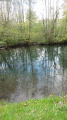
(1) Turn right onto this track and follow it until you reach a pond on your left.

(2) At the cross, turn right, passing between the fence posts, onto the forest track signposted ‘Chemin des Vernou’. At the junction, turn right until you reach a gate.

(3) Turn left at the gate and follow the path as it winds its way round the Les Bordes golf course, ignoring the various tee boxes.

(4) At the crossroads, turn left at a right angle, then shortly afterwards turn right, following the contours of the golf course along the avenue on your right. At the Fork in the road, continue straight ahead along the avenue lined with plane trees, ceasing to skirt the golf course to the right.

(5) At the junction, turn right towards the “Chemin des Minettes”, ignoring the other paths leading to private properties. This path gives way to a road at a place called Ganay on your right, which you should follow until you reach a crossroads.

(6) Turn left, then right as you approach the D925 to follow the forest track (starting from the car park) which leads to the hamlet of La Boulaie, ignoring the various paths leading towards the departmental road. At the T-junction with a wide track, turn left onto the Chemin de la Boulaie, which becomes Ruelle à la Boulaie. Cross the D951 (take care) and take the tarmac-surfaced Allée de Chaffin opposite. Pass Rue du Petit Chaffin on your right and carry on until you reach Rue Basse, also on your right.

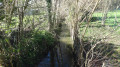
(7) Turn right onto this street, pass the Moulin de Chaffin and carry on straight ahead along what becomes the Chemin de la Rue Basse, lined with poplar trees bordering the Ardoux on your left, ignoring the various turn-offs to the right.

(8) At the junction, carry on straight ahead along Rue de Maulne, ignoring the various side roads. This street curves to the right.

(9) At the junction with Rue des Moises, turn left. At the crossroads, follow Rue de Maulne, which branches off to the left and then leads to the hamlet of Maulne, until you reach another junction.

(10) Turn right onto Rue de la Haut (GRP® Vallée des Rois Historical Trail), until you reach the D951 or Route de Blois (take care).

(11) Follow this road to the left, taking the tarmac path on the verge. Pass Rue de Lignières on your left.

(12) Turn right off the Route de Blois onto the tarmac track known as the Clos des Aventures, then take the first track on the left leading to a T-junction with the Chemin des Plantes. Turn right, then left onto the Chemin des Carleries and continue to Rue de Vezenne, ignoring the various adjacent turn-offs. Turn left to return to the car park at the starting point (S/E).


Waypoints

  1. S/E : mi 0 - alt. 289 ft - Behind the Auberge des Trois Cheminées. Near the - Vézenne (cours d'eau) - Affluent de l'Ardoux
  2. 1 : mi 1.68 - alt. 331 ft - Chemin des Cochons on the right
  3. 2 : mi 2.47 - alt. 325 ft - Turn right at the fork
  4. 3 : mi 2.9 - alt. 312 ft - Portal, on the left
  5. 4 : mi 3.83 - alt. 331 ft - Path at a right angle, on the left
  6. 5 : mi 4.54 - alt. 325 ft - Crossroads. Keep right
  7. 6 : mi 5.56 - alt. 312 ft - Forest track leading to the hamlet of La Boulaie
  8. 7 : mi 6.73 - alt. 262 ft - Rue Basse. Follow the - Ardoux (rivière) - Affluent de la Loire
  9. 8 : mi 7.51 - alt. 266 ft - Rue de Maulne
  10. 9 : mi 7.97 - alt. 269 ft - On the left
  11. 10 : mi 8.14 - alt. 279 ft - Rue de la Haut, on the right
  12. 11 : mi 8.33 - alt. 305 ft - Turn right onto the Route de Blois
  13. 12 : mi 8.56 - alt. 308 ft - T-junction. Turn right onto Chemin du Clos des Aventures
  14. S/E : mi 9.22 - alt. 289 ft - Behind the Auberge des Trois Cheminées

Notes

The route requires great caution between (6) and the junction with the D951, as the old path no longer allows you to leave the Domaine des Bordes, following the development of the golf course.

Avoid this route in wet weather.

Watch out for signs indicating private estates. There are many of them and their placement is often confusing. Stick to the route and do not take any shortcuts.

During the hunting season, from mid-September to the end of February, hunters and walkers have equal rights in the countryside. Hunters will tell you what to do: keep quiet, maintain a safe distance, take a detour, etc., to ensure your safety without disturbing them or preventing you from hiking. You may come across a driven hunt. If there are temporary signs placed across the path, please respect them.
Otherwise:
1/ Approach the first hunter on post to find out the extent of the hunting area and the current situation (has the game been flushed?)
2/ Gather the walkers together to cross the path as a group, without making noise or causing unnecessary commotion. Avoid having a snack in the middle of the drive.
3/ Learn to distinguish between a drive and the actual hunting action – for example, when the dogs are barking.
In this case, it is best to stop and wait for the action to move away, which usually happens very quickly.
In all cases, ensure you are visible from a distance: wear a fluorescent yellow vest over your rucksack.
In groups, many leaders and rear guards have adopted this practice, which is also strongly recommended for individual hunters.
See the leaflet *Outdoor Users and Hunting Safety*published by the National Office for Hunting and Wildlife:

Worth a visit

Enjoy the tranquillity of the forest paths and the Val d’Ardoux; most of the walk takes place far from roads and built-up areas.
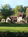
The mills at Vezenne and Chaffin – one in the heart of the forest, the other in the Val d’Ardoux – have been transformed into magnificent residences, each beautifully showcased within its own setting.

Reviews and comments

3.9 / 5
Based on 3 reviews

Reliability of the description
4 / 5
Ease of following the route
4.3 / 5
Route interest
3.3 / 5
Jean-Louis Pinault
Jean-Louis Pinault

Thank you very much, I’ve made the changes. The forest track after (6) now appears on the IGN map.
Have a good day,
Jean-Louis

Machine-translated

manceaunanie
manceaunanie

A lovely walk. The fences in some places didn’t bother us in the slightest. The walk is varied. Along the way, there’s a beautiful, well-trodden path lined with tall trees, a llama on a property by the side of the path, and blackberries.
Please note:
At point 2, there is now a sign for ‘Chemin des Vernous’ – this is the direction you should take.
At point 5, there is a sign opposite the Sablonnière property marked ‘Chemin des Minettes’; head in that direction. We didn’t see the junction of the five paths described by the author.
At point 6, the “forest track (not shown on the IGN map)” is in the car park. If there are cars parked there, it can be difficult to find. Look carefully.

Machine-translated

Jean-Louis Pinault
Jean-Louis Pinault

That’s a real downer, Pierre! If I’ve understood correctly, you’re ready to give up the fight and leave these vast, unspoilt expanses – marred, it’s true, by fences and ‘no entry’ signs – to those big landowners and hunters who are just waiting for the chance!
I look forward to seeing you again somewhere in Sologne on a sunnier day.
Jean-Louis

Machine-translated

pierre1er
pierre1er

Overall rating : 3.7 / 5

Date of your route : Apr 26, 2021
Reliability of the description : ★★★★★ Very good
Ease of following the route : ★★★★★ Very good
Route interest : ★☆☆☆☆ Very disappointing
Very busy route : No

Once again, everyone’s cowering before these landowners.
It feels like walking round a concentration camp. We spend half the walk following a wire fence that completely takes away any sense of space or the forest. We end up looking like a chicken searching for a way out between two rows of 3-metre-high wire fencing. Poor creatures.
As if that weren’t enough, the people who live there have privatised the paths by putting up a ‘private property’ sign on the walking trail.
And the final straw is these tree trunks laid across the path for kilometres on end, no doubt to stop motorbikes or 4x4s from getting through. If I were in their shoes, I’d cut a hole in the wire fence and head over to the private side – it’s wide open there. Of course, I’m not the sort to take on that sort of provocation, and I’m past that age anyway. All I can do is NEVER set foot there again and tell you: DON’T GO THERE. It’s not worth it. The Loiret isn’t really good for hiking, at least not in this part of it.

Machine-translated

Jean-Louis Pinault
Jean-Louis Pinault

Actually, I’ve just deleted the waypoint (4), which caused more confusion than it clarified. All you need to do is follow the winding contours of the golf course.

Machine-translated

tournesol32
tournesol32

Overall rating : 4.7 / 5

Date of your route : Apr 28, 2018
Reliability of the description : ★★★★★ Very good
Ease of following the route : ★★★★★ Very good
Route interest : ★★★★☆ Good

I couldn’t work out how to turn right at point 4
I only had a fence on my right

Machine-translated

Jean-Louis Pinault
Jean-Louis Pinault

Thank you for bringing this to my attention; I have updated the description of the walk.

Machine-translated

Cduceau1973
Cduceau1973

Overall rating : 3.3 / 5

Date of your route : Mar 12, 2018
Reliability of the description : ★★☆☆☆ Disappointing
Ease of following the route : ★★★☆☆ Average
Route interest : ★★★★★ Very good

Disappointing – the description is too vague

Machine-translated

Other walks in the area

For more walks, use our search engine .

The GPS track and description are the property of this route's author. Please do not copy them without permission.