Between Ardoux and Ime, near Lailly-en-Val

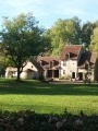
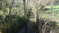
A picturesque walk through the Ardoux valley, best enjoyed in late spring or early summer to take in the scents and colours – green pastures, yellow rapeseed flowers, golden wheat… The wild course of the Ardoux and Ime rivers is delightful.

Details

n°847846
Creation:
Last update:
Last review:
  • Walking
    Activity: Walking
  • ↔
    Distance: 6.92 mi
  • ◔
    Average duration: 3h 10 
  • ▲
    Difficulty: Moderate

  • ⚐
    Back to start: Yes
  • ↗
    Ascent: + 16 ft
  • ↘
    Descent: - 16 ft

  • ▲
    Highest point: 285 ft
  • ▼
    Lowest point: 256 ft

Photos

Description of the walk

The walk starts at the car park of the Stade Maurice Dubreuil, south of Beaugency. To get there, turn right south of the Beaugency bridge, then take the lane on the left. The sports facilities are just past the embankment on the left, at a place called Le Pré d’Allonne.

(S/E) Take the road on the left, heading south-east, then, after 200 metres, turn slightly right onto theGRP®, a grassy path known as the ‘Sentier Historique de la Vallée des Rois’. Ignore the path on the right, then the one on the left.

(1) Cross the Fossé Juré de l’Ormoie, then take the path opposite, which is slightly to the right. Walk alongside the copse. The path passes under a power line, then curves to the right and arrives at a crossroads.

(2) Turn left, cross the Ardoux via the Pont de la Planche, then leave theGRP® at the first junction after crossing the Ardoux by turning right onto a path that curves in an S-shape.

(3) At the T-junction, turn right and continue until you reach Rue de Maulne.

(4) Turn right onto this street, ignoring the dirt track known as Rue Basse, which runs as a continuation of Rue de Maulne. This street takes a wide right-hand bend, then meanders past the lovely ‘Fosse du Gué’ before heading north-west.

(5) At the crossroads, turn sharply left to run alongside the houses of Grand Fins on your right. Continue along this lane in a south-westerly direction, ignoring any side roads, until you reach the junction with the D925 (take care). Cross the road to take the path opposite towards Grand Champ, Sublette and Le Goulet. Cross the Ime.

(6) At the first junction, turn left onto Chemin de Sublette, pass through the hamlet and continue to a T-junction.

(7) Turn right to follow the winding Chemin des Brosses until you reach another T-junction at Grand Champ.

(8) Turn left onto Chemin de Grand Champ to cross the embankment designed to contain the Loire’s floodwaters, which you’ll follow on the right. Continue along the embankment until you reach the D925 (take care), which you’ll cross.

(9) Carry on along the embankment until you find the road leading to the Stade Maurice Dubreuil on the right, which is our starting point (S/E).


Waypoints

  1. S/E : mi 0 - alt. 272 ft - Maurice Dubreuil Stadium car park
  2. 1 : mi 0.81 - alt. 269 ft - Fossé Juré de l’Ormoie
  3. 2 : mi 1.34 - alt. 269 ft - Turn left towards the - Ardoux (rivière) - Affluent de la Loire
  4. 3 : mi 1.86 - alt. 269 ft - Turn right at the junction
  5. 4 : mi 2.33 - alt. 269 ft - On the right, Rue de Maulne
  6. 5 : mi 2.93 - alt. 272 ft - Turn left at Grand Fins
  7. 6 : mi 3.66 - alt. 259 ft - On the left, Chemin de Sublette
  8. 7 : mi 4.2 - alt. 259 ft - Turn right onto the Chemin des Brosses
  9. 8 : mi 4.76 - alt. 269 ft - Turn left onto the Chemin de Grand Champ
  10. 9 : mi 6.72 - alt. 282 ft - Crossing the D925 - La Loire
  11. S/E : mi 6.92 - alt. 272 ft - Maurice Dubreuil Stadium car park

Notes

The walk, which is mainly on open ground, presents no difficulty.

Avoid this route in wet weather and during the hunting season.

Watch out for signs indicating private property. There are many of them and their locations are often confusing. Stick to the marked route and do not take any shortcuts.

Worth a visit

Nearby, the town of Beaugency boasts numerous monuments listed as Historic Monuments. This is particularly true of a large part of the town centre, with its castle, César Tower and abbey church...

Reviews and comments

4 / 5
Based on 2 reviews

Reliability of the description
4.5 / 5
Ease of following the route
4.5 / 5
Route interest
3 / 5
Jean-Louis Pinault
Jean-Louis Pinault

Thank you for your comments,
Jean-Louis

Machine-translated

Galopin-Bernard.
Galopin-Bernard.

Overall rating : 3.7 / 5

Date of your route : Jun 04, 2026
Reliability of the description : ★★★★☆ Good
Ease of following the route : ★★★★☆ Good
Route interest : ★★★☆☆ Average
Very busy route : No

Route completed on 3 June 2026 with a group of friends. Very overgrown between points 3 and 4.

Machine-translated

bionat
bionat

Overall rating : 4.3 / 5

Date of your route : Feb 26, 2019
Reliability of the description : ★★★★★ Very good
Ease of following the route : ★★★★★ Very good
Route interest : ★★★☆☆ Average

A few pleasant stretches.
No signposting, but easy to follow.
Unfortunately, too much open countryside with views of the high-voltage power lines and the nuclear power station.

Machine-translated

Other walks in the area

For more walks, use our search engine .

The GPS track and description are the property of this route's author. Please do not copy them without permission.