The forgotten drovers' roads in Bonnevaux

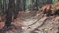
Whilst roads have often been built along the valley floor, shepherds have chosen the ridge paths to lead their flocks to the lush pastures. This long circular walk offers breathtaking views.

Details

n°40986789
Creation:
Last update:
Last review:
  • Walking
    Activity: Walking
  • ↔
    Distance: 7.19 mi
  • ◔
    Average duration: 4h 50 
  • ▲
    Difficulty: Moderate

  • ⚐
    Back to start: Yes
  • ↗
    Ascent: + 1,719 ft
  • ↘
    Descent: - 1,703 ft

  • ▲
    Highest point: 3,140 ft
  • ▼
    Lowest point: 1,821 ft

Description of the walk

Start from the village of Bonnevaux.

(S/E) Head through the centre of the village, following signs for ‘Bonnevaux Calade’, and wander through the narrow streets lined with superb stone houses. You’ll come to a Fork in the road.

(1) Turn left towards Chabanemareou and continue straight on at the next junction, then keep right to reach the signpost for Les Bastides.

(2) At the crossroads, turn right (north) to follow the ridge path leading to the Cessenades menhir, at an altitude of almost 1,000 metres. Carry on straight ahead to the Garde de Dieu cross.

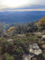
(3) From this point, keep to the right until you reach the menhir junction. Along this stretch, take a moment to admire the valley on your left, with Mont Lozère as a backdrop.

(4) At the Cessenades menhir, turn right, following signs for Font de l’Aille. Take in the view of the hamlets in the neighbouring valley. If you look closely, you’ll spot a few tree-trunk beehives. Carry on straight ahead until you reach the crossroads near the summit of Font de l’Aille.

(5) Turn right towards Valat de Balizac to head back down to the abbey bridge. Then keep left and then right towards Nojaret.

(6) Cross through the hamlet and continue straight on at the bend in the road to reach the abbey.

(7) Head back up a small path to the village of Bonnevaux.

(8) When you reach the road, carry on straight ahead, then turn right towards the church and the cemetery before returning to the starting crossroads.

(1) Return to the car park by heading straight ahead. (S/E)

Waypoints

  1. S/E : mi 0 - alt. 2,395 ft - Bonnevaux car park
  2. 1 : mi 0.07 - alt. 2,428 ft - Bonnevaux Paved Slanting Street
  3. 2 : mi 0.72 - alt. 2,615 ft - The Bastides
  4. 3 : mi 1.98 - alt. 3,094 ft - La Garde de Dieu
  5. 4 : mi 2.69 - alt. 3,041 ft - Cessenades menhir
  6. 5 : mi 4.26 - alt. 2,989 ft - Font de l’Aille
  7. 6 : mi 5.56 - alt. 2,070 ft - Nojaret
  8. 7 : mi 6.27 - alt. 1,821 ft - Pont de l’Abbaye
  9. 8 : mi 6.91 - alt. 2,503 ft - Route
  10. S/E : mi 7.19 - alt. 2,395 ft - Bonnevaux car park

Notes

Park in the small car park at the entrance to the village when approaching from the Col du Péras

Reviews and comments

4.2 / 5
Based on 2 reviews

Reliability of the description
3.5 / 5
Ease of following the route
4.5 / 5
Route interest
4.5 / 5
Sylvie Jz
Sylvie Jz
• Edited:

Overall rating : 4 / 5

Date of your route : May 28, 2025
Reliability of the description : ★★★☆☆ Average
Ease of following the route : ★★★★☆ Good
Route interest : ★★★★★ Very good
Very busy route : No

This walk is the same as the one entitled “Landes, chestnut trees and old drovers' roads in Bonnevaux”, which is classified as difficult. In my view, this walk should be classified as difficult, given the elevation gain right from point 1. Also, after the menhirs at Cessenades, the path leading to the summit of La Fage is gruelling. But the worst bit is point 11: a 1.4 km stretch of path (in theory, it’s not long and should take about 20 minutes?) but with a 15 per cent gradient all the way to Bonnevaux. However, according to another review, taking the road (2.4 km) isn’t exactly a walk in the park either. Luckily, we had the Visorando GPS track on my phone (thank you, Visorando, for the audible alert when we strayed from the route!), as some of the markings aren’t very visible given the lush vegetation in this rainy spring, and we went the wrong way several times. Be sure to follow the few cairns you come across. At Nojaret, a sign indicates that the path leading to the Abbey Bridge (a private priory) is cut off at Les Sognes: a detour of a few more kilometres! Nevertheless, after speaking to a local resident, we went along the path anyway; it’s true that you need to be careful around the landslide, which narrows the path, but it saved us a long detour. However, the path hasn’t been maintained as very few people use it. Setting off late in the morning, we had a picnic at La Garde de Dieu. The scenery is magnificent throughout this walk, and we were accompanied by the scent of broom, the sight of all that greenery and the flowers, the streams and the birdsong. How beautiful the Cévennes are – but you really have to work for them!

Machine-translated

biot
biot

Overall rating : 4.3 / 5

Date of your route : Sep 03, 2024
Reliability of the description : ★★★★☆ Good
Ease of following the route : ★★★★★ Very good
Route interest : ★★★★☆ Good
Very busy route : No

stunning panoramic views along the walk

Machine-translated

Other walks in the area

For more walks, use our search engine .

The GPS track and description are the property of this route's author. Please do not copy them without permission.