The Capdebos ridges from Bordes

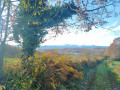
This short walk in the hills above Bordes (65190) offers a pleasant stroll through the forest and a lovely view of the Pyrenees.

Details

n°42666690
Creation:
Last update:
Last review:
  • Walking
    Activity: Walking
  • ↔
    Distance: 2.93 mi
  • ◔
    Average duration: 1h 45 
  • ▲
    Difficulty: Easy

  • ⚐
    Back to start: Yes
  • ↗
    Ascent: + 446 ft
  • ↘
    Descent: - 449 ft

  • ▲
    Highest point: 1,457 ft
  • ▼
    Lowest point: 1,027 ft

Photos

Description of the walk

Park on the left-hand side of the Chemin du Bois de la Haute, near the return path.

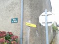
(S/E) Take the tarmac road that leads uphill. After a double hairpin bend, pass two charming, renovated houses on your left and carry on straight ahead along the road.

(1) At the junction, turn left onto Chemin d’Oléac, passing a radio mast on your right.

(2) At the wayside cross, the road curves slightly to the left. Carry on along it as you begin to see a panoramic view of the Pyrenees. Continue to the hamlet of Hourquet.

(3) Turn left onto a dirt track that climbs slightly: a fire hydrant marks the junction. Head down towards the south-east and pass the hunters’ hut, where you can take a break. Further on, you’ll come to a tarmac road.

(4) Turn left. Walk past Miquéou’s house, then take the path to its right which runs alongside it, overlooking a meadow on your right. Continue to the end of the meadow.

(5) You’ll come to a path that descends to the right, heads into the Bois de la Haute forest and eventually joins the road you set off on, not far from the car park (S/E).

Waypoints

  1. S/E : mi 0 - alt. 1,033 ft - Car park
  2. 1 : mi 0.73 - alt. 1,404 ft - Oléac Path
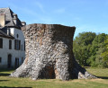
  3. 2 : mi 0.97 - alt. 1,391 ft - Calvaire
  4. 3 : mi 1.36 - alt. 1,437 ft - Hourquet, fire hydrant
  5. 4 : mi 1.96 - alt. 1,273 ft - Boundary between path and road
  6. 5 : mi 2.36 - alt. 1,283 ft - Corner of the meadow
  7. S/E : mi 2.93 - alt. 1,027 ft - Car park

Notes

Please be considerate if you stop for a break at the hunters’ hut.

Reviews and comments

4.7 / 5
Based on 1 review

Reliability of the description
5 / 5
Ease of following the route
5 / 5
Route interest
4 / 5
ours65
ours65

Overall rating : 4.7 / 5

Date of your route : Oct 14, 2024
Reliability of the description : ★★★★★ Very good
Ease of following the route : ★★★★★ Very good
Route interest : ★★★★☆ Good
Very busy route : No

A ‘leisurely’ route, half on small tarmac roads and half on country lanes: lovely meadows, beautiful oak trees, and a lovely forest between point ‘5’ and the end of the route. Please note that the hunters’ hut at point ‘3’ is closed, but there is a large wooden table with benches in front of it.

Machine-translated

Other walks in the area

For more walks, use our search engine .

The GPS track and description are the property of this route's author. Please do not copy them without permission.