From Escaladieu Abbey to Mauvezin Castle

A walk steeped in local history. Starting at a 12th-century Cistercian abbey, a pleasant path leads to the 14th-century Château de Mauvezin de Gaston Phébus. Take a break on this rocky outcrop, which offers remarkable 360° views. The return to the abbey follows a downhill path through the woods.

Details

n°1729817
Creation:
Last update:
Last review:
  • Walking
    Activity: Walking
  • ↔
    Distance: 4.92 mi
  • ◔
    Average duration: 3h 05 
  • ▲
    Difficulty: Moderate

  • ⚐
    Back to start: Yes
  • ↗
    Ascent: + 906 ft
  • ↘
    Descent: - 909 ft

  • ▲
    Highest point: 1,749 ft
  • ▼
    Lowest point: 1,007 ft

Photos

Description of the walk

Park in the car park at Escaladieu Abbey.

(S/E) On the road, turn left towards the bridge over the Arros and, just before the bridge, take the path branching off to the right. Cross a stream and follow the path opposite which runs alongside the river before heading up into the forest. Continue along this path until you reach a small tarmac road.

(1) Turn left and continue along this small road, which passes through the village of Bonnemazon. At the junction (at an altitude of 330m), turn left onto the road leading down towards the river.

(2) Before the bridge, take the path on the right until you reach a junction with a path that crosses the Arros. Turn left to cross the bridge and follow this tarmac road until you reach a junction with a path leading off to the right. Take the path straight ahead until you reach the ford across the Garravet stream.

(3) A few metres of slightly challenging terrain along the stream before taking the path onto firmer ground. Stay on this steeply sloping path until you reach the road leading to the village of Mauvezin. This path is not shown on the IGN map but is marked on OSM Trails.

(4) Take the road on the right, which climbs up through the village of Mauvezin. At the junction, turn left onto the small road along the ridge leading to Gaston Phébus’s castle and keep.

(5) Leave the castle on your right and, at the end of the track, take the path down to the right, heading due north, until you reach the crossroads. Then take the wide path on your left until the next junction.

(6) Turn left onto the downhill track, which gradually becomes a path winding through the woods. Make sure you stay on the correctPR®® path, as it is not always clearly signposted. Continue along the downhill path until you reach the road on the plain that runs alongside the Arros.

(7) Take the road on the left towards Escaladieu until you reach the junction in the village.

(8) Turn right and continue along the D938 road; take care as you cross the bridge over the Arros, then walk alongside the abbey to the car park (S/E).

Waypoints

  1. S/E : mi 0 - alt. 1,010 ft - Car park at the - Abbaye de l'Escaladieu (Bonnemazon)
  2. 1 : mi 0.85 - alt. 1,158 ft - Road on the left
  3. 2 : mi 1.14 - alt. 1,027 ft - Path on the right before the bridge - Arros (rivière) - Affluent de l'Adour
  4. 3 : mi 1.72 - alt. 1,060 ft - Fording
  5. 4 : mi 2.25 - alt. 1,604 ft - Turn right towards Mauvezin
  6. 5 : mi 2.74 - alt. 1,745 ft - Château de Mauvezin
  7. 6 : mi 2.88 - alt. 1,673 ft - Crossroads, path leading downhill to the left
  8. 7 : mi 4.23 - alt. 1,037 ft - Exit the path, take the road on the left
  9. 8 : mi 4.51 - alt. 1,063 ft - L’Escaladieu, on the right
  10. S/E : mi 4.92 - alt. 1,010 ft - Escaladieu Abbey car park

Notes

Between points (3) and (4), the climb up to the castle is quite steep.

Worth a visit

Escaladieu Abbey.
Mauvezin Castle, built by Gaston Phébus.

Always be cautious and plan ahead when you're outdoors. Visorando and the author of this route cannot be held responsible for any accidents occurring on this route.

The GR® and PR® markings are the intellectual property of the Fédération Française de Randonnée Pédestre.

Reviews and comments

4.6 / 5
Based on 36 reviews

Reliability of the description
4.7 / 5
Ease of following the route
4.7 / 5
Route interest
4.4 / 5
Araignée
Araignée

Overall rating : 4.3 / 5

Date of your route : Sep 14, 2026
Reliability of the description : ★★★★★ Very good
Ease of following the route : ★★★★★ Very good
Route interest : ★★★☆☆ Average
Very busy route : No

Start of the walk: an ascent and descent through the forest with no views whatsoever, apart from when you reach the castle.

Machine-translated

User 29827736

Overall rating : 4 / 5

Date of your route : Jul 19, 2026
Reliability of the description : ★★★★★ Very good
Ease of following the route : ★★★★☆ Good
Route interest : ★★★☆☆ Average
Very busy route : Yes

A lovely walk.
However, if you’re doing the circular route, the route needs updating on the return leg between Mauvezin Castle and the abbey, as following heavy rain, lots of trees are blocking the path. An alternative route has been signposted, but Visorando hasn’t been updated.

Machine-translated

P@utine
P@utine

Overall rating : 4.7 / 5

Date of your route : Jul 12, 2026
Reliability of the description : ★★★★☆ Good
Ease of following the route : ★★★★★ Very good
Route interest : ★★★★★ Very good
Very busy route : No

A really lovely walk, which we went on despite the heatwave. As the climb was in the shade, it wasn’t a problem at all. The view from up there is magnificent!!!

Machine-translated

ChristianQ
ChristianQ

Overall rating : 5 / 5

Date of your route : Mar 22, 2026
Reliability of the description : ★★★★★ Very good
Ease of following the route : ★★★★★ Very good
Route interest : ★★★★★ Very good
Very busy route : No

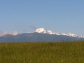
A magnificent, varied hike with a good climb to get you in shape, and a picnic at the foot of Mauvezin Castle with views of the Pyrenees...
Not to be missed

Machine-translated

Patgob66
Patgob66

Overall rating : 4 / 5

Date of your route : Sep 22, 2025
Reliability of the description : ★★★★☆ Good
Ease of following the route : ★★★★☆ Good
Route interest : ★★★★☆ Good
Very busy route : No

A beautiful hike, but not to be done in hot weather. Follow the GPS carefully in the forest when descending from the castle. I recommend visiting the castle and the abbey

Machine-translated

User 26551934

Overall rating : 4.3 / 5

Date of your route : Aug 11, 2025
Reliability of the description : ★★★★☆ Good
Ease of following the route : ★★★★★ Very good
Route interest : ★★★★☆ Good
Very busy route : No

Nice route, ideal in hot weather thanks to the wooded areas. The only downside is the sections on the road.

Machine-translated

jjd64290
jjd64290

Overall rating : 4.3 / 5

Date of your route : Jul 31, 2025
Reliability of the description : ★★★★☆ Good
Ease of following the route : ★★★★★ Very good
Route interest : ★★★★☆ Good
Very busy route : No

a beautiful walk, especially in the forest. Be careful, even in the middle of summer the ground is muddy in some places...

The start at the abbey and the passage through the castle are two moments where you can appreciate the beautiful architecture. Plan your visits if you have time.

The walk is very peaceful; we didn't meet anyone else even though it was the middle of summer.

Machine-translated

Angélique65
Angélique65
• Edited:

Overall rating : 5 / 5

Date of your route : Jul 26, 2025
Reliability of the description : ★★★★★ Very good
Ease of following the route : ★★★★★ Very good
Route interest : ★★★★★ Very good
Very busy route : No

Hello everyone,
A very nice hike, which took two hours, with a beautiful view of the Baronnies at the top of this famous climb through the woods (great for working your thighs).
The weather was overcast, so there was no view of the Pic, but I would still advise against doing this route in the sun!
No particular problems with the signposting.
Angélique and Perrine

Machine-translated

Kris65
Kris65

Overall rating : 3.7 / 5

Date of your route : Sep 14, 2024
Reliability of the description : ★★★☆☆ Average
Ease of following the route : ★★★☆☆ Average
Route interest : ★★★★★ Very good
Very busy route : No

A beautiful hike with magnificent views of the Pic du Midi. The first part in the forest is not maintained, so it was time to get back on the road! The arrival at the castle is really nice, even if the climb through the woods is a bit long. The path behind the castle is superb, but then it's difficult to stay on track and find the right path. We got lost in the forest until we found the road again!

Machine-translated

Nath Madrid
Nath Madrid

Overall rating : 5 / 5

Date of your route : Jul 25, 2024
Reliability of the description : ★★★★★ Very good
Ease of following the route : ★★★★★ Very good
Route interest : ★★★★★ Very good
Very busy route : No

It's a beautiful route through the forest! We recommend it... it's quite a climb but very cool, and you feel like you're travelling back in time to the Middle Ages! We didn't meet any other hikers! A beautiful hike!

Machine-translated

Jojobalse301045
Jojobalse301045

Overall rating : 4.7 / 5

Date of your route : Jun 24, 2024
Reliability of the description : ★★★★★ Very good
Ease of following the route : ★★★★★ Very good
Route interest : ★★★★☆ Good
Very busy route : Yes

Hello
a 3-hour hike with very little road and well-maintained trails
with beautiful views
i recommend it
Georges Balse

Machine-translated

montanini
montanini

Overall rating : 5 / 5

Date of your route : May 20, 2024
Reliability of the description : ★★★★★ Very good
Ease of following the route : ★★★★★ Very good
Route interest : ★★★★★ Very good
Very busy route : No

Hello, thank you for sharing and for the description (precise and accurate). The forest sections were very pleasant (for the descent, one section requires caution to stay on the recommended route) and the arrival at the castle offers a beautiful view of the surrounding area, among other things
Between the countryside and the mountains.
Thanks again.
Daniel

Machine-translated

janaser
janaser
• Edited:

Overall rating : 5 / 5

Date of your route : May 12, 2024
Reliability of the description : ★★★★★ Very good
Ease of following the route : ★★★★★ Very good
Route interest : ★★★★★ Very good
Very busy route : No

A beautiful hike with varied landscapes and superb views of the Pic du Midi de Bigorre.

Machine-translated

grandonneur
grandonneur

Overall rating : 5 / 5

Date of your route : Apr 08, 2024
Reliability of the description : ★★★★★ Very good
Ease of following the route : ★★★★★ Very good
Route interest : ★★★★★ Very good
Very busy route : No

Very good trail, suitable for children aged 7 and above. It requires minimal equipment (suitable footwear in particular). Depending on the season, crossing the stream may be difficult (risk of getting your shoes a little wet) but it is not dangerous.

Machine-translated

jdecor
jdecor

Overall rating : 4.3 / 5

Date of your route : Mar 11, 2024
Reliability of the description : ★★★★☆ Good
Ease of following the route : ★★★★☆ Good
Route interest : ★★★★★ Very good
Very busy route : Yes

A beautiful and enjoyable hike

Machine-translated

Other walks in the area

For more walks, use our search engine .

The GPS track and description are the property of this route's author. Please do not copy them without permission.