Padula Forest, starting from Vezzani

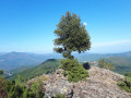
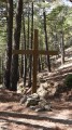
Set off to explore the magnificent Padula Forest, situated in the municipality of Noceta. This remarkable site will allow you to discover, via the ‘i chjassi di e padule’ trail of ponds, part of this beautiful forest, as well as various themes relating to geology, fauna and flora, through a signposted educational trail. You’ll also enjoy several high vantage points offering magnificent views. The route is almost entirely shaded, making it a particularly pleasant walk in hot weather.

Details

49992172
Creation:
Last update:
Last review:
  • Walking
    Activity: Walking
  • ↔
    Distance: 4.90 mi
  • ◔
    Average duration: 3h 15 
  • ▲
    Difficulty: Moderate

  • ⚐
    Back to start: Yes
  • ↗
    Ascent: + 1,175 ft
  • ↘
    Descent: - 1,178 ft

  • ▲
    Highest point: 3,261 ft
  • ▼
    Lowest point: 2,497 ft
  • ⚐ Country: France
  • ⚐ City: Vezzani (20242)
  • ⚑
    Start/End: N 42.173164° / E 9.246693°
  • ❏
    IGN map(s): Ref. 4352OT
  • Hour-by-hour weather

Photos

Description of the walk

Park in the square by the church in Vezzani.

(S/E) From the church square, follow the orange trail markings (Mare e Monte Livantinu) as you head uphill. Continue straight ahead, climb the steps to reach the street known as A Traversa and follow it to the right until you reach the town hall.

(1) Carry on straight ahead to the cemetery.

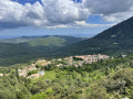
(2) Take the track on the left, then turn right after about 150 metres. You’ll reach a junction leading to a lovely viewpoint (Razzu Rossu) overlooking the village of Vezzani.

(3) Save this detour for the return journey and carry on straight ahead.

(4) Pass another viewpoint at Petra u monte and carry on until you reach a four-way junction.

(5) Cross the main track and carry on straight ahead to the green barrier.

(6) At the far end of the old stadium, turn right to head back down to the D343, at the Padula Fountain, where there is an information sign indicating the route to follow to explore “i chjassi di e Padule”.

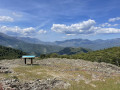
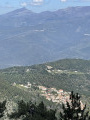
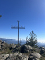
(7) Turn left, then turn left again about a hundred metres further on to reach the orientation table and the lovely view over the Vénacais, the Cortenais, the Boziu, the San Pedrone, etc.

(8) Continue to the left to go round the old stadium and rejoin the path you took on the way up. Turn right onto it, heading in the opposite direction, and follow it to the junction with the first viewpoint you passed on the way up.

(3) Turn right to reach it and enjoy the view over the village.

(9) Return to the junction.

(3) Follow the path you took on the way out, in the opposite direction, to the town hall.

(1) Carry on to the right along the departmental road to go round the village to the west. You’ll reach the small square with the Fontaine des Trois Grâces.

(10) Carry on, past the children’s playground and the sports ground, then turn left at the junction to return to the church square (S/E).


Waypoints

  1. S/E : mi 0 - alt. 2,507 ft - Church Square
  2. 1 : mi 0.2 - alt. 2,575 ft - Town Hall
  3. 2 : mi 0.37 - alt. 2,625 ft - Cemetery
  4. 3 : mi 0.72 - alt. 2,884 ft - Viewpoint junction
  5. 4 : mi 0.84 - alt. 3,041 ft - Petra u monte, viewpoint
  6. 5 : mi 1.57 - alt. 3,136 ft - Main track
  7. 6 : mi 1.91 - alt. 3,084 ft - Old stadium, on the right
  8. 7 : mi 2 - alt. 2,989 ft - Padula fountain, information board
  9. 8 : mi 2.27 - alt. 3,241 ft - Orientation board
  10. 9 : mi 3.89 - alt. 2,982 ft - Razzu Rossu, panoramic view of the village of Vezzani
  11. 10 : mi 4.75 - alt. 2,526 ft - Fountain of the Three Graces
  12. S/E : mi 4.9 - alt. 2,507 ft - Church Square

Notes

There is a fountain at (S/E) and also in the Padula forest.
In the village, you’ll find shops where you can buy drinks and food; there’s also a grocery shop.

(3) You can, of course, also visit the Razu Rossu viewpoint (9) on the way up.

Worth a visit

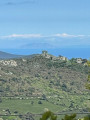
The return journey follows the same route. On the descent, you’ll enjoy a magnificent view of the Pieve della Rogna, some of the villages of Boziu, the village of Antisanti, the Urbino lake and, on a clear day, a view of the islands of the Tuscan archipelago: Monte Cristo and Giglio.

Once back at the starting point, do take the opportunity to visit the beautiful village of Vezzani.

Reviews and comments

4.3 / 5
Based on 4 reviews

Reliability of the description
4.5 / 5
Ease of following the route
4.3 / 5
Route interest
4.3 / 5
User 3751865

Overall rating : 5 / 5

Date of your route : Aug 04, 2026
Reliability of the description : ★★★★★ Very good
Ease of following the route : ★★★★★ Very good
Route interest : ★★★★★ Very good
Very busy route : No

A lovely walk in the hills above Vezzani and the Venacais
Although the start of the walk just outside Vezzani involves a fairly steep climb, it’s well worth the effort because, once you reach the top, you emerge onto the plateau with the Padule/Vezzani Laricio pine forest – a truly magnificent spot.
The information board above the Padule fountain offers a lovely view of the peaks and the valley
And, unusually, we didn’t meet a single soul on the trail!!
Also worth noting is the beauty of the church in Vezzani

Machine-translated

marco 85
marco 85

Overall rating : 4 / 5

Date of your route : Jun 14, 2025
Reliability of the description : ★★★★☆ Good
Ease of following the route : ★★★★☆ Good
Route interest : ★★★★☆ Good
Very busy route : No

I gave it a rating of 8/10. It's a nice hike that can be combined on the way back at point 4 with the Razzu Rossu loop, which takes you back to the same starting point via another pleasant route, avoiding a return trip.

Machine-translated

THISIS2B
THISIS2B

Overall rating : 4.3 / 5

Date of your route : Sep 15, 2024
Reliability of the description : ★★★★★ Very good
Ease of following the route : ★★★★☆ Good
Route interest : ★★★★☆ Good
Very busy route : No

A lovely walk, which is pleasant as you’re always in the shade beneath giant Laricio pines and chestnut trees.
We had a bit of trouble finding the markings after the orientation table.
On the way back, we did the Razzu Rossu circular path, a short, well-cleared and signposted path.
The village of Vezzani is well worth a visit.

Machine-translated

gilles.percheron
gilles.percheron

Overall rating : 4 / 5

Date of your route : Sep 10, 2024
Reliability of the description : ★★★★☆ Good
Ease of following the route : ★★★★☆ Good
Route interest : ★★★★☆ Good
Very busy route : No

A walk just as described, through a beautiful chestnut forest followed by a pine forest

Machine-translated

Other walks in the area

For more walks, use our search engine .

The GPS track and description are the property of this route's author. Please do not copy them without permission.