Doucy and its villages

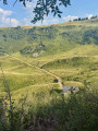
A route to explore the mountain landscape through forests and mountain pastures, with panoramic views of the surrounding peaks.

Details

18245209
Creation:
Last update:
Last review:
  • Walking
    Activity: Walking
  • ↔
    Distance: 5.69 mi
  • ◔
    Average duration: 4h 00 
  • ▲
    Difficulty: Moderate

  • ⚐
    Back to start: Yes
  • ↗
    Ascent: + 1,621 ft
  • ↘
    Descent: - 1,637 ft

  • ▲
    Highest point: 4,111 ft
  • ▼
    Lowest point: 2,530 ft

Description of the walk

Park near the tourist office.

(S/E) Start the route by taking the path opposite the tourist office, behind the car park. This crosses the road once and leads to the Raclaz barns. First turn right then left and continue uphill. Once in En Provins, go round the buildings on the right and make sure to keep heading in the same direction to cross the road a second time. Continue straight on until you reach Doucy.

(1) In the village, take the road to the left, then turn right at a sharp bend and carry on straight ahead to cross the village. Once past the small car park on your right, go down the street to the left for about ten metres, then turn right and continue along the main road running parallel to the valley floor. At the three-way junction on leaving the village, leave the road leading down to the church and cemetery by keeping to the right onto the track suitable for vehicles.

(2) At the end of the mountain pasture track, continue along a path that enters the Morel State Forest. The path is relatively wide and descends towards the valley floor.

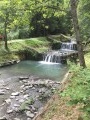
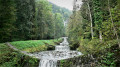
(3) Cross the Morel – the lowest point of the route – and head back up the opposite side via a few bends before veering right onto a path that follows the Morel against the current. Continue straight up this slope until you reach the recently renovated old mill.

(4) At this point, cross the stream again via a bridge and take a farm track that leads to the edge of the forest and the entrance to the hamlet of Régnier. Walk up the street.

(5) Turn left to leave the hamlet and head towards Le Villaret.

(6) Leave the main road by continuing straight along the street until the next hairpin bend.

(7) Leave the road and take a track on your left, through the sloping meadows. After about 300 m, follow the track that branches off to the left in a hairpin bend before joining the tarmac road. Follow it to the left, uphill, for about 150 m.

(8) Join the track on the right. Continue up this slope, staying on the main route and negotiating two hairpin bends.

(9) Carry on straight ahead and pass through the Villaret barns.

(10) Back at the resort, turn right onto the road, then keep left at the hairpin bend to reach the car park where you started (S/E).


Waypoints

  1. S/E : mi 0 - alt. 4,111 ft - Doucy Station, car park
  2. 1 : mi 0.97 - alt. 3,251 ft - Doucy village
  3. 2 : mi 1.44 - alt. 3,104 ft - Morel State Forest
  4. 3 : mi 2.13 - alt. 2,546 ft - Le Morel
  5. 4 : mi 2.92 - alt. 2,956 ft - Old Mill
  6. 5 : mi 3.21 - alt. 3,169 ft - Le Régnier
  7. 6 : mi 3.47 - alt. 3,281 ft - Le Villaret
  8. 7 : mi 3.63 - alt. 3,379 ft - Vehicle-accessible track
  9. 8 : mi 4.26 - alt. 3,694 ft - Return to the track on the right
  10. 9 : mi 4.91 - alt. 3,953 ft - Junction, go straight on
  11. 10 : mi 5.49 - alt. 4,094 ft - Return to the resort, turn right
  12. S/E : mi 5.69 - alt. 4,111 ft - Doucy Station, car park

Notes

This route is strongly discouraged in the event of heavy rain or thunderstorms.

The circular walk is suitable for occasional walkers and active families, but is not recommended for beginners or those without a minimum level of fitness.

Worth a visit

(1) and (6) Typical Savoyard villages.

(4) Old mill.

Reviews and comments

4.4 / 5
Based on 3 reviews

Reliability of the description
4.7 / 5
Ease of following the route
4 / 5
Route interest
4.7 / 5
Bernard ROUSSEL
Bernard ROUSSEL

Overall rating : 5 / 5

Date of your route : Dec 08, 2025
Reliability of the description : ★★★★★ Very good
Ease of following the route : ★★★★★ Very good
Route interest : ★★★★★ Very good
Very busy route : No

A lovely route that can be enjoyed in any season. Done in autumn on a beautiful sunny day, it will be just as interesting in summer, with the refreshing stream running alongside, or in spring, with nature coming back to life. In winter, the more experienced can also follow it in the snow.

Machine-translated

User 3850328

Overall rating : 4.7 / 5

Date of your route : Jul 14, 2025
Reliability of the description : ★★★★★ Very good
Ease of following the route : ★★★★☆ Good
Route interest : ★★★★★ Very good
Very busy route : Yes

Hello,
The descent at the start is a bit of a slog. After that, it’s fine. We just had a bit of trouble finding our way after Villaret.

Machine-translated

STEPHANE.WIBAUX
STEPHANE.WIBAUX

Overall rating : 3.7 / 5

Date of your route : Aug 12, 2024
Reliability of the description : ★★★★☆ Good
Ease of following the route : ★★★☆☆ Average
Route interest : ★★★★☆ Good
Very busy route : No

I’m not sure when the description of the walk was written, but recent obstacles have forced me to find an alternative route. The crossing over the stream is closed, so you mustn’t turn left as barriers have been put up. You need to carry on uphill and turn right. This path joins the original route after a few hundred metres.

Machine-translated

Other walks in the area

For more walks, use our search engine .

The GPS track and description are the property of this route's author. Please do not copy them without permission.