Country:

 City:
City:


Coming from Villeneuve-Minervois via the D111 – a renowned truffle-growing area – drive through the village of Cabrespine towards Pradelles-Cabardès. On leaving the village, after the last houses, park on the left; the car park has around ten spaces.
(S/E) With your back to the car park, turn right and walk down the street for about 150 metres, then take the narrow alleyway on the left (passing under the external staircase of a house). You’ll come to a cobbled street with great views over a small stream. Turn right, walk past the Post Office and Town Hall, then turn left. After the restaurant and the recently renovated little square, head towards the bridge spanning the River Clamoux and turn right, then immediately left (sign for “Circular Route of the Pas de l’Aube”, yellow-green markings). A cobbled street leads to the junction of the circular route.
(1) Leave the return path on your left and continue along the path which climbs steadily alongside gardens and orchards. Pass close to the Costo Granié sheepfold and arrive at the Col de la Cocaillèro. See Practical Information.
(2) Carry on straight ahead; at the next junction of paths, continue northwards, following a fence until you reach a wide stony track. Cross it and climb the slope opposite to bypass the track’s hairpin bend. Turn right, follow the track, noting as you go the “Circular Path of the Pas de l’Aube” which branches off to the left. Continue climbing this grassy track until you come to another stony track; head left along this until you reach a hairpin bend.
(3) Leave the track and take the path opposite, which climbs through the woodland before continuing out into the open, where you’ll catch sight, in the distance, of the huge antenna on the Pic de Nore. The path widens, becomes a grassy track and turns left at the edge of the woods, heading east. Ignore all the offshoots to the left and right until you reach the three-way junction. You’ll reach the Col de Las Aygos.
(4) Continue to the left to find a path that branches off to the left, skirting the Roc du Tonnerre. Carry on along this path, ignoring the next path branching off to the right, skirting the summit of La Vitarelle (828m) and descending a little further to enter a woodland. Turn left at the next junction to reach a spring at the junction with the path leading up to Lespinassières.
(5) Pass beneath the “Fount Fréjo” spring and ignore the track leading down to the left; instead, take a level path on the right (yellow-green markings). This lovely, largely level path crosses a gully before reaching a stream flowing through a bend. Follow this path, which runs alongside a fence, to the Col du Coudel track.
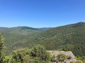
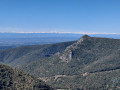
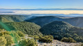
(6) Cross the track, pass to the right of a picnic table, and continue along the path which leads to a small summit (elevation 837: a huge cairn and a fine view over the northern part of the Montagne Noire). The path then descends, reaches a junction (sign for Castans on the right) and continues towards Cabrespine via Serremijeanne.
(7) Cross the hamlet, turning left towards the east (yellow-green markings on the stones of the beautiful houses) to take the path that descends south-south-west. After a hairpin bend to the left, it joins a tarmac road. Take the path opposite that descends and crosses the Serremijeanne stream before climbing back up to the road.
(8) Turn right and follow this tarmac road downhill for about 2.5 km until you reach a left-hand bend heading south.
(9) At this bend, head down to the right along a path (signposted ‘Cabrespine’) to reach a footbridge, then climb back up to the road at a bend. About twenty metres further on, just after the bend, leave the road and take a footpath (signposted ‘Cabrespine’). You’ll do the same again a little further on. Then continue along this tarmac road, passing above the houses and the Laval mill. The hamlet of Laval comes into view.
(10) Before crossing the bridge over the Clamoux, take a path that runs parallel between the private track and the stream and, about fifty metres further on, join the private track. Cross it to take the path that climbs to the left, crosses the Coumbo stream and continues above the hamlet of Laval, visible on the right. Follow this path to reach the junction you passed on the way out.
(1) Return to the bridge and the streets of Cabrespin by following the route in reverse to the one taken on the way there, and head back to the car park (S/E).

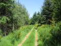
 Thanks for the map. The only downside is that it's not very useful in certain areas, where the grass is very tall and there are brambles, etc.
 Visorando Member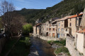


 Difficult