


Refine your search for walks in Coudrecieux
Coudrecieux walks


 The angel musicians of Les Loges
 Tourism professional
 7.26 mi
 +295 ft
 -282 ft
 3h 35
3h 35
 Moderate
 Departure from Coudrecieux (Sarthe)
The present-day commune of Coudrecieux consists of the former parish of the same name, which was merged with that of Les Loges in 1808. Their place names reflect the wooded environment of these villages, which are still 50% forest today. Coudrecieux refers to the hazel wood known locally as ‘coudre’, and Les Loges to the light dwellings, made of branches and heather, temporarily occupied by charcoal burners and other forest workers. The Coudrecieux route will allow you to discover the rich architectural and landscape heritage of this commune. This is evidenced by the Manoir de la Cour, the Château des Loges, and the church of Les Loges (with its renowned stone bell tower dating from the year 1000)… These features are highlighted by information panels.
In the footsteps of Gohan in Bouloire
 10.05 mi
+486 ft
-509 ft
5h 05
Moderate
Departure from Bouloire (Sarthe)
10.05 mi
+486 ft
-509 ft
5h 05
Moderate
Departure from Bouloire (Sarthe)
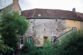
Bouloire is nestled in the heart of a vast, hilly agricultural region crossed by the Dué and Tortue rivers. Human presence along the ancient road between Le Mans and Orléans is attested to by a coin dating back to the Merovingian period. Its name comes either from a Celtic place name meaning "fortification" or from an etymology meaning "between two coasts ". The town centre is rich in ancient architectural heritage. The Church of Saint-Georges, destroyed by a fire that ravaged the village in 1680, bears the coat of arms of Marshal Guillaume Testu de Balincourt, who enabled its reconstruction. The town's coat of arms is also linked to this figure.
An unusual walk in Dollon
 14.36 mi
+715 ft
-689 ft
7h 15
14.36 mi
+715 ft
-689 ft
7h 15
 Difficult
Departure from Dollon (Sarthe)
Difficult
Departure from Dollon (Sarthe)
This route will allow you to discover the villages of Lavaré, Dollon and Semur-en-Vallon. These villages developed in the Middle Ages on land that was often sandy or stony, not particularly suitable for farming before modernisation. The villagers therefore found additional sources of income through textile crafts and the extraction of building materials. Situated away from major transport routes, these villages have retained their vitality despite the rural exodus that affected them following the decline of rural industries and traditional activities. Furthermore, these villages have managed to maintain a vibrant community life, fostering the development of unique events and venues such as the tourist train in Semur-en-Vallon and the Museum of Mechanical Music in Dollon.
On the Via Turniacensis in Maisoncelles
 5.48 mi
+82 ft
-82 ft
2h 35
5.48 mi
+82 ft
-82 ft
2h 35
 Easy
Departure from Maisoncelles (Sarthe) (Sarthe)
Easy
Departure from Maisoncelles (Sarthe) (Sarthe)
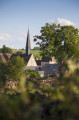
The village of Maisoncelles, described as a ‘street village’, has developed linearly along the road linking Bouloire to Tresson and Écorpain, running perpendicular to the Ruisseau de l’Étangsort. Although difficult to date precisely, the imposing Church of Notre-Dame, possibly dating back to the Romanesque period, is undoubtedly the oldest building in the village. You can, however, see typical rural features from theThird Republic, such as the public pump at the foot of the church. Heading towards the cemetery, you will see on the right the old communal washhouse, recently converted to welcome walkers, and further up, a former school recognisable by its two-storey structure and brick window frames.
In the eye of the Saint-Jean Fountain
 9.14 mi
+354 ft
-344 ft
4h 30
Moderate
Departure from Montaillé (Sarthe)
9.14 mi
+354 ft
-344 ft
4h 30
Moderate
Departure from Montaillé (Sarthe)
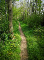
Montaillé has developed around two centres: the village centre, built up around the church, and La Brenaille, a cluster of hamlets and farms to the north of the village. The site of La Brenaille appears to have been inhabited since ancient times, whilst the village centre seems to have been settled during the Gallo-Roman period, as evidenced by the route of an ancient road between Le Mans and Orléans. ‘Montaillé’ likely derives from a contraction of the Latin ‘montem’, meaning mountain or high ground, and the name ‘Alhierus’, a Germanic name that may have referred to the landowner following the barbarian invasions ofthe 5th century. As the name suggests, the land is situated on high ground and is close to a stream, the Pibeau, and a spring, the Fontaine Saint Jean-Baptiste.
In the shade of the hedgerows towards Thorigny-sur-Dué
 7.30 mi
+203 ft
-213 ft
3h 30
Moderate
Departure from Thorigné-sur-Dué (Sarthe)
7.30 mi
+203 ft
-213 ft
3h 30
Moderate
Departure from Thorigné-sur-Dué (Sarthe)
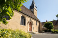
A few archaeological finds attest to human presence in Thorigné as far back as the Neolithic period. In Gallo-Roman times, a large agricultural estate (villa) is thought to have been the origin of a permanent settlement, which is better documented from the Middle Ages onwards. Despite the destruction of its medieval castle, which was replaced by a bourgeois house in the19th century, Thorigné stands out as a fairly large village offering a wide variety of civil architecture, spread out along the main axis linking the Dué valley to the church. Probably of Romanesque origin, the church was enlarged in the16th century and remodelled inthe 18th century . It houses interesting stained-glass windows and furnishings, such as the high altarpiece dating from 1669 and the18th-century side altarpieces.
The ore route in Vibraye
 Visorando Member
 6.49 mi
+243 ft
-269 ft
3h 10
Moderate
Departure from Vibraye (Sarthe)
6.49 mi
+243 ft
-269 ft
3h 10
Moderate
Departure from Vibraye (Sarthe)
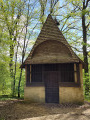
Rated as easy, this hike crosses the Vibraye Forest. To make it a circular route, allow about 3 hours and do not leave the marked trail, which is public. Unlike the forest, which is private, the route is marked with round signs 10 cm in diameter reminiscent of the work of the forge. You are in the Haut Maine region. In the Middle Ages, this region was home to a significant metallurgical industry, made possible by the presence of iron ore, extracted from flint clay and quartz sand, as well as the large quantities of wood needed for the forges. The forest was managed by cutting down coppice wood every 18 years to renew the resource. The dominant species is oak, but the forest also consists of aspens, birches, chestnuts and pines. This pleasant route describes a craft activity through the display boards scattered around the former mining sites.
The Two Oaks of Luart Route
 4.15 mi
+69 ft
-69 ft
2h 00
Easy
Departure from Le Luart (Sarthe)
4.15 mi
+69 ft
-69 ft
2h 00
Easy
Departure from Le Luart (Sarthe)
This rural village had a population of just over 1,000 in themid-19th century before seeing its population gradually decline due to rural depopulation until 1962, when it fell to 643 inhabitants. The closure of many small farms gradually freed up the least productive agricultural land for building. Thanks to a proactive policy by the local council and the presence of a construction company in the village, Le Luart experienced considerable suburban development, leading to a spectacular rise in its population, which reached 1,445 inhabitants in 2012. Since then, the population has tended to stabilise.
Route of photography from Conflans-sur-Anille
 14.34 mi
+617 ft
-600 ft
7h 10
Difficult
Departure from Conflans-sur-Anille (Sarthe)
14.34 mi
+617 ft
-600 ft
7h 10
Difficult
Departure from Conflans-sur-Anille (Sarthe)
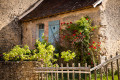
Situated on a small spur at the confluence of the Anille and Roulecrotte rivers, the village, first mentioned in the 13th century, retains several old houses, including the town hall, a former presbytery built in the 15th century. The church, rebuilt around 1780, features a beautiful collection of murals painted around 1860 using potassium silicate (a new technique for the time).
The ‘Route des Cormiers’
 10.01 mi
+541 ft
-512 ft
5h 05
Moderate
Departure from Conflans-sur-Anille (Sarthe)
10.01 mi
+541 ft
-512 ft
5h 05
Moderate
Departure from Conflans-sur-Anille (Sarthe)
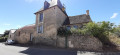
Setting off from this village-street with its rich architectural heritage, head along the ancient sunken paths, sections (1) to (6) ofthe GR®® 235, lined with a variety of trees – oaks, service trees, serviceberries, wild pear trees and so on – offering walkers an enchanting, shaded route. These paths, in the heart of the rolling countryside of the Perche Sarthois, are linked by a network of quiet country lanes, offering stunning 180° panoramic views from the higher points.
Along the banks of the Tusson towards Val-d'Etangson
 7.85 mi
+308 ft
-315 ft
3h 55
Moderate
Departure from Évaillé (Sarthe)
7.85 mi
+308 ft
-315 ft
3h 55
Moderate
Departure from Évaillé (Sarthe)
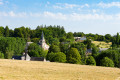
Val-d’Étangson is a new commune formed in 2019 from the merger of the communes of Évaillé and Sainte-Osmane. Possibly first mentioned as early as the9th century, the village on the banks of the Tusson consisted in 1829 of nothing more than the church, the18th-century presbytery with its courtyard and garden, and around fifteen houses. It expanded after 1840, no doubt linked to the opening of the road connecting the two sub-prefectures of La Flèche and Saint-Calais (now the D13).
The Étangsort Valley towards Tresson
 8.68 mi
+348 ft
-351 ft
4h 20
Moderate
Departure from Tresson (Sarthe)
8.68 mi
+348 ft
-351 ft
4h 20
Moderate
Departure from Tresson (Sarthe)
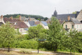
The origins of the settlement of Tresson are very ancient, as evidenced by a dolmen situated not far from Les Basses Poches. Furthermore, the territory of Tresson is crossed by the Via Turniacensis, near which a large agricultural estate is recorded in 572. This villa was donated by Bishop Domnole to Saint-Vincent Abbey, which established a priory in Tresson. This combination of factors led to the development of the present-day village in the Étangsort valley.
The Calaisienne Loop
 9.62 mi
+318 ft
-305 ft
4h 40
Moderate
Departure from Saint-Calais (Sarthe)
9.62 mi
+318 ft
-305 ft
4h 40
Moderate
Departure from Saint-Calais (Sarthe)
The evolution of Saint-Calais is evident in its town planning, which developed in the Middle Ages on either side of the Anille. On the right bank, the former abbey site founded inthe 6th century is still visible in the two tall gables of the current resource centre. During the Revolution, it gave way to another administrative centre with imposing buildings and the straight streets typical ofthe 19th century. On the left bank, on the hillside between the river and the castle founded inthe 11th century to rival the powerful abbey, you can easily make out the medieval quarter, which was built around the axis of the Grande Rue on an irregular and densely packed grid of plots.
Route du père from Vibraye
 9.68 mi
+453 ft
-449 ft
4h 50
Moderate
Departure from Vibraye (Sarthe)
9.68 mi
+453 ft
-449 ft
4h 50
Moderate
Departure from Vibraye (Sarthe)
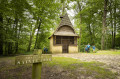
The village is characterised by the presence of the forest. This enabled its owner, the Marquis de Vibraye, to establish forges on the Braye river in Champrond in the early 17th century, where charcoal from the forest fuelled the furnaces producing pig iron and wrought iron until 1913. The trail partly follows the route taken by the convoys laden with heavy iron bars to the workshop in the hamlet of La Fenderie, on the pond of the same name. At La Bouverie, another vanished hamlet, eight houses provided accommodation for the forges’ carters, whilst charcoal burners and miners lived in makeshift huts. Now silent once more, the forest retains of this past activity only the network of paths. Part of it is now a Natura 2000 site.
The Vow of Saint-Quentin
 5.43 mi
+266 ft
-269 ft
2h 45
Easy
Departure from Saint-Maixent (Sarthe)
5.43 mi
+266 ft
-269 ft
2h 45
Easy
Departure from Saint-Maixent (Sarthe)
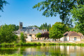
Bordering the Huisne valley to the west and the Vibraye forest to the east, Saint-Maixent is first mentioned in the13th century. Although the settlement is largely scattered (27 farms and 59 cottages in 1841), there are large hamlets such as Les Blousières, whose houses, clustered around a now-vanished pond, once housed up to 40 people, likely hemp workers. The village, crossed by the medieval road known as the “Chemin aux Bœufs” leading to Paris via Châteaudun, grew considerably in the 19th century thanks to the trade generated by this route.
Around Duneau
2.42 mi
+138 ft
-138 ft
1h 15
Easy
Departure from Duneau (Sarthe)
The village of Duneau is located in a dominant position on the left bank of the Huisne, on a route that has been highly sought-after since prehistoric times. The Pierre Fiche menhir and the Pierre Couverte dolmen, dating from the Neolithic period (around 4000 BC), bear witness to this. These are the only visible archaeological remains among many others covering the periods of Antiquity and the Middle Ages.