Country:

 City:


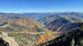
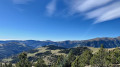
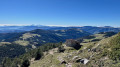
From Prats-de-Mollo, cross the road bridge over the Tech and turn right towards La Preste-les-Bains via the D115A. Walk past the thermal baths, skirt round the large car park (parking available) and continue along the road, crossing the road bridge over the Tech. Pass the goat farm on your left and carry on until you reach an old barrier, where the track really starts to deteriorate. Park on the right-hand side without obstructing the path.
(S/E) Continue along the rough track for 300 m. Signposts mark the start of the path.
(1) Head left up the path through the woodland.
(2) Cross a track suitable for vehicles. Further on, ignore a track that climbs steeply to the left and reach a fork. There is an old wooden signpost on the left. Yellow and white markings.
(3) Head right-hand side up the winding path through the woodland. Fir trees obstruct the path, but they can be easily negotiated.
(4) Cross a track suitable for vehicles. Continue climbing steeply through the forest along the path until you reach a track.
(5) First turn right then left onto the track for about thirty metres, then head up the path through the forest. You’ll reach a fork.
(6) Continue straight ahead along the path through the woodland. You’ll reach another fork in a clearing.
(7) Head left up the path and emerge at the Coll de Siern at a fork. Border marker no. 515. Signpost: Pic Costabone. End of the yellow and white markings.
(8) Head up to the right along the grassy track running along the edge of the border ridge. Note: yellow markings on a rock; further on, red and white markings. From here, a steep ascent begins, with sections of steep incline. You’ll reach an altitude of 2,040 m, where there is a small rock, a white and red marker and a cairn. Also note, to the right behind the border fence, a cairn marking the start of the Chemin des Mines, which you’ll take on the return journey.
(9) Two alternative routes: see the ‘Practical Information’ section.
Alternatively, at this junction, turn left, keeping level along the side of the mountain pasture, heading west, and pass the ruins of an ‘orri’. Continue for about a hundred metres, still keeping level, until you reach a gap in the electrified fence (insulated handle).
(10) Turn sharply right, heading due north with the fence on your right. Climb very steeply up a gullied path towards Roca dels Soms. You’ll reach a fork (a deviation from the OSM map).
(11) Leave the rutted path which continues straight ahead (marked with a red and white cross). Turn left, following the recent red and white markings, and head due north again until you finally reach the junction: Les Torrelleres (alt. 2,156 m). There is a painted steel signpost pointing in four directions: follow signs for Coll de Pal.
(12) Continue to the left along a stony path, then keep level. White and red markings. The mountain hut is clearly visible to the north-west.
(13) Altitude 2,185 m: look out for the return path on the right, which climbs up into the mountain pasture. Carry on straight ahead, keeping level, heading north-west.
(14) Ignore the ascent to Coll de Pal. Continue on level ground, passing two springs. Further on, descend to the left, heading south-west, and arrive at Refugí Costabona at an altitude of 2,168 m. A lovely spot for a well-deserved lunch break, with a clean refuge and a stone bench opposite. Unobstructed 180° view.
(15) Turn back, following the same route as on the way there, staying at the same level after the two springs, and rejoin the path you followed on the way there.
(13) Head up to the left towards the south-east and, after 100 m, turn right towards the south and follow the red and white markings. Descend steeply along the border fence and rejoin the junction you passed on the way up at an altitude of 2,040 m.
(9) Turn left, heading due north, on level ground along a faintly marked but clearly visible path with cairns. Fir trees cut flush with the ground also indicate the path to follow. Cross the heavily eroded area of the Còrrec de la Solaneta and emerge onto a vast grassy area, joining the Chemin des Mines and following the yellow markings.
(16) Leave the grassy track to your left. Continue to the right along the flat section. There are some beautiful views along this stretch on a narrow, almost flat track running along the mountainside, which once provided access to the garnet mines. Pass the Còrrec de Font Negre and veer right, heading north-east for about 150 m (alt. 1,980 m).
(17) Take care: do not be tempted by a path opposite. Descend completely to the right along the winding track through the forest. Further down, the narrow grassy track is obstructed by fallen fir trees, which can be easily stepped over or bypassed. At the very bottom, you’ll reach a fork just before a large wooden enclosure.
(18) Carry on straight ahead along the grassy track; just past the enclosure, a simple bench on the left is a good spot for a break. A very beautiful spot. From here, head down a small pastoral track. You’ll reach a large clearing at elevation 1510. Look out for the yellow markings.
(19) Take care: leave the track suitable for vehicles and head down to the left, into the forest, along a stony path. Further on, let a track branch off to the left and rejoin the junction from thefirst circular loop you passed on the way out, at the old signpost.
(3) Continue straight ahead and, following the reverse route of the outward journey, rejoin the badly worn track from the start much further down; follow it to the right to return to the car park (S/E).
 Visorando Member
 Very difficult

 Moderate