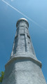
The Zundelkopf and the Andlau Waterfall

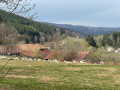
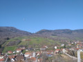
This circular walk is a relatively short hike offering the chance to explore the heights of Hohwald without having to cover a long distance. It is particularly suitable for walkers looking for a few hours’ outing in the forest, with a moderate elevation gain and a typically Vosges atmosphere. The route can also make for a good additional walk during a stay in Hohwald or at the Col du Kreuzweg.

Details

n°108760364
Creation:
Last update:
Last review:
–
  • Walking
    Activity: Walking
  • ↔
    Distance: 3.59 mi
  • ◔
    Average duration: 2h 15 
  • ▲
    Difficulty: Easy

  • ⚐
    Back to start: Yes
  • ↗
    Ascent: + 669 ft
  • ↘
    Descent: - 692 ft

  • ▲
    Highest point: 2,785 ft
  • ▼
    Lowest point: 2,313 ft

Description of the walk

Park at the Col du Kreuzweg.

(S/E) Join the D425 and walk carefully along its left-hand side until you reach the rest area and the small pond.

(1) Turn left to follow the Chemin du Zundelkopf and continue along the forest track of the same name. Carry on straight ahead and negotiate the sharp bend to the right.

(2) Carry on to the left and head for the junction situated at the highest point of the circular route.

(3) Take the path on the right and emerge onto the Métairie Rohrbach Forest Road.

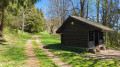
(4) Cross this and take the path opposite. You’ll reach the banks of the Andlau; turn left at the junction to head for the waterfall: there are benches and tables nearby.

(5) Return to the junction and take the path on the left to cross the footbridge over the Andlau. Walk past the mast and you’ll come to a fork in the path.

(6) Continue straight ahead to the right and return to the starting junction at the Zundelkopf pond.

(1) Go straight on, carefully following the D425 to return to the Kreuzweg Pass, then turn right to return to the car park (S/E).

Waypoints

  1. S/E : mi 0 - alt. 2,556 ft - Car park - Buchbuckel
  2. 1 : mi 0.4 - alt. 2,405 ft - Junction of the circular loop - Étang du Zundelkopf
  3. 2 : mi 1.41 - alt. 2,707 ft - Junction
  4. 3 : mi 1.67 - alt. 2,785 ft - Highest point of the circular loop
  5. 4 : mi 1.98 - alt. 2,579 ft - Rohrbach Forest Road Dairy Farm
  6. 5 : mi 2.35 - alt. 2,320 ft - La cascade de l'Andlau
  7. 6 : mi 2.79 - alt. 2,402 ft - Junction
  8. S/E : mi 3.59 - alt. 2,556 ft - Car park - Buchbuckel

Notes

The route mainly follows forest tracks and paths. Wear suitable footwear, particularly in wet weather. A GPS track is recommended as several forest tracks intersect.

Please observe any restrictions relating to forestry work or hunting.

Difficulty: easy to moderate, depending on the terrain.

Other walks in the area

For more walks, use our search engine .

The GPS track and description are the property of this route's author. Please do not copy them without permission.