The old mill at Poyen

In the land of sugar cane, a very short walk through dry woodland, featuring a few majestic trees, a lovely pond and the ruins of a mill that once belonged to a former sugar estate.

Details

799210
Creation:
Last update:
Last review:
  • Walking
    Activity: Walking
  • ↔
    Distance: 1.36 mi
  • ◔
    Average duration: 0h 40 
  • ▲
    Difficulty: Easy

  • ⚐
    Back to start: Yes
  • ↗
    Ascent: + 69 ft
  • ↘
    Descent: - 69 ft

  • ▲
    Highest point: 72 ft
  • ▼
    Lowest point: 26 ft

Photos

Description of the walk

Access and starting point:
Take the N6 between Petit-Canal and Port-Louis. Turn onto an unmarked track; at the end of this, you will see a sign indicating a railway line:
- when coming from Petit-Canal, the track is on the right, at the end of a long straight stretch and before entering the hamlet of Gaschet.
- if you’re coming from Port-Louis, it’s on the left, just after a right-hand bend once you’ve left Gaschet.
Cross the tourist train railway line and park in the small car park just beyond on the left, near the station.

Route:

Unmarked

(S/E) Continue north along the track leading to the station. At a fork in the road, stay on the track to the right and walk past a few houses on your right.

Yellow markings

(1) Turn left just before the ‘Managed Nature Reserve’ sign. Walk alongside a woodland on your right, join a path coming from the left and continue westwards along the edge of the woodland. At a fork in the road, take the right-hand path and pass a refreshment hut on your left.

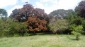
(2) After a few metres, leave the track and head right towards a large open shelter (carbet). Go round the shelter on the right and cross a lawn diagonally to the left towards some majestic trees (the route on the IGN map is approximate here). Walk alongside a pond on your left and, at the end, follow a clear path into the woods on the right.

At the bottom of a descent, at a T-junction, turn right. Ignore a path branching off to the right and, at the three-way junction that appears immediately, take the right-hand fork and head slightly uphill.

(3) At a three-way junction in the path (signposted ‘Réserve biologique dirigée’), turn right again. Stay on the main path, which winds slightly through the woods, and ignore a few vague offshoots to the sides. This will take you back to the junction of the circular path.

Unmarked

(1) Continue straight ahead along the track you took on the way out and you’ll soon reach the little train station (S/E).

Waypoints

  1. S/E : mi 0 - alt. 26 ft - Tourist train station - Site de Poyen
  2. 1 : mi 0.18 - alt. 56 ft - Junction on the Poyen circular loop
  3. 2 : mi 0.34 - alt. 26 ft - Junction leading to a large carbet
  4. 3 : mi 0.78 - alt. 69 ft - Three-Way Junction
  5. S/E : mi 1.36 - alt. 26 ft - Tourist train station

Notes

Lightweight walking boots or good trainers are suitable for this short walk, which follows well-maintained paths. Although the route is mainly through woodland, bring sun protection depending on your sensitivity to the sun.

Remember to bring a supply of water, even though the route is short.

The forest you’ll be walking through is a managed nature reserve. Follow the instructions on the sign at point (1) and, as always, do not leave any rubbish behind.

It is probably possible to reach the starting point by the little tourist train. Enquire on the spot.

The signposting is clear and of good quality throughout the circular route from point (1) (as at October 2017). A detailed map is nevertheless useful (at the very least, the one accompanying this description).

Walk completed by the author on 3 October 2017.

Worth a visit

Along the route:
- Beautiful trees around the pond after (2), information boards.
- Ruins of the Moulin de Poyen. The mill is situated in the woods, on the right-hand side of the path just before returning to point (1) when approaching from point (3). On the IGN map, at a scale of 1:6250, it is marked by a grey disc. I walked along the path three times and couldn’t find any way into the ruins: this was in October 2017, two weeks after Hurricane Maria had struck, knocking down a great deal of vegetation; perhaps that explains it. I hope other walkers will have better luck than I did...

In Petit-Canal (near the church, to the west of the village):
- Memorial to the Unknown Slave, unveiled in 1994 to mark the bicentenary of the first abolition of slavery.
- Slaves’ Steps. More moving than the memorial itself, these steps lead to the quay where slaves were sold as they disembarked from the ships. Plaques indicate the names of the African ethnic groups from which they originated.

In Port-Louis:
- The Sugar Cane Museum, on the site of the former Beauport sugar mill.

Reviews and comments

4.3 / 5
Based on 2 reviews

Reliability of the description
4.5 / 5
Ease of following the route
4.5 / 5
Route interest
4 / 5
Fassoa
Fassoa

Overall rating : 4 / 5

Date of your route : Mar 01, 2026
Reliability of the description : ★★★★☆ Good
Ease of following the route : ★★★★☆ Good
Route interest : ★★★★☆ Good
Very busy route : No

A lovely little hike, fairly well shaded, ending with a visit to the ruins of the old mill, which is very impressive and colossal, serving as a support for a cursed ficus tree...
Watch your feet, and wear closed shoes as there are large thorns lying around which punctured my flip-flops twice...

Machine-translated

Cappe b
Cappe b

Overall rating : 4.7 / 5

Date of your route : Oct 27, 2024
Reliability of the description : ★★★★★ Very good
Ease of following the route : ★★★★★ Very good
Route interest : ★★★★☆ Good
Very busy route : No

A short, interesting walk with descriptions of the surroundings (trees, a mill, bats), which we did with our children (aged 5 and 8).

Machine-translated

Other walks in the area

For more walks, use our search engine .

The GPS track and description are the property of this route's author. Please do not copy them without permission.